Map of the Town of Guilford, New Haven County, Connecticut
SurveyorSurveyed by
H. Irvine
American
PrintmakerLithographed by
John F. Watson
American, active 1835 - 1861
PrinterPrinted by
Wagner & McGuigan
American, 1845 - 1859
PublisherPublished by
Richard Clark
American
Date1852
MediumLithography; black printer's ink and watercolor on wove paper mounted on fabric
DimensionsPrimary Dimensions (image height x width): 41 3/8 x 39in. (105.1 x 99.1cm)
Sheet (height x width): 43 1/2 x 41 1/8in. (110.5 x 104.5cm)
Sheet (height x width): 43 1/2 x 41 1/8in. (110.5 x 104.5cm)
ClassificationsGraphics
Credit LineMuseum purchase
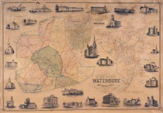
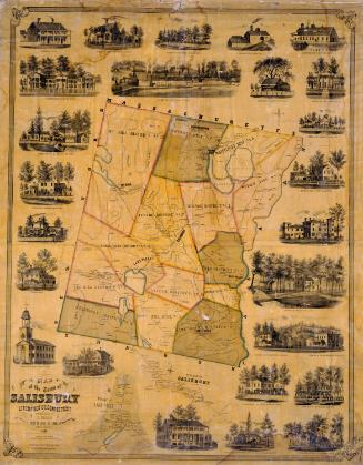
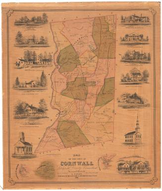
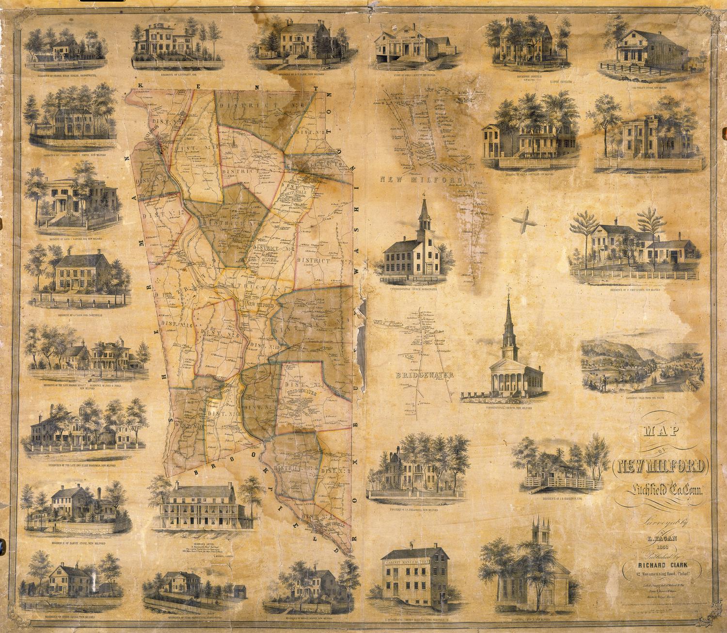
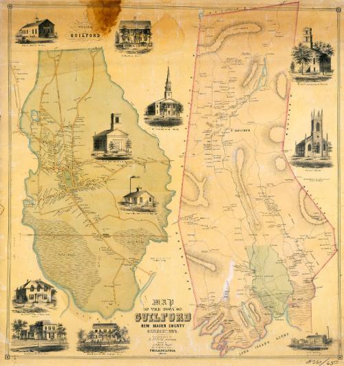
DescriptionMap of the town of Guilford, Connecticut, with Durham on the north, North Madison and Madison on the east, Long Island Sound on the south, and Branford and North Branford on the west. Streams, laked, ponds, and extensive salt marsh meadows are shown. Hills appear as outlines surrounded by hachure marks. Toket Mountain, Hungry Hill, Quennypaug Lake, Nut Plains, Dudley's Town, Guilford Borough, and North Guilford are identified. A separate detailed map of the village of Guilford is at the left. Streets, businesses, and houses are shown; names of property owners appear on both maps, though the names of property owners in Guilford village do not appear on the larger map. The New Haven and New London Railroad appears on both maps. Vignettes depict the Papier Mache Works, M. Bradley's Hotel, the First Congregational Church, the Third Congregational Church, the Methodist Episcopal Church, Christ Church, George B. Parmelee's Iron Foundry, J. S. Norton's American Lock Works, and the residences of the Reverend E. Edwin Hall, H. Isbell, and William Faulkner.
Object number1986.288.2
MarkingsOn verso, upper left, on gummed label, typed in black ink, "MAPS / Case 4 / No. 3"On verso, upper right, on gummed label, typed in black ink, "MAPS / Case 4 / No. 3"InscribedOn recto, lower center, printed in black ink, "MAP / OF THE TOWN OF / GUILFORD / NEW HAVEN COUNTY / CONNECTICUT. / From Actual Survey by / H. IRVINE, SURVEYOR / Published by / RICHARD CLARK / 384 South Third Street, / PHILADELPHIA / 1852."
On recto, lower right, in black crayon, "#260/65.00"
On verso, upper left, in pencil, "MAPS / Case 4 / No. 3"
On verso, upper center, in pencil, in pencil, "1361"
On verso, upper right, in pencil, "MAPS / Case 4 / No. 3"
On verso, center, in black ink, "CtHi / 08562"
On verso, lower right, in pencil, "1986.288.2"NotesCartographic Note: 2 1/4 inches equals 60 rods (Guilford village); One inch equals 100 rods (main map)
Collections
- Maps and Charts: Finding Your Place in Connecticut History
On View
Not on view