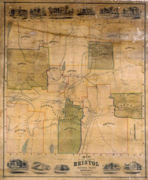
Map of the Town of Bristol, Hartford County, Connecticut
SurveyorSurveyed by
E. M. Woodford
American, 1824 - 1862
PrinterPrinted by
Wagner & McGuigan
American, 1845 - 1859
PublisherPublished by
Richard Clark
American
Date1852
MediumLithography; black printer's ink and watercolor on wove paper mounted on fabric
DimensionsPrimary Dimensions (image height x width): 41 3/4 x 34 1/4in. (106 x 87cm)
Sheet (height x width): 44 1/4 x 37 1/4in. (112.4 x 94.6cm)
Sheet (height x width): 44 1/4 x 37 1/4in. (112.4 x 94.6cm)
ClassificationsGraphics
Credit LineMuseum purchase
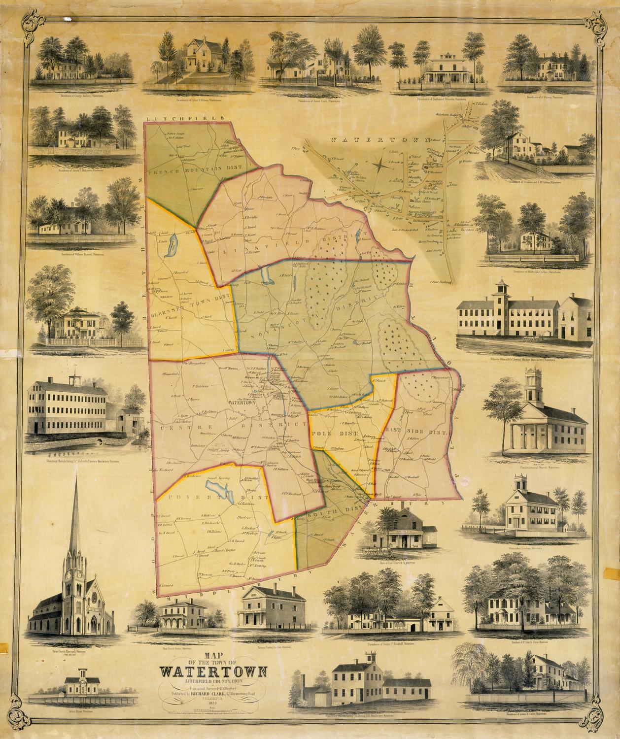
DescriptionMap of the town of Bristol, Connecticut, with Burlington to the north, Farmington to east, Wolcott and Southington to the south, and Plymouth to the west. The town is divided into twelve districts. The southeastern district is shown as "ANNEXED TO PLAINVILLE DISTRICT." Swamps, ponds, streams, and hills are shown. Elevation is indicated by hachure marks. The Providence, Hartford and Fishkill Railroad runs through town. Roads, including a "proposed road," are shown. Houses and businesses are shown with names of property owners. Vignettes along the upper and lower margins depict A. N. Platt and Company's Clock and Spring Manufactory, the Bristol Mining Company, Foote's Hotel, and the residences of E. O. Goodwin, L. Hubbard, Almon Lewis, Charles T. Foote, S. H. Carrington, R. E. Manross, E. L. Dunbar, and J. C. Brown.
Object number1956.95.3
MarkingsOn verso, upper left, on gummed label, typed in black ink, "MAPS / Case 6 / No. 13"On verso, upper right, on gummed label, typed in black ink, "MAPS / Case 6 / No. 13"InscribedOn recto, lower center, printed in black ink, "MAP / OF THE TOWN OF / BRISTOL / HARTFORD COUNTY / CONNECTICUT / From Original Surveys by E.M. WOODFORD, Surveyor. / Published by RICHARD CLARK, No. 384 So. 3th [sic] St. / PHILADELPHIA / 1852"
On verso, lower right, in pencil, "1956.95.3"NotesCartographic Note: One inch equals 50 rods
Collections
- Maps and Charts: Finding Your Place in Connecticut History
On View
Not on view