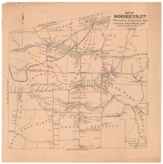
Map of Tolland County Connecticut
SurveyorSurveyed by
W. C. Eaton
American, active 1855 - 1857
SurveyorSurveyed by
H. C. Osborn
American, active 1856 - 1857
PrintmakerLithographed by
William H. Rease
American, 1818 - after 1860
MakerMade by
Wagner & McGuigan
American, 1845 - 1859
PublisherPublished by
Woodford & Bartlett
American, active 1857
PublisherCopyrighted by
E. M. Woodford
American, 1824 - 1862
Date1857
MediumLithography; printer's ink and watercolor on wove paper mounted on fabric
DimensionsPrimary Dimensions (image height x width): 53 x 46 1/2in. (134.6 x 118.1cm)
Sheet (height x width): 54 1/4 x 48in. (137.8 x 121.9cm)
Sheet (height x width): 54 1/4 x 48in. (137.8 x 121.9cm)
ClassificationsGraphics
Credit LineMuseum purchase
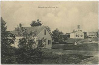
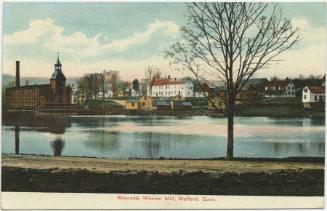
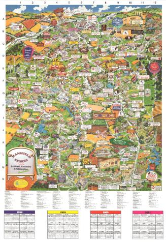
DescriptionMap of Tolland County, Connecticut, with Massachusetts to the north; Ashford, Chaplin, and Windham, Connecticut to the east; Lebanon and Colchester to the south; and Marlborough, Glastonbury, Manchester, South Windsor, East Windsor, and Enfield to the west. Inset maps around the large map show the communities of Mansfield Center, Hebron, Somerville, Furnace Hollow, Rockville, Somers Street, Stafford Springs, Staffordville, Columbia, Tolland, Foxville, Eagleville, South Coventry, and Ellington Center. Ponds, swamps, hills, streams, rivers, roads, businesses, and property owners are shown on the main map and inset maps, with more detail on the inset maps. Elevation is indicated with hachure marks. Vignettes, set in a decorative border of grapevines, include J. H. Bolton's residence in Stafford; J. R. Brockway's residence in Ellington; the village of Stafford Springs, including the Springs Hotel and Granite Mill; Ellington Mills; Alanson Washburn's residence in Coventry; the monument to Nathan Hale in South Coventry; Hydeville Manufacturing Company in Stafford; N Kingsbury and Company's Mills in South Coventry; H. R. Fargo's Mills, South Coventry; a bank and courthouse, possibly in South Coventry; Hope Company's Satinet Mill in Staffordville; and E. Converse's residence in Stafford. A chart shows the population of each town in 1850, broken down into male and female, white and colored.
Object number1918.6.1
MarkingsOn verso, upper left, on gummed label, typed in black ink, "MAPS / Case 5 / No. 4"On verso, upper right, on gummed label, typed in black ink, "MAPS / Case 5 / No. 4"InscribedOn recto, lower left, printed in black ink, "MAP / OF / TOLLAND / COUNTY / CONNECTICUT / FROM ACTUAL SURVEYS / BY WM. C. EATON & H.C. OSBORN / PUBLISHED BY WOODFORD & BARTLETT / N.E. Cor. 4th & Chestnut St. / PHILADELPHIA / 1857. / Lith by W. H. Rease, N.E. Cor. 4th & Chestnut Sts. Printed by Wagner & McGuigan, Franklin Place / Entered according to act of Congress in the year 1857 by E.M. Woodford in the Clerks Office of Dist. Court of the East Dist. of Penna."
On verso, upper left, in red ink, "28030"; in pencil, "Tolland" "MAPS / Case 5 / No. 4"
On verso, upper right, in pencil, "MAPS / Case 5 / No. 4"
On verso, lower right, in pencil, "1918.6.1"NotesCartographic Note: 1 1/2 inches equals one mile
Collections
- Maps and Charts: Finding Your Place in Connecticut History
On View
Not on view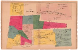


Towne Crier Marketing, Inc..
1998