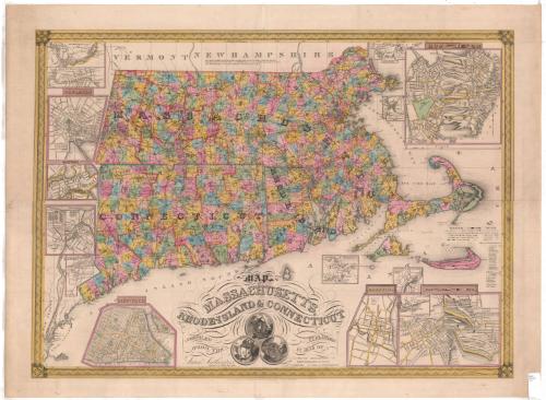
Map of Massachusetts, Rhode Island and Connecticut, Compiled From the Latest Authorities
PrintmakerEngraved by
J. Wells
American
PublisherPublished by
A. F. Wilcox
American, active 1834 - 1836
PublisherPublished by
Light & Stearns
American
PublisherPublished by
C. Shepard
American
Date1836
MediumEngraving; black printer's ink and watercolor on wove paper
DimensionsPrimary Dimensions (image height x width): 26 x 34 1/4in. (66 x 87cm)
Platemark (height x width): 27 x 36in. (68.6 x 91.4cm)
Sheet (height x width): 29 1/4 x 38in. (74.3 x 96.5cm)
Platemark (height x width): 27 x 36in. (68.6 x 91.4cm)
Sheet (height x width): 29 1/4 x 38in. (74.3 x 96.5cm)
ClassificationsGraphics
Credit LineConnecticut Museum of Culture and History collection
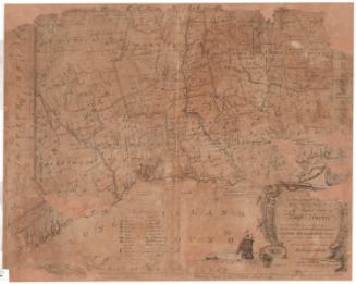
DescriptionMap of Massachusetts, Connecticut and Rhode Island, from the borders of Vermont and New Hampshire to the north, Massachusetts Bay and the Atlantic Ocean to the east, the Long Island Sound to the south, and the border of New York State to the west. The states are divided into counties and towns, with villages, large towns, academies, banks, court houses, light houses, and mills denoted with symbols. Insets around the map show the towns of Norwich, Connecticut; Fall River, Massachusetts; New Haven, Connecticut; Salem, Massachusetts; Lowell, Massachusetts; New Britain, Connecticut; New York, New York; Warwick and Coventry factories in Rhode Island; Hartford, Connecticut; Pawtucket and Central Falls, Rhode Island; Providence, Rhode Island; North Adams, Massachusetts; Canton, Massachusetts; and Boston, Massachusetts. On the right side are a list of references and a list of mills and factoriesThe decorative cartouche features three circles, within which are the seals of the three states depicted, and the mottos of Connecticut and Massachusetts.
Object number2005.184.0
MarkingsRecto, bottom right corner, printed in black ink on sticker: "Maps / Drawer / 134"InscribedRecto, top, printed in black ink: "This Map in addition to the information usually found on the best Maps, contains the Factories / Churches Academies, Banks &c. There are 1244 Factories viz. 469 C. 225 W. & Sat. 97 P. 57 F. & 397 others. / Also 1560 Churches 603 C. 318 B. 215 M. 142 U. 123 E. 66 Ut. 46 F. & 42 others."Bottom, printed in black ink: "MAP / OF / MASSACHUSETTS, / RHODE-ISLAND & CONNECTICUT / COMPILED / FROM THE / Latest Authorities / Engraved by J. Wells New York. / PUBLISHED / IN 1836 BY / A.F. WILCOX MIDDLETOWN CT. / LIGHT & STEARNS BOSTON / C. SHEPARD N. YORK & PROVIDENCE"
Bottom, printed in black ink: "Entered according to act of Congress in the year 1836 by A.F. Wilcox of the State of Connecticut."
Bottom right, handwritten in pencil: "[98947]"NotesCartographic Note: No scale
Collections
- Maps and Charts: Finding Your Place in Connecticut History
On View
Not on view
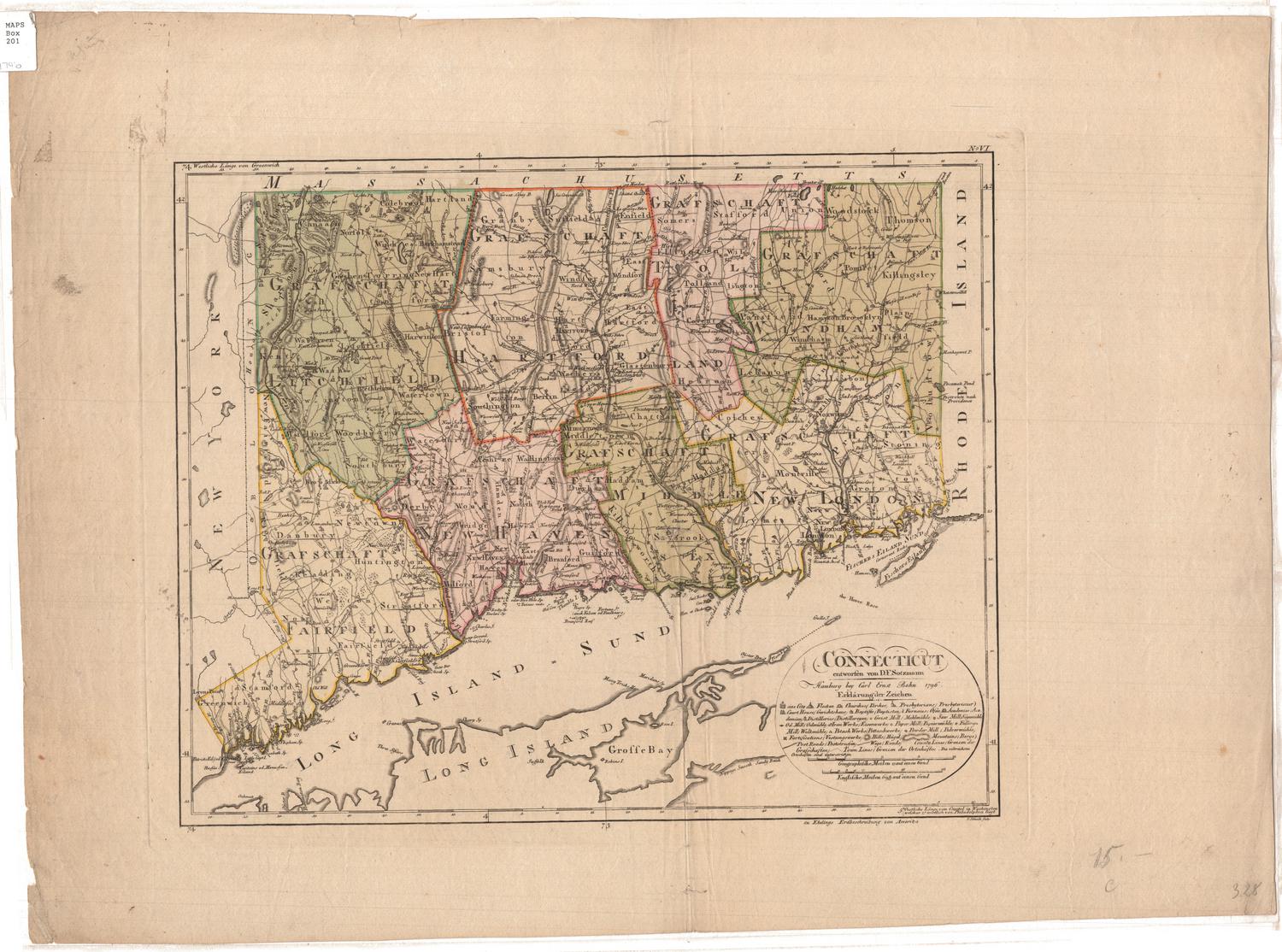
Joel Knott Allen
1791 or 1792
Joel Knott Allen
1792