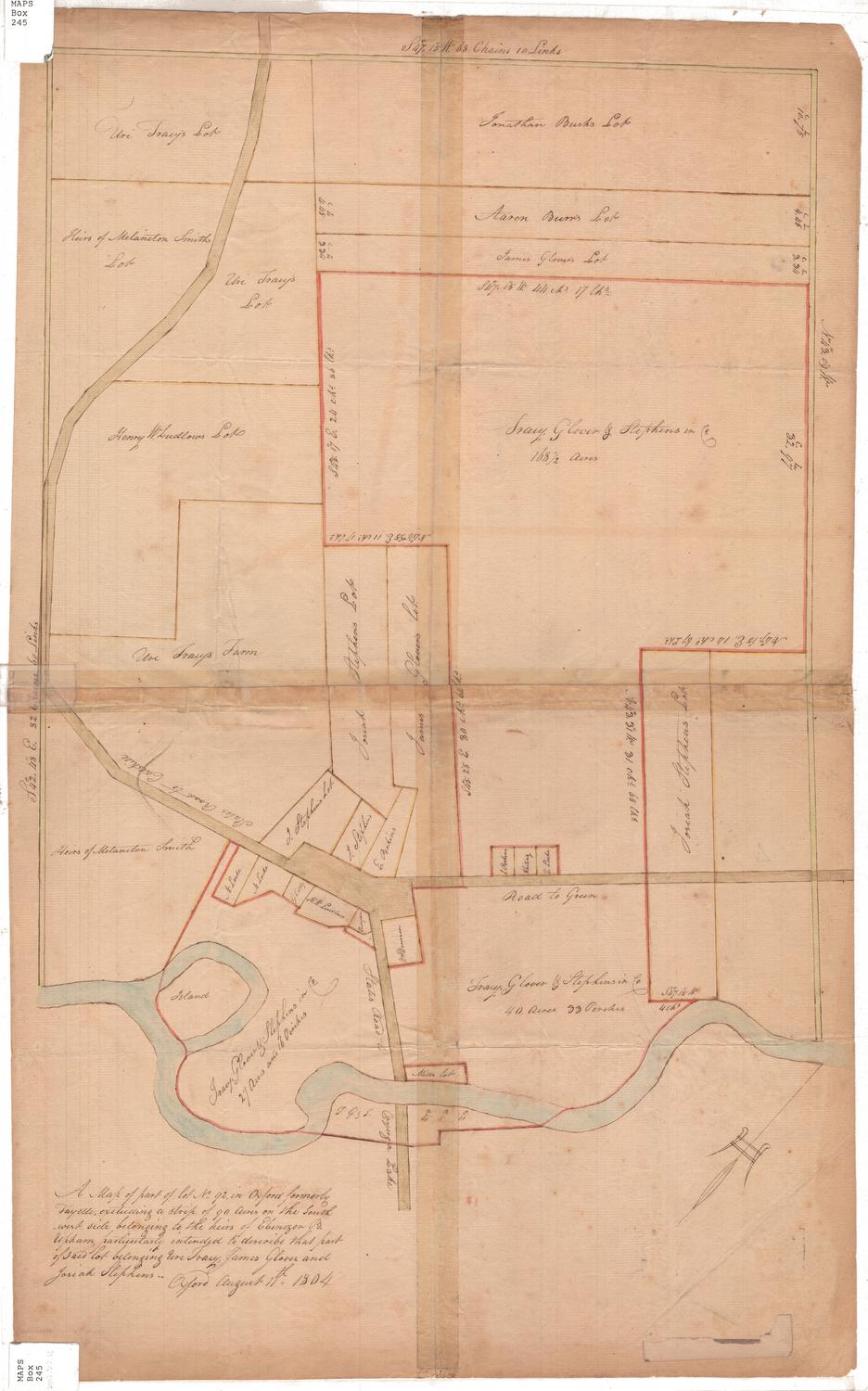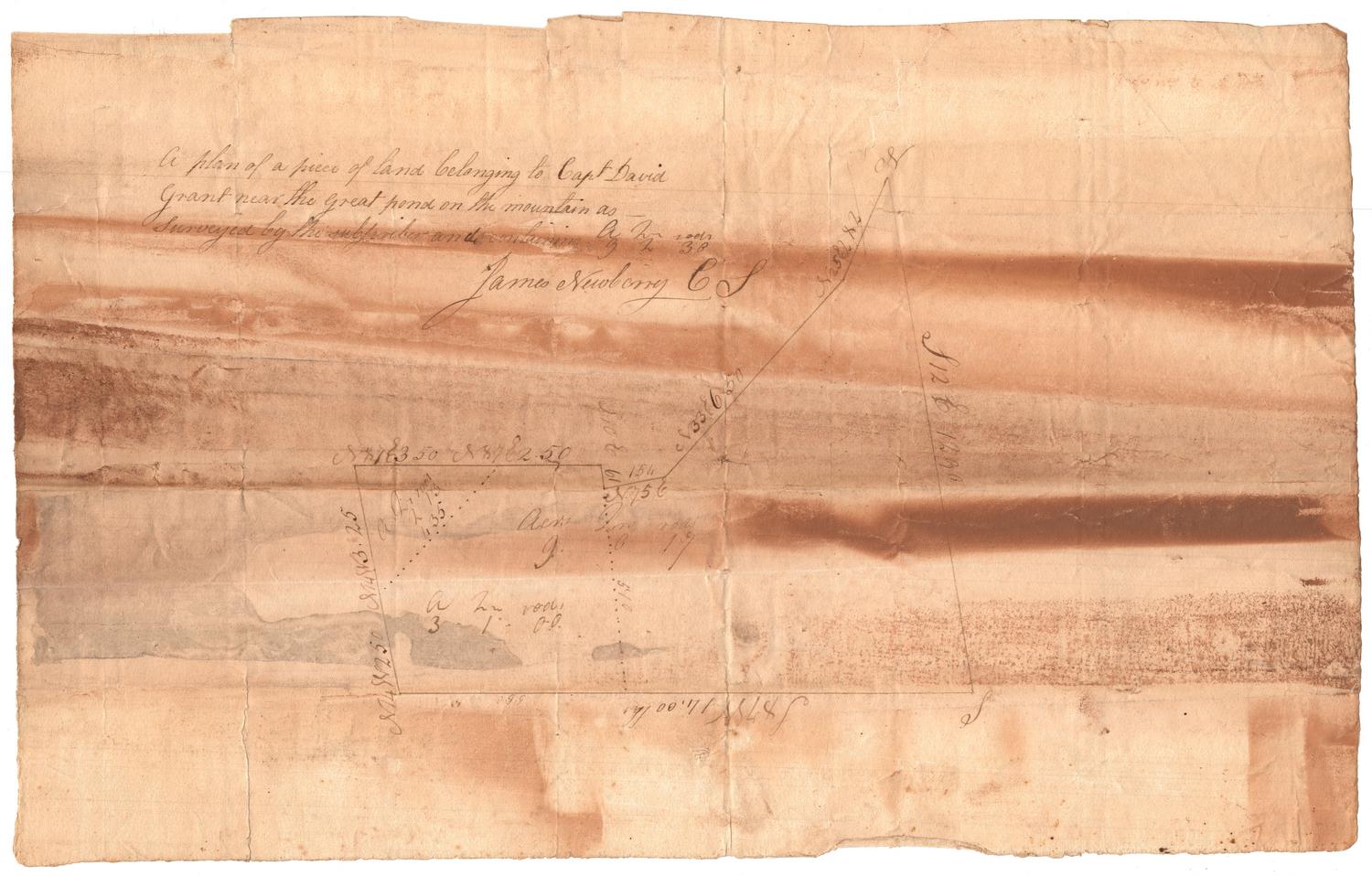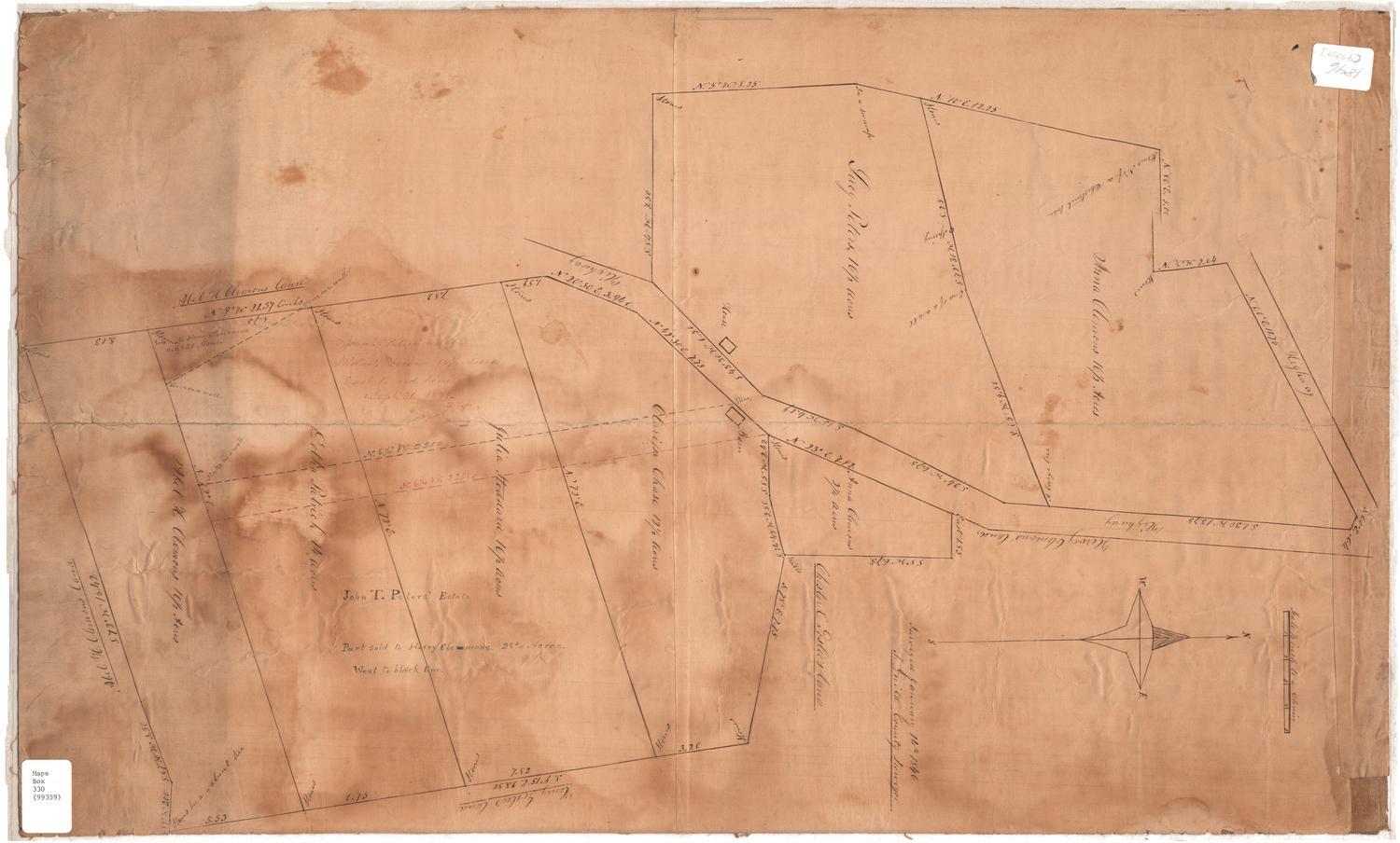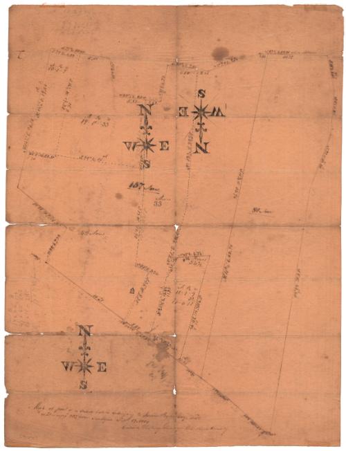
Map of Part of a Farm Lately Belonging to Josias Byles, Esq., dec'd.
SurveyorSurveyed by
Calvin Whiting
American, active 1835
Date1835
MediumDrawing; black ink on wove paper
DimensionsPrimary Dimensions (image height x width): 20 x 15 1/4in. (50.8 x 38.7cm)
Sheet (height x width): 20 x 15 1/4in. (50.8 x 38.7cm)
Sheet (height x width): 20 x 15 1/4in. (50.8 x 38.7cm)
ClassificationsGraphics
Credit LineMuseum purchase
DescriptionMap of Josias Byles' farm, probably in Ashford, Connecticut, with various boundary lines, with distances in chains and lines, and area in acres. One building is shown on the map, near the bottom.
Object number2006.117.0
MarkingsCompass with cardinal directions stamped in black ink in three places on the rectoInscribedRecto, bottom, handwritten in black ink: "Map of part of a Farm lately belonging to Josias Byles Esq. died. / containing 237 acres. Surveyed Sept. 19 1835 / Calvin Whiting Surveyor Windham County"Bottom left, handwritten in pencil: "[99290]"
There are various calculations, distance measurements and acreage written in pencil on the mapNotesCartographic Note: No scale
Collections
- Maps and Charts: Finding Your Place in Connecticut History
On View
Not on view