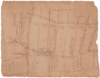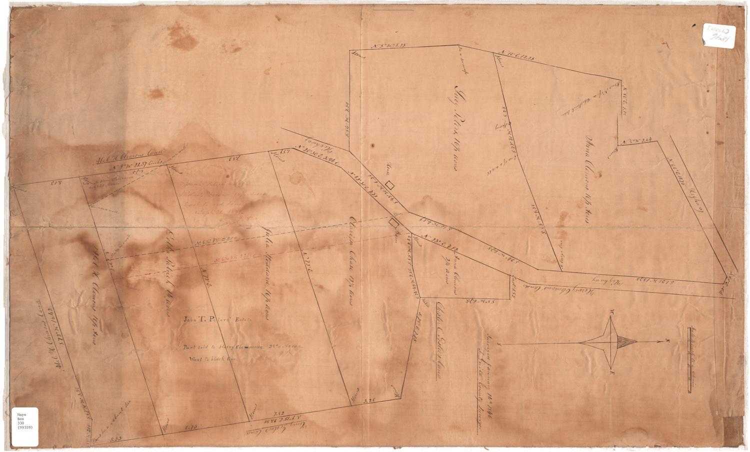
A plan of Wood in lots Belonging to Mr. John L. Lambert, Situate North of the Episcopal Church in Wilton
SurveyorSurveyed by
John S. Taylor
American, 1795 - 1877
DraftsmanDrawn by
John S. Taylor
American, 1795 - 1877
Date1829
MediumDrawing; black ink and watercolor on wove paper, linen strips on side edges
DimensionsPrimary Dimensions (image height x width): 15 3/8 x 29in. (39.1 x 73.7cm)
Sheet (height x width): 15 3/8 x 29in. (39.1 x 73.7cm)
Sheet (height x width): 15 3/8 x 29in. (39.1 x 73.7cm)
ClassificationsGraphics
Credit LineConnecticut Museum of Culture and History collection
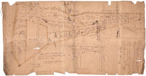
DescriptionMap of 61 land lots in Wilton, Connecticut, up for sale in 1829 for the wood they contained. Each lot is numbered, contains what is presumably the name of the purchaser, and the price for which it sold. In a list below the map, the sizes of the lots in acres, rods and perches. On the right side near the edge the terms of the sales are listed, including when the wood had to be removed.
Object number2010.445.0
InscribedRecto, lower left, handwritten in black ink: "A plan of Wood in lots Belonging to / Mr. John L. Lambert, Situate North of the / Episcopal Church in Wilton - / J S. Taylor, County Surveyor / January - 1829"Right side, handwritten in black ink: "Terms of Sale for the Wood [underlined] / 60 days credit on receiving approved notes / 12 months from the first of March next / to take off the wood--- / Wilton January 20th 1829 / Payable 1 April 1829"NotesCartographic Note: Scale: 1 inch equals 6 rods
Collections
- Maps and Charts: Finding Your Place in Connecticut History
On View
Not on view