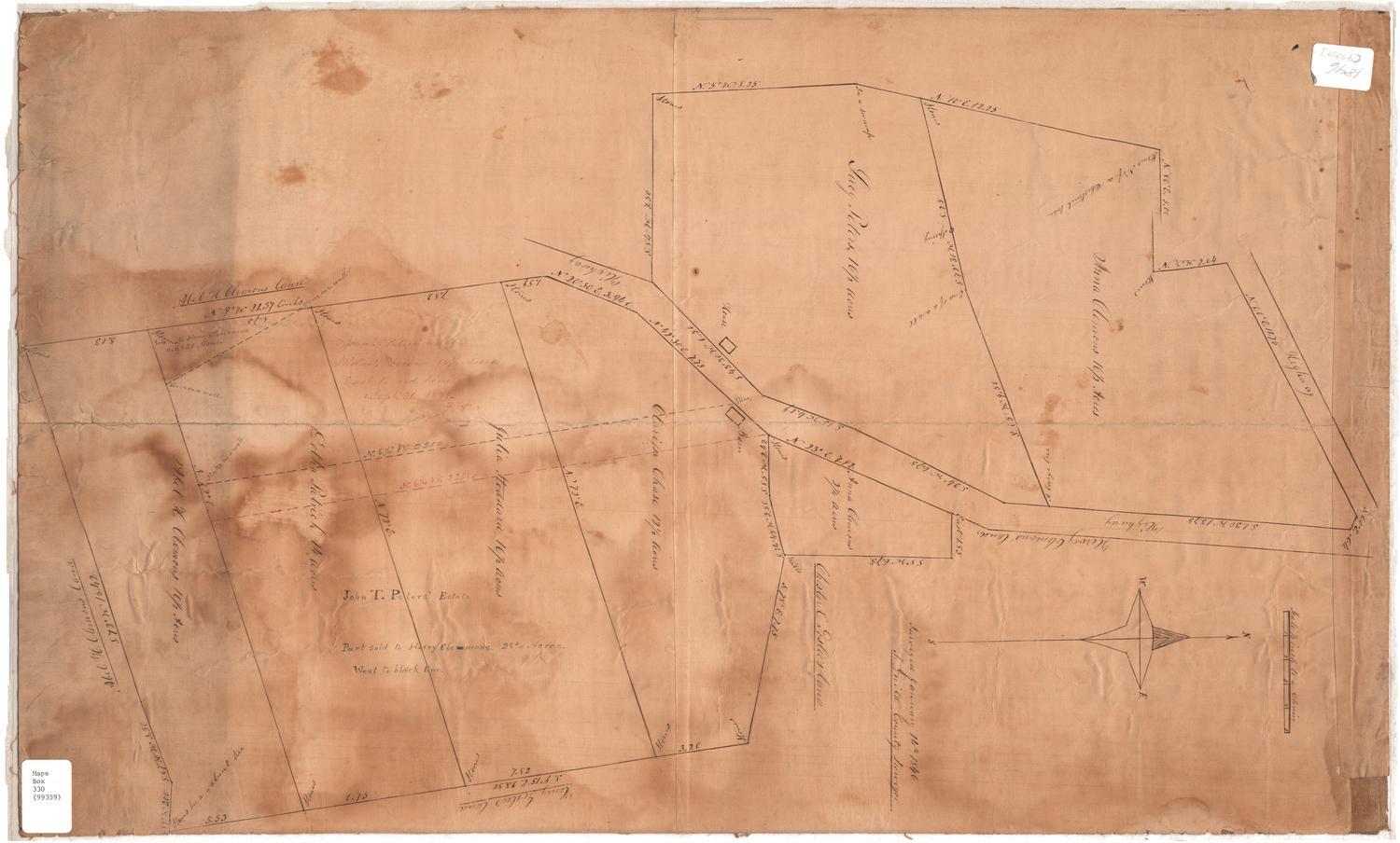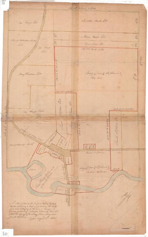
A Map of part of lot No. 92 in Oxford formerly Fayette
DraftsmanDrawn by
Unknown
Date1804
MediumDrawing; black ink and watercolor on laid paper
DimensionsPrimary Dimensions (image height x width): 20 3/4 x 14 1/16in. (52.7 x 35.7cm)
Sheet (height x width): 24 1/2 x 15 1/4in. (62.2 x 38.7cm)
Sheet (height x width): 24 1/2 x 15 1/4in. (62.2 x 38.7cm)
ClassificationsGraphics
Credit LineConnecticut Museum of Culture and History collection
DescriptionManuscript map of a lot in Oxford, New York, with subdivisions. The map is oriented so that the plot of land appears to run north-south, while in fact it probably ran southeast. An unnamed river (the Chenango) makes up the bottom boundary of the plot. The top and side boundaries are outlined in a light green line, while the subdivisions are outlined in yellow or red. Geographic coordinates of the outer and some of the inner boundary lines are provided, in directions, degrees and minutes. Additionally, the subdivisions' boundary lines are given in chains and lines, and their size in acres and perches.
Object number2012.312.22
MarkingsRecto, top and bottom left corners, printed in black ink on stickers: "MAPS / Box / 45"InscribedRecto, bottom left, handwritten in black ink: "A Map of part of lot No. 92, in Oxford formerly / Fayette, excluding a strip of 90 Acres on the South / -west side belonging to the heirs of Ebenezer B. / Upham, particularly intended to describe that part / of said lot belonging Uri Tracy, James Glover and / Josiah Stephens - / Oxford August 11th 1804"NotesCartographic Note: No scaleCollections
- Maps and Charts: Finding Your Place in Connecticut History
On View
Not on view