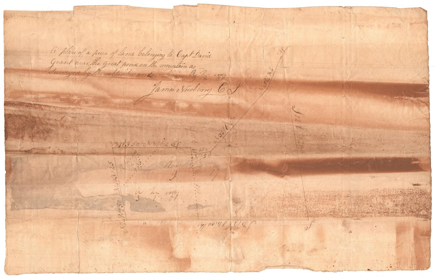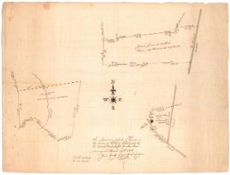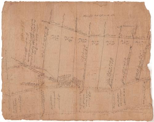
Land in Windham County, probably owned by Captain Joseph Kingsbury
SurveyorSurveyed by
Gideon Cobb
American, active 1763
Date1763
MediumDrawing; black ink on paper
DimensionsPrimary Dimensions (image height x width): 25 3/4 x 20 5/8in. (65.4 x 52.4cm)
Sheet (height x width): 25 3/4 x 20 5/8in. (65.4 x 52.4cm)
Sheet (height x width): 25 3/4 x 20 5/8in. (65.4 x 52.4cm)
ClassificationsGraphics
Credit LineMuseum purchase
DescriptionMap of a number of lots of land in Windham County, Connecticut, with distance measurements in rods and area in acres. Several trees are depicted with little sketches and notes about what species of tree they were. The West Brook is shown on the left side of the map.
Object number1952.96.0
MarkingsRecto, top left, printed in black ink on sticker: "MAPS / Box / 226"InscribedRecto, top left, handwritten in red ink: "60088"Left side, handwritten in black ink: "Windham September the 17th 1763 / then at the Defens [?] of Capt. Joseph Kingsbury J L[illegible] and / tuck [?] this plan assisted By Chairmen under oth / [illegible] me Gideon Cobb County Surveyor"
Verso, right side, handwritten in pencil: "Maps / Flat / 156"
Right side, handwritten in black ink: "Joseph Kingsbury"
Right side, handwritten in pencil: "Deacidified / 10/25/99"
NotesCartographic Note: No scale
Collections
- Maps and Charts: Finding Your Place in Connecticut History
On View
Not on view