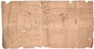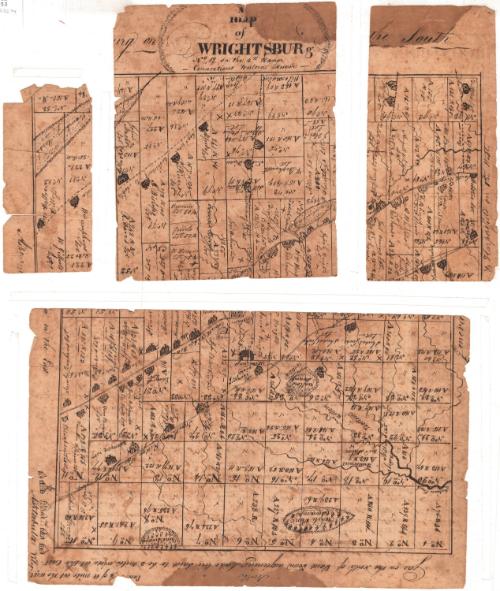
A Map of Wrightsburg, No. 12 in the 4th range
MakerMade by
Unknown
Date1811-1827
MediumDrawing; black ink on wove paper
DimensionsPrimary Dimensions (.a image height x with): 5 7/16 x 2 9/16in. (13.8 x 6.5cm)
Sheet (.a height x width): 5 7/16 x 2 9/16in. (13.8 x 6.5cm)
Primary Dimensions (.b image height x width): 6 x 6 7/16in. (15.2 x 16.4cm)
Sheet (.b height x width): 8 x 6 7/16in. (20.3 x 16.4cm)
Primary Dimensions (.c image height x width): 6 x 3 3/8in. (15.2 x 8.6cm)
Sheet (.c height x width): 8 x 3 3/4in. (20.3 x 9.5cm)
Primary Dimensions (.d image height x width): 7 x 11 5/8in. (17.8 x 29.5cm)
Sheet (.d height x width): 8 x 12 13/16in. (20.3 x 32.5cm)
ClassificationsGraphics
Credit LineConnecticut Museum of Culture and History collection
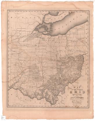
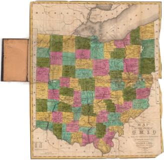
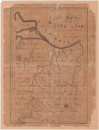
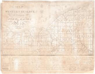
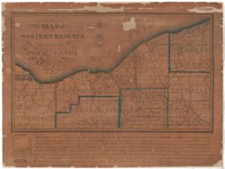
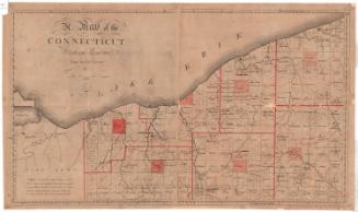
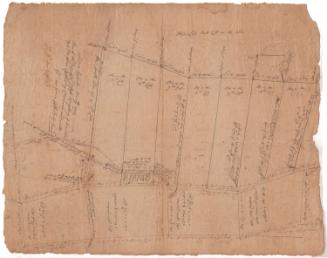
DescriptionMap of Wrightsburg, Ohio (now Saybrook, Ohio), which was located in the northeastern part of the state, oriented with south at the top of the page, Geneva and Harpersfield to the west, and Ashtabula to the east. The map is divided into 93 plots of land, with their size in what is presumably acres (denoted with a capital "A") and rods. Houses, roads, creeks, marshes, and pine and willow swamps are drawn in, and many of the lot owners' or occupants' names are provided.
Object number2012.312.94a-d
MarkingsRecto, top left, printed in black ink on sticker: "MAPS / Box / 153"InscribedRecto, top, handwritten in black ink: "A / map / of / WRIGHTSBURG / No 12 on the 4th Range / Connecticut Western Reserve"Top, handwritten in black ink: "[portion of map missing]urg on the South"
Right side, handwritten in black ink: "Geneva & Harpersfield on the West"
Bottom, handwritten in black ink: "Gore [?] on the North of Laid Town adjoining Lake Erie Said to be 3 miles wide at the east"
Bottom, handwritten in black ink: "North"
Bottom, handwritten in black ink: "En[illegible] [illegible]/4 of a mile at the west"
Left side, handwritten in black ink: "Asht[illegible] on the East"
Left side, handwritten in black ink: "Ashtabula Vilage"
Verso, top, handwritten in black ink: "John HA[?]-- NB [underlined] Sir there is a number of Buildings which is not Laid / Down on this map Sutch as [cross symbol] hors [?] Shedes Shops +c +c Likewise / our mistake Whipples House Should stand on the other side / of the Road + his Shed where the House is Laid Down there Should Likewise / be a House directly oppositeT. Stephens Inn. Elder Montgomerys House / Should be Laid down between Esqr Sweets Inn and Wm. Wrights on the South / Side the Road: but his Lot being only 20 Acres I could not Bring it down / It Stands about 20 Rods west of Esqr Sweets Josiah Wright will be / Able to Explain the Sum and Substance of the Map to you I will give / you an Idea of the distance to Some of the most Noted places (Viz / from Saml Wrights to B. Sweets Inn half mile from Sweets to Wm Wrights / half mile from Wm Wrights to Stephens Inn one mile from Stephens to / Whipples one Hundred Rods from Whipples to Blinns half mile from Blins / to the west Line of the Town one mile - East from Saml Wrights to Blackinton / 100 Rods from Blackinton to N. Williams Inn 100 Rods from / Williams Inn to J[illegible] Wrights one and half mile from J[illegible] W. to East / Line one mile from S. Wrights to the saw mill three forths of a mile / from S.W. to Charles Pratts 2 miles from S.W. to Mr. Juiles [?] 2 miles South from / S. Wrights to Sol. Bates three fourths of a mile from S. Bates to Fields Quanter / of mile where half Lots are Sold and where 2 or 3 men owns one Lot / you will Notice the Lot divided by a fine Stroke with the pen / [next line illegible; map in pieces]"
Center, handwritten in black ink: "Map.-- [underlined]"
Center, handwritten in black ink: "Wrightsburgh, / Map of. -No. 2 ["No. 2" underlined]"
Bottom, handwritten in black ink: "[cross symbol] Some Barns Esqr. Sweets has 2 barns / and a Store which is not Laid down / one Barns the Store are not finished off / yet"
Collections
- Maps and Charts: Finding Your Place in Connecticut History
On View
Not on view