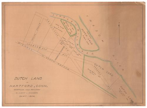
Dutch Land in Hartford, Connecticut
MakerMade by
Albert L. Washburn
American, 1857 - 1948
Date1904
MediumDrawing; black ink and pastel on wove paper, lined with linen
DimensionsPrimary Dimensions (image height x width): 20 7/8 x 28 3/4in. (53 x 73cm)
Sheet (height x width): 22 1/8 x 30in. (56.2 x 76.2cm)
Mount (height x width): 22 1/8 x 30in. (56.2 x 76.2cm)
Sheet (height x width): 22 1/8 x 30in. (56.2 x 76.2cm)
Mount (height x width): 22 1/8 x 30in. (56.2 x 76.2cm)
ClassificationsGraphics
Credit LineConnecticut Museum of Culture and History collection
DescriptionMap of Dutch land in Hartford, Connecticut, in the 1660s, extending from the Little or Mill River to the north, the Vresch (Connecticut) River to the east, the highway to South Meadow to the south, and Taylor street to the west. The plots of land shown on the map are labeled with the owner's name or the owner and previous owner's names. Outlined in green are the Dutch land areas.
Object number2012.312.170
InscribedRecto, bottom left, handwritten in black ink: "DUTCH LAND / IN / HARTFORD, CONN. / COMPILED FROM RECORDS / BY ALBERT L. WASHBURN. / SEPT. 1904."Verso, right side, handwritten in pencil: "Dutch lands in Hartford / Map"NotesCartographic Note: No scale
Collections
- Maps and Charts: Finding Your Place in Connecticut History
On View
Not on view
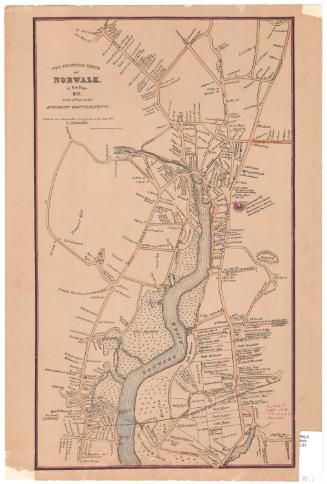
Silvermine Production
1973