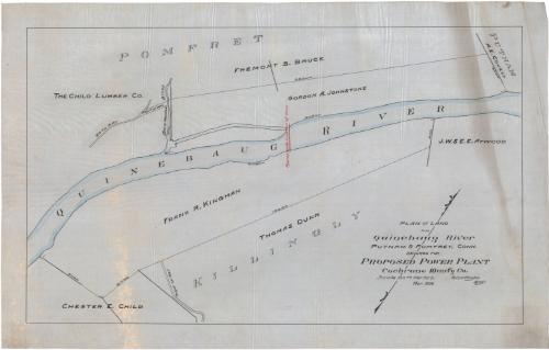
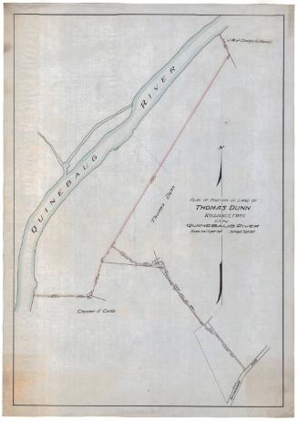
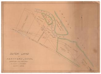
Plan of Land on Quinebaug River, Putnam and Pomfret, Connecticut, Secured for Proposed Power Plant.
DraftsmanDrawn by
Erastus Worthington
American, 1863 - 1953
Date1908
MediumDrawing; black and red ink and watercolor on drafting linen
DimensionsPrimary Dimensions (image height x width): 20 7/8 x 34 1/2in. (53 x 87.6cm)
Sheet (height x width): 24 3/8 x 38 1/8in. (61.9 x 96.8cm)
Sheet (height x width): 24 3/8 x 38 1/8in. (61.9 x 96.8cm)
ClassificationsGraphics
Credit LineConnecticut Museum of Culture and History collection
DescriptionMap of part of the Quinebaug River and the land on it as it flows through parts of Putnam and Pomfret, Connecticut. Lots are labeled with the owner's name and dimensions (presumably in feet). Property owners include the Child Lumber Company, Chester E. Child, Frank R. Kingman, Fremont S. Bruce, Gordon A. Johnstone, J.W. and E.E. Atwood, and A.E. Covell. The approximately location of the dam is noted in red ink. Rights of way, a road, and Bork Meadow Brook are also shown.
Object number2012.312.227
InscribedRecto, bottom right, handwritten in black ink: "PLAN OF LAND / ON / Quinebaug River / PUTNAM & POMFRET, CONN. / SECURED FOR / PROPOSED POWER PLANT / Cochrane Man'fg Co. / Scale 100 feet Per Inch. E. Worthington / Mar. 1908 Engr."NotesCartographic Note: Scale: 1 inch equals 100 feetCollections
- Maps and Charts: Finding Your Place in Connecticut History
On View
Not on view
Erastus Worthington
about 1908
Erastus Worthington
1907


Connecticut Yankee Atomic Power Company
before 1996