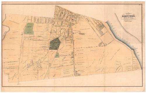
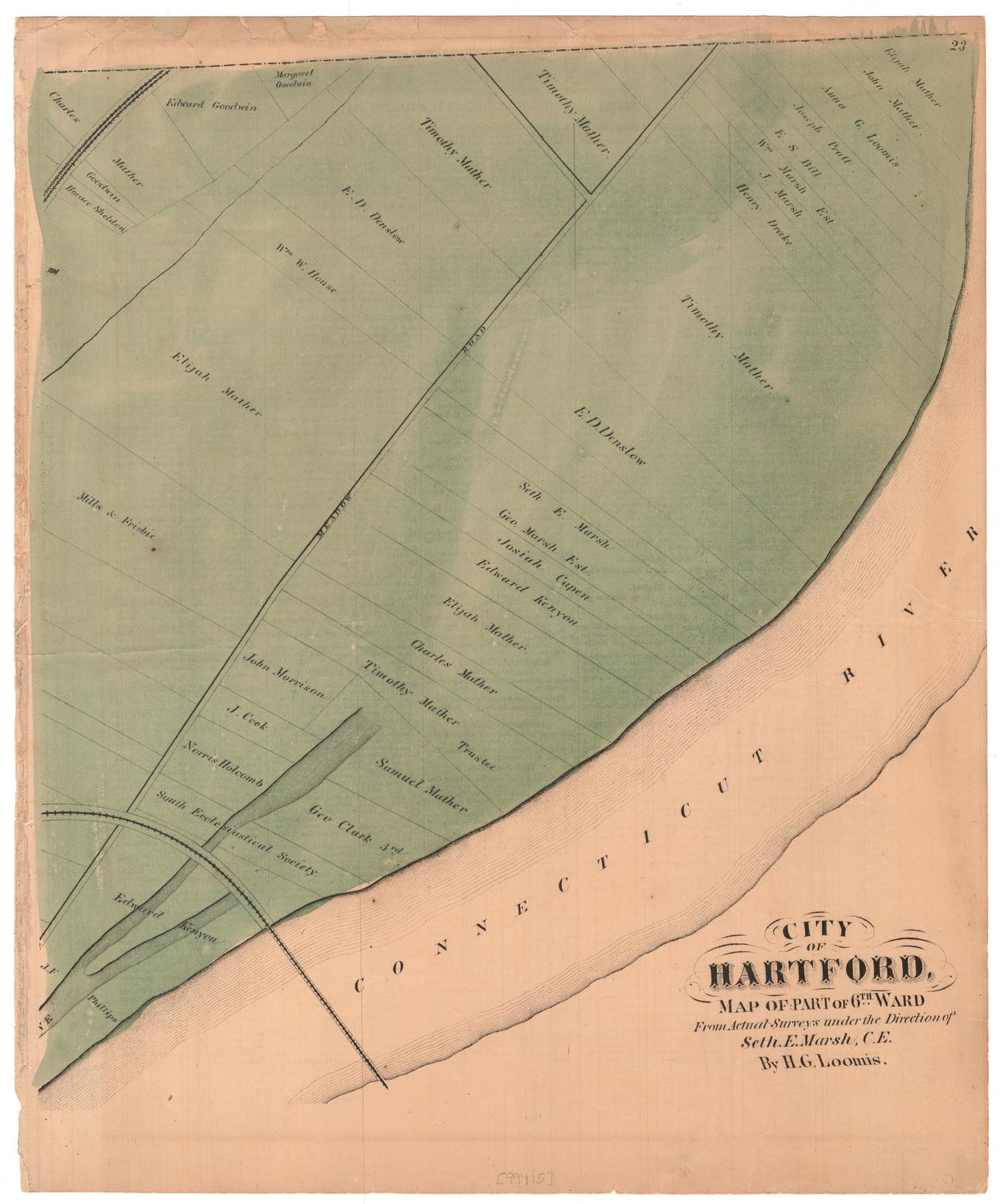
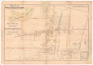
City of Hartford, Map of 4th Ward
SurveyorSurveyed by
Hiram G. Loomis
American, 1834 - 1911
SurveyorSurveyed by
Seth E. Marsh
American, about 1823 - 1878
PublisherPublished by
Baker & Tilden
founded 1869
Date1869
MediumLithograph; black printer's ink and watercolor on wove paper, lined with paper
DimensionsPrimary Dimensions (image height x width): 21 1/2 x 36 5/8in. (54.6 x 93cm)
Sheet (height x width): 23 1/2 x 37 3/4in. (59.7 x 95.9cm)
Mount (height x width): 23 1/2 x 37 3/4in. (59.7 x 95.9cm)
Sheet (height x width): 23 1/2 x 37 3/4in. (59.7 x 95.9cm)
Mount (height x width): 23 1/2 x 37 3/4in. (59.7 x 95.9cm)
ClassificationsGraphics
Credit LineConnecticut Museum of Culture and History collection
DescriptionMap of the Fourth Ward of Hartford, Connecticut, from Charter Oak Avenue to the north, the Connecticut River to the east, Bond Street to the south, and the South Fork of the Park River to the west. Streets are labeled, and land lots are denoted and include the names of some lot owners as well as the location and general shape of buildings on the lots. Notable landowners include Solomon Porter and Samuel Colt. Colt's Fire Arms Manufactory is located in the northeast corner. Parks and green spaces include Zion Hill Cemetery, Barnard's Cemetery, the old cemetery and South park. In the center of the ward is the space that housed the Retreat for the Insane (now the Institute of Living at Hartford Hospital), two bowling alleys, and a museum. The Hartford and Wethersfield Horse Railroad runs north-south through the ward.
Object number2012.312.160
MarkingsVerso, center, stamped in blue ink: "CtHi"InscribedRecto, top right corner, printed in black ink: "25."Top right corner, printed in black ink: "CITY / OF / HARTFORD, / MAP OF 4TH WARD / From Actual Surveys under the Direction of / Seth. E. Marsh, C.E. / By H. G. Loomis"NotesCartographic Note: No scale
Collections
- Maps and Charts: Finding Your Place in Connecticut History
On View
Not on view


Object/Object