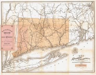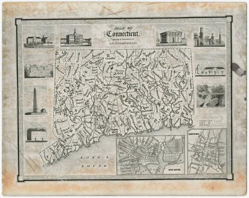
Map of Connecticut
After a work byAfter a work by
J. H. Goldthwait
American
Dateabout 1910
MediumProbably photomechanical reproduction; black ink on card stock
DimensionsPrimary Dimensions (image height x width): 4 5/8 x 6 1/8in. (11.7 x 15.6cm)
Sheet (height x width): 5 1/2 x 6 7/8in. (14 x 17.5cm)
Sheet (height x width): 5 1/2 x 6 7/8in. (14 x 17.5cm)
ClassificationsGraphics
Credit LineMuseum purchase
DescriptionMap of Connecticut showing only the south border along the Long Island Sound. The state is divided into counties which are labeled and delineated with crossed lines, and towns which are labeled and delineated with solid lines. Around the map are vignettes depicting the State House in New Haven, Yale College, Wesleyan University, the falls at Norwich, the theological institution in East Windsor, the Groton Monument, the falls at Canaan, Washington College, and the State House in Hartford. Below the map to the right are two insets featuring Hartford and New Haven.
Object number1981.142.1
MarkingsVerso, center, stamped in blue ink: "CtHi"Center, stamped in blue ink: THE CONNECTICUT / 83231 / H[ISTORICAL] [SOC]IETY"InscribedRecto, top center, printed in black ink: "MAP OF / Connecticut, / DRAWN & ENGRAVED BY / J.H. GOLDTHWAIT."NotesCartographic Note: No scale
Collections
- Maps and Charts: Finding Your Place in Connecticut History
On View
Not on view