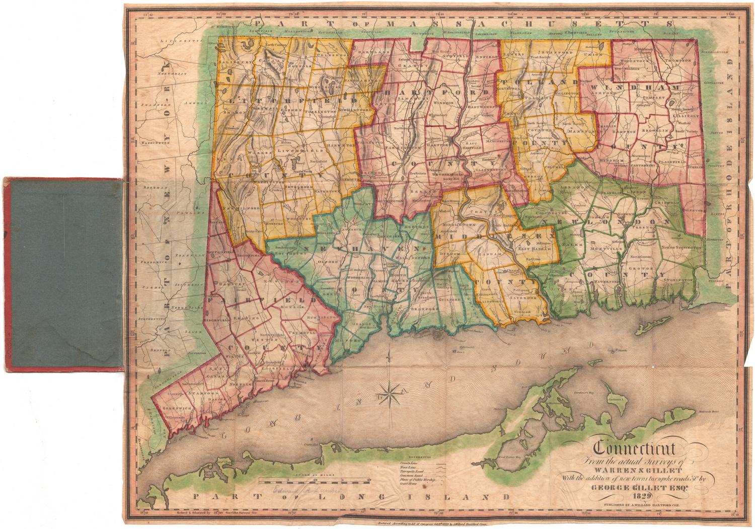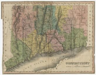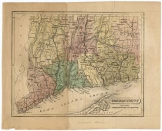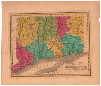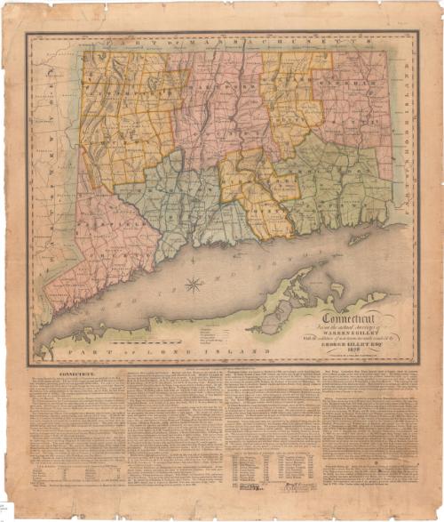
Connecticut from the actual surveys of Warren & Gillet With the addition of new towns, turnpike roads &c by George Gillet
SurveyorSurveyed by
Moses Warren Jr.
1762 - 1835
SurveyorSurveyed by
George Gillet
American, 1771 - 1853
DraftsmanDrawn by
George Gillet
American, 1771 - 1853
PublisherPublished by
Asaph Willard
1786 - 1880
Date1829
MediumEngraving; printer's ink and watercolor on wove paper
DimensionsPrimary Dimensions (image height x width): 18 x 21 1/4in. (45.7 x 54cm)
Sheet (height x width): 27 1/2 x 23 3/4in. (69.9 x 60.3cm)
Sheet (height x width): 27 1/2 x 23 3/4in. (69.9 x 60.3cm)
ClassificationsGraphics
Credit LineConnecticut Museum of Culture and History collection
DescriptionMap of the state of Connecticut with the border of Massachusetts to the north, Rhode Island to the east, part of Long Island and the Long Island Sound to the south, and New York to the west. The state is divided into counties which are labeled and delineated with broken solid and dotted lines, and towns which are labeled and delineated with solid lines. Turnpike roads are denoted with solid parallel lines and common roads with dotted lines. Population centers are shown as clusters of dots, with places of public worship and courthouses denoted with symbols. Elevation is conveyed through hachure marks. Rivers, ponds and lakes, islands and harbors are shown. Below the map is text that describes the natural features, cities, academic institutions, prisons and the history of Connecticut. The list of governors has been updated in manuscript through 1844.
Object number2005.197.0
InscribedRecto, bottom right, printed in black ink: "Connecticut / From the actual Surveys of / WARREN & GILLET / With the addition of new towns turnpike roads &c by / GEORGE GILLET ESQR. / 1829 / PUBLISHED BY A. WILLARD HARTFORD CON."Bottom left, printed in black ink: "Reduced & delineated by Geo. Gillet Surveyor Gen."
Center bottom, printed in black ink: "Entered According to Act of Congress Oct 1829 by A. Willard Hartford Conn."
NotesCartographic Note: Scale: 15/16 inches equals 5 miles
Collections
- Maps and Charts: Finding Your Place in Connecticut History
On View
Not on view