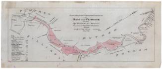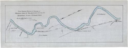
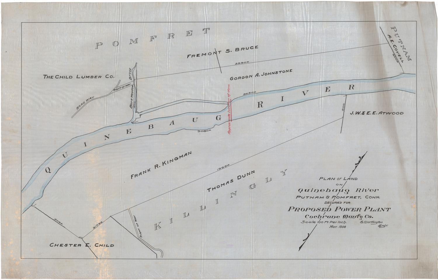
Plan Showing Portion of Flowage of Proposed Dam of the Danielson Cotton Company, Quinebaug River, Putnam, Connecticut
DraftsmanDrawn by
Erastus Worthington
American, 1863 - 1953
Dateabout 1908
MediumDrawing; black ink, pencil and watercolor on drafting linen
DimensionsPrimary Dimensions (image height x width): 10 x 31 1/2in. (25.4 x 80cm)
Sheet (height x width): 12 5/8 x 34in. (32.1 x 86.4cm)
Sheet (height x width): 12 5/8 x 34in. (32.1 x 86.4cm)
ClassificationsGraphics
Credit LineConnecticut Museum of Culture and History collection
DescriptionMap of the Quinebaug River and owned land along it as it flows through portions of Putnam, Connecticut. Lots are labeled with the owner's name, a sketch of any existing fences or stone walls, and a broken solid line marking the flow line. Property owners include J.W. and Ethelyn A. Atwood, Gilbert Tracey, David E. Clark, E.W. Wheaton, Philetus Heath and Mary Partello. A highway and the Consolidated Street Railway Company tracks appear on the right side of the map.
Object number2012.312.228
InscribedRecto, left side, handwritten in black ink: "PLAN SHOWING PORTION OF FLOWAGE OF / PROPOSED DAM OF THE DANIELSON COTTON CO. / QUINEBAUG RIVER, PUTNAM, CONN. / Scale 200 [crossed out in pencil; "300" written in pencil] Feet = 1 Inch / E. Worthington / Engr."NotesCartographic Note: Scale: 1 inch equals 300 feetCollections
- Maps and Charts: Finding Your Place in Connecticut History
On View
Not on view
Erastus Worthington
1907