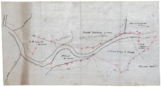
Borough of Danielsonville in Towns of Killingly and Brooklyn
SurveyorSurveyed by
Ormando Willis Gray
American, born 1829
PrinterPrinted by
Kellogg & Bulkeley
American, 1867 - 1990
PublisherPublished by
C. G. Keeney
American, about 1810 - 1888
Date1869
MediumLithography; black printer's ink and watercolor on wove paper
DimensionsPrimary Dimensions (image height x width): 28 x 17 1/8in. (71.1 x 43.5cm)
Sheet (height x width): 28 1/2 x 18 1/4in. (72.4 x 46.4cm)
Sheet (height x width): 28 1/2 x 18 1/4in. (72.4 x 46.4cm)
ClassificationsGraphics
Credit LineConnecticut Museum of Culture and History collection
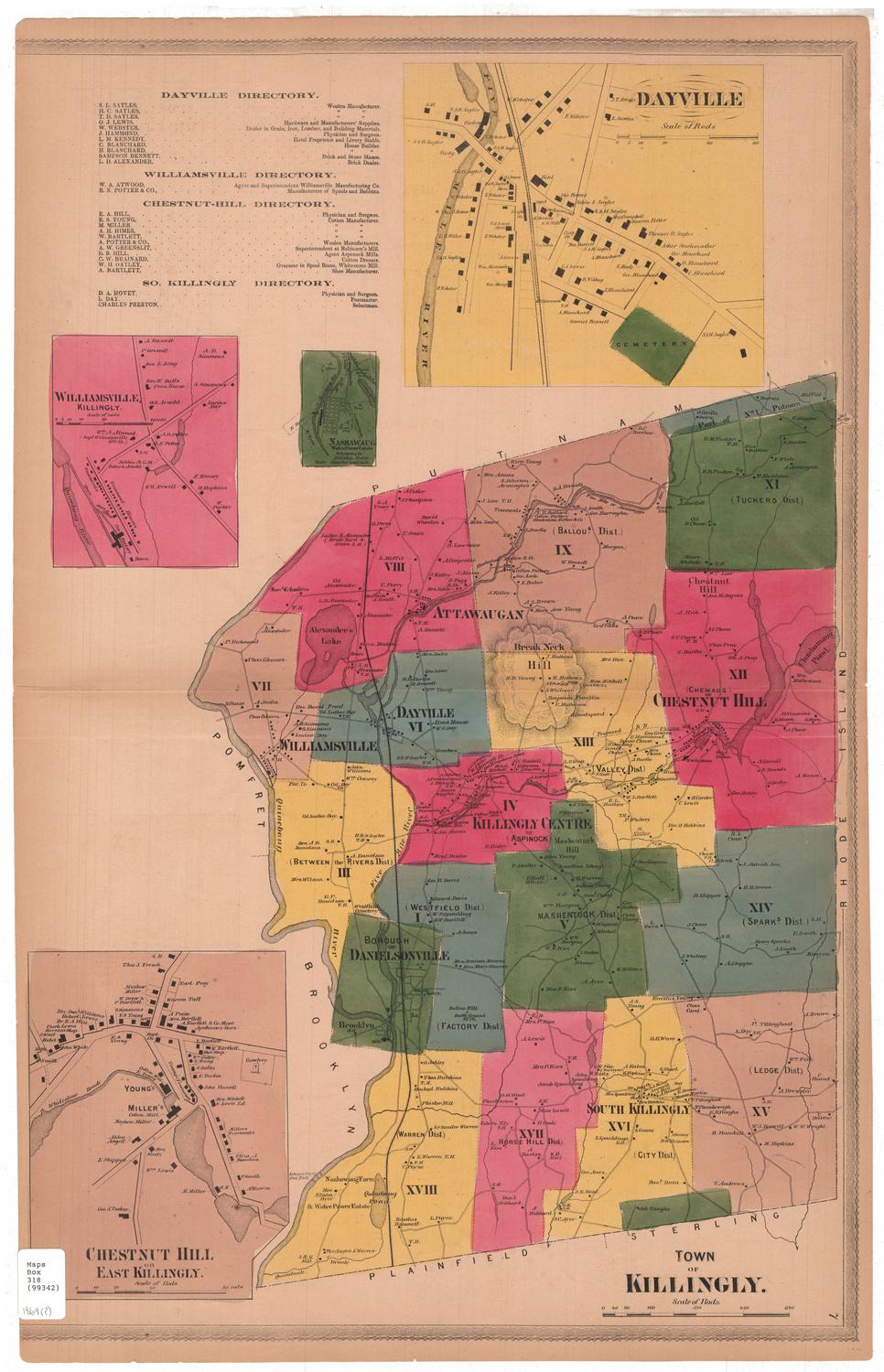
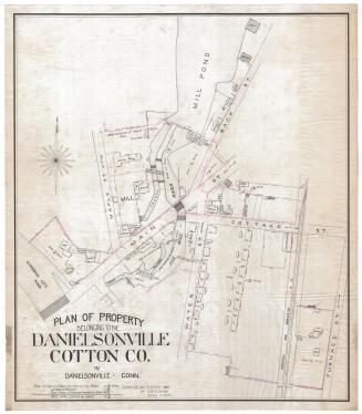
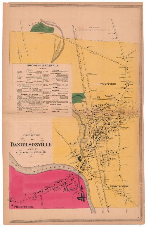
DescriptionMap of the borough of Danielsonville as it spans the towns of Killingly and Brooklyn, Connecticut. Killingly, colored yellow, is shown from Westfield Cemetery to the north, Broad Street to the east, the Quinebaug River to the south, and Maple Street to the west. The Norwich and Worcester Railroad line runs north-south through Killingly. Brooklyn, colored red, is on the other side of the river. Danielsonville is located primarily in Killingly, near the river. Roads are labeled and lined with residences and businesses, which are labeled with the owner's name or the name of the business. On the left side is a directory of Danielsonville that contains listings for attornies, agents, the bank, druggists, physicians and dentists, merchants and dealers, a jeweler, an engineer, manufacturers, hotels, the sheriff, milliners, carpenters and builders, painters, a photographer, a blacksmith and a collector.
Object number2006.123.0
MarkingsRecto, top left corner, printed in black ink on sticker: "Maps / Box / 338 / (99370)"InscribedRecto, top right corner, printed in black ink: "8"Left side, printed in black ink: "BOROUGH / OF / DANIELSONVILLE / IN TOWNS OF / KILLINGLY AND BROOKLYN"
Bottom right, printed in black ink: "9"NotesCartographic Note: Scale: 1 inch equals 20 rods
Collections
- Maps and Charts: Finding Your Place in Connecticut History
On View
Not on view