Town of Killingly
SurveyorSurveyed by
Ormando Willis Gray
American, born 1829
PrinterPrinted by
Kellogg & Bulkeley
American, 1867 - 1990
PublisherPublished by
C. G. Keeney
American, about 1810 - 1888
Date1869
MediumLithography; black printer's ink and watercolor on wove paper
DimensionsPrimary Dimensions (image height x width): 27 5/8 x 17 7/8in. (70.2 x 45.4cm)
Sheet (height x width): 28 1/2 x 18 1/4in. (72.4 x 46.4cm)
Sheet (height x width): 28 1/2 x 18 1/4in. (72.4 x 46.4cm)
ClassificationsGraphics
Credit LineConnecticut Museum of Culture and History collection
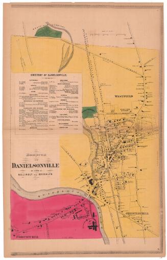
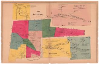
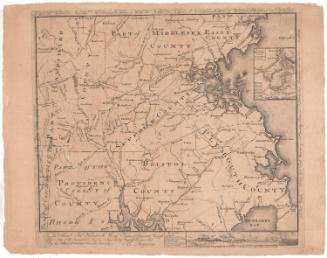
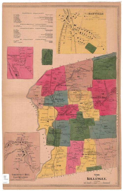
DescriptionMap of Killingly, Connecticut, from Putnam to the north, Rhode Island to the east, Plainfield and Sterling to the south, and the Quinebaug River, Pomfret and Brooklyn to the west. Killingly is divided into eighteen numbered districts and the borough of Danielsonville. Roads are shown but not labeled, and buildings are marked with a black square and the owner or occupant's name. An unnamed railroad runs north-south through the town. Natural features depicted include elevation, conveyed through hachure marks, ponds, rivers, and brooks. Inset maps show Dayville, Nashawaug water power estate, Williamsville, and Chestnut Hill. At the top of the sheet are directories for Dayville, Williamsville, Chestnut Hill and South Killingly.
Object number2006.126.0
MarkingsRecto, bottom left corner, printed in black ink on sticker: "Maps / Box / 318 / (99342)"Verso, top right corner, stamped in blue ink: "THE CONNECTICUT / HISTORICAL SOCIETY"InscribedRecto, bottom right, printed in black ink: "TOWN / OF / KILLINGLY."NotesCartographic Note: Scale: 1 inch equals 160 rods
Collections
- Maps and Charts: Finding Your Place in Connecticut History
On View
Not on view