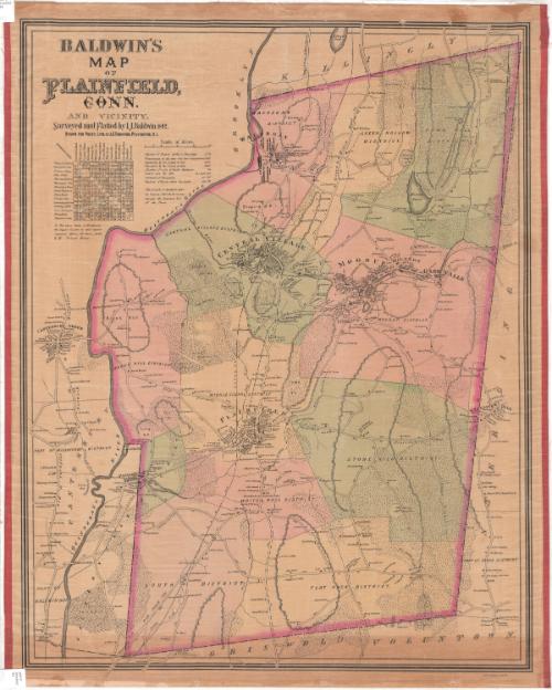
Baldwin's Map of Plainfield, Conn. and Vicinity
SurveyorSurveyed by
I. J. Baldwin
DraftsmanDrawn by
J. C. Thompson
PrinterPrinted by
Providence Lithograph Company
American, founded 1875
Date1892
MediumPhotolithography; black printer's ink and watercolor on wove paper, lined with linen
DimensionsPrimary Dimensions (image height x width): 30 x 23 3/4in. (76.2 x 60.3cm)
Sheet (height x width): 31 1/2 x 24 5/8in. (80 x 62.5cm)
Mount (height x width): 31 1/2 x 25 1/4in. (80 x 64.1cm)
Sheet (height x width): 31 1/2 x 24 5/8in. (80 x 62.5cm)
Mount (height x width): 31 1/2 x 25 1/4in. (80 x 64.1cm)
ClassificationsGraphics
Credit LineMuseum purchase
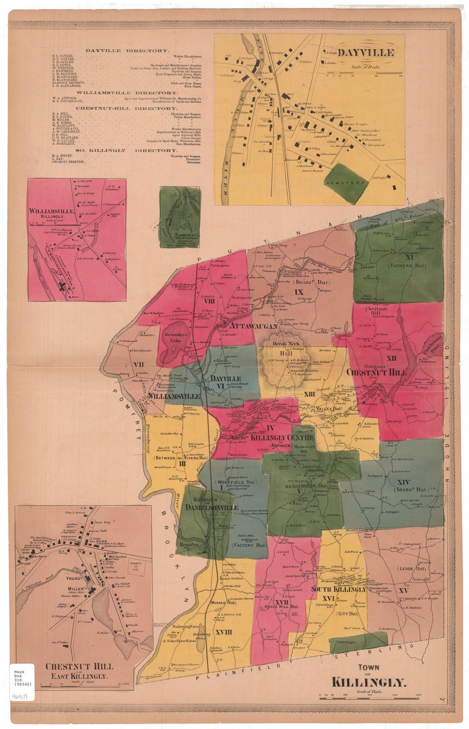
DescriptionMap of Plainfield, Connecticut, with Killingly to the north; Sterling to the east; Griswold and Voluntown to the south; and the Quinebaug River, Canterbury and Brooklyn to the west. Plainfield is divided into districts, colored yellow, pink or green. The roads are labeled and small black squares mark the locations of houses and stores, labeled with the owner's name. The New York and New England Railroad runs through the town. Physical features include elevation, conveyed with hachure marks, swamps, brooks, and forests. In the top left corner are a distance table and a list of facts about Plainfield, including its population, latitude, and altitude.
Object number1983.192.1
MarkingsRecto, top and bottom left corners, printed in black ink: "MAPS / Drawer / 94"Verso, top left corner, stamped in blue ink: "THE CONNECTICUT / 82868 / HIST [illegible, the rest is faded]"InscribedRecto, top left, printed in black ink: "BALDWIN'S / MAP / OF / PLAINFIELD, / CONN. / AND VICINITY. / Surveyed and Platted by I.J. Baldwin 1892. / DRAWN FOR PHOTO. LITH. BY J.C. THOMPSON, PROVIDENCE, R.I."
Bottom right corner, printed in black ink: "PROVIDENCE LITH. CO."NotesCartographic Note: Scale: about 3/4 inch equals 1/4 mile
Collections
- Maps and Charts: Finding Your Place in Connecticut History
On View
Not on view