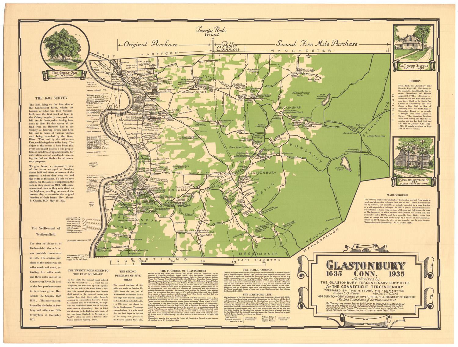
Glastonbury Conn.
MakerPrepared by
Robert O. Rider
American, 1892 - 1956
MakerPrepared by
Herbert T. Clark
American, 1878 - 1972
MakerPrepared by
John T. Henderson
American, 1876 - 1962
PublisherPublished by
Glastonbury Tercentenary Committee
American, founded 1935
Date1935
MediumLithography; black and green printer's inks on wove paper
DimensionsPrimary Dimensions (image height x width): 15 1/2 x 21in. (39.4 x 53.3cm)
Sheet (height x width): 17 x 22 1/2in. (43.2 x 57.2cm)
Sheet (height x width): 17 x 22 1/2in. (43.2 x 57.2cm)
ClassificationsGraphics
Credit LineConnecticut Museum of Culture and History collection
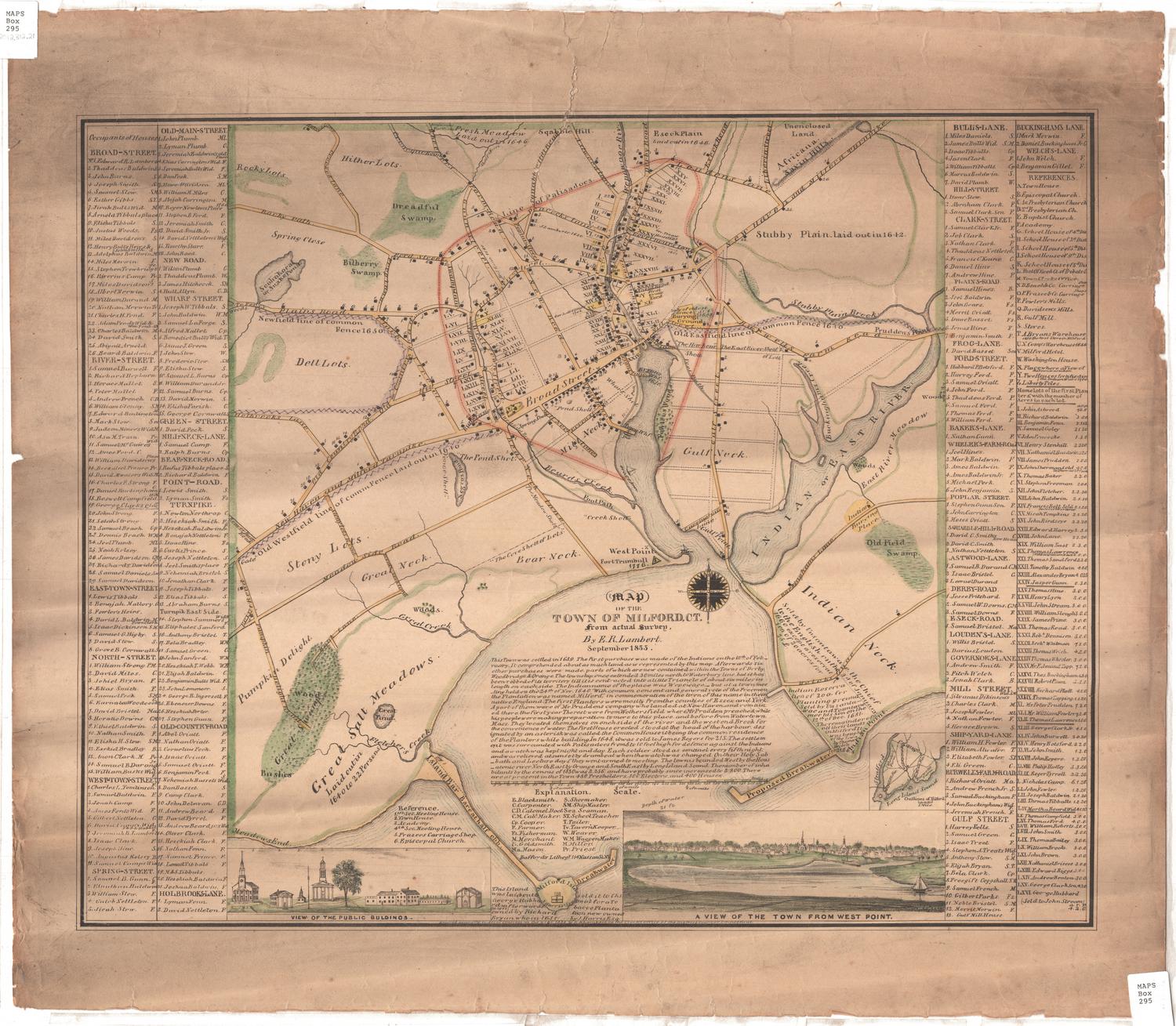
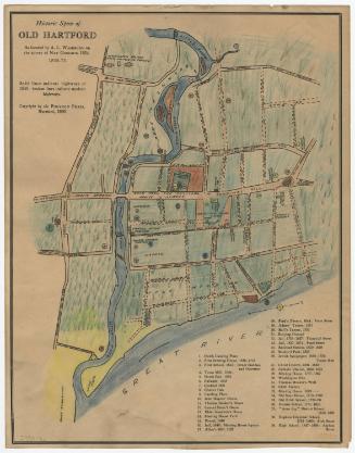
DescriptionMap of Glastonbury, Connecticut, extending from the borders of Hartford and Manchester to the north, Hebron and Marlborough to the east, Portland and East Hampton to the south, and the Connecticut River to the west. Created for Glastonbury's tercentenary, the map contains the locations, dates and owners' names of residences and industries that existed before 1800, as well as business and public buildings contemporary to the map. The original purchase, public common and second five mile purchase are delineated in broken solid and broken solid and dotted lines. Natural features include the Connecticut River, lakes, and the use of green color to denote forests. To the top left of the map, there is a vignette featuring "The Great Oak at Wassuc," and to the right, there is a vignette of Revered Timothy Stevens' house from 1693 and one of the John Hollister House from 1675. Text recounting the history of the founding and settling of Glastonbury appears around the map.
Object number2012.312.195
MarkingsVerso, right side, stamped in blue ink: "CtHi"InscribedRecto, lower right, printed in black ink: "GLASTONBURY / 1635 CONN. 1935 / Authorized by / THE GLASTONBURY TERCENTENARY COMMITTEE / for THE CONNECTICUT TERCENTENARY / PREPARED BY THE HISTORIC MAP COMMITTEE / Robert O. Rider Herbert T. Clark / 1685 SURVEY, ANCIENT COURSE OF RIVER, THREE MILE BOUNDARY PREPARED BY / Mr. John T. Henderson of Hartford, Connecticut / On this map are shown houses built prior to 1800, and now standing, as / well as the sites of unique industries, also present industries, public / buildings, and so forth. The names and dates were obtained from / Town Records and Histories, local sources and tradition."NotesCartographic Note: No scaleCollections
- Maps and Charts: Finding Your Place in Connecticut History
On View
Not on view
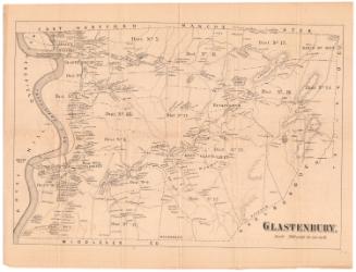

Lucius Stebbins & Co.
1859
Object/Object