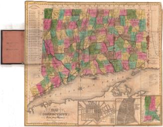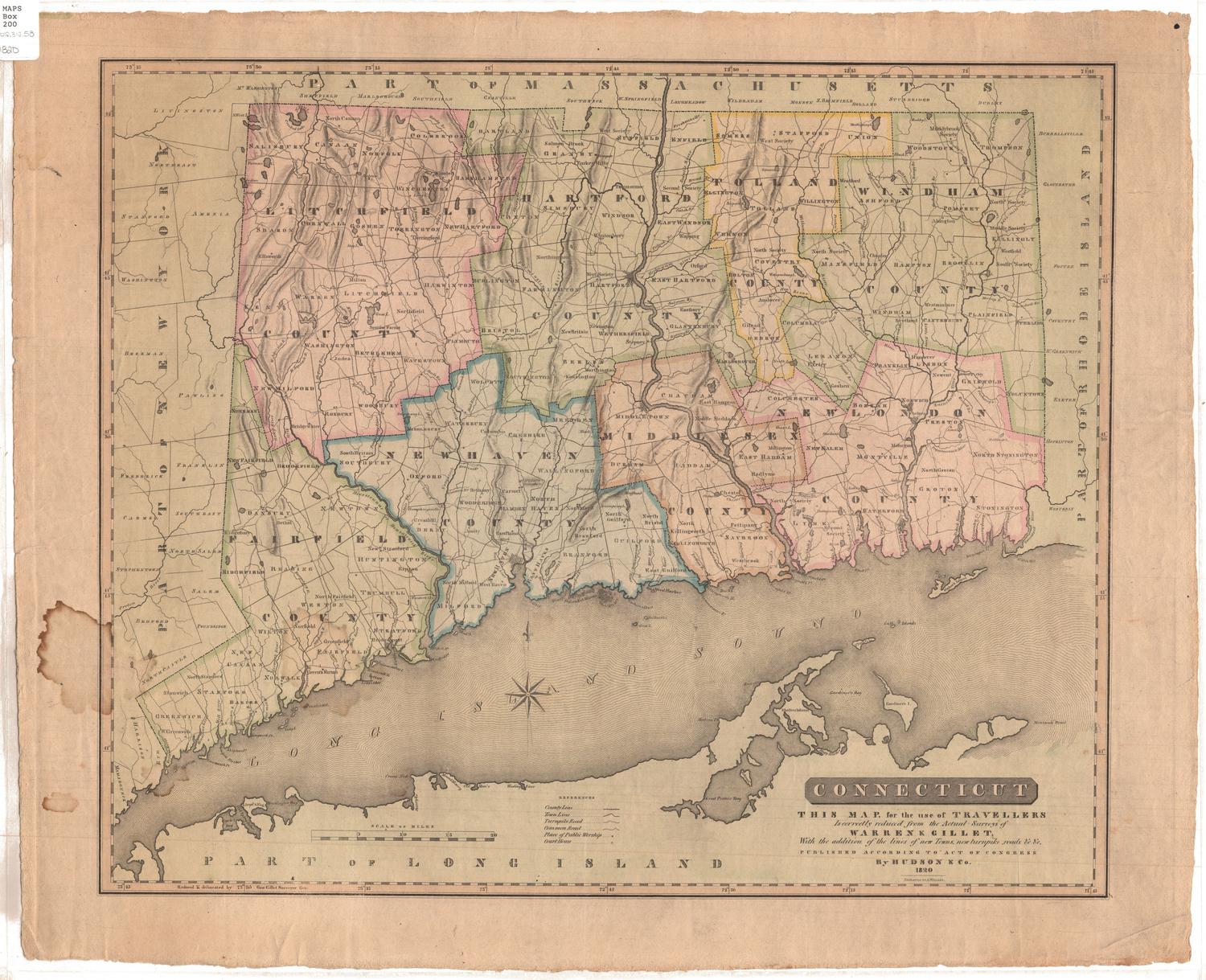
Map of Connecticut from actual survey
PrintmakerEngraved by
Daggett & Ely
American, 1831 - 1836
PublisherPublished by
Brown and Parsons
American, 1838 - 1851
Date1849
MediumEngraving; black printer's ink and watercolor on wove paper, unfolded from cardboard covers
DimensionsPrimary Dimensions (image height x width): 19 1/8 x 21 1/2in. (48.6 x 54.6cm)
Sheet (height x width): 19 1/4 x 21 5/8in. (48.9 x 54.9cm)
Sheet (height x width): 19 1/4 x 21 5/8in. (48.9 x 54.9cm)
ClassificationsGraphics
Credit LineConnecticut Museum of Culture and History collection
DescriptionMap of Connecticut, with Massachusetts to the north, Rhode Island to the east, the Long Island Sound to the south, and New York to the west. All of the towns in the state are bounded by solid black lines, and are colored blue, yellow, green or pink, and the counties are bounded by broken solid and dotted lines that are colored dark pink. Turnpikes, "common" roads, places of public worship, courthouses, canals and railroads are depicted on the map with lines and symbols. Four vignettes, one to the right of the map and three below it, show a "Profile of the Farmington Canal," plans of New Haven and Hartford, and the New England states, respectively. To the left of the map is a list of the governors of Connecticut since the charter. The map was originally folded into covers with the title "Map of Connecticut," the cardboard covers are attached to the verso of the encapsulation.
Object number2012.312.65
MarkingsRecto, top and bottom left corners, printed in black ink on sticker: "MAPS / Box / 239"InscribedRecto, bottom left, printed in black ink: "MAP / OF / CONNECTICUT / From actual Survey / Published by BROWN & PARSONS, Hartford Conn. / 1849"Bottom left, printed in black ink: "Engraved by Daggett & Ely New Haven"
Recto of cardboard cover: "MAP OF / CONNECTICUT"NotesCartographic Note: Scale: About 7/8" equals 5 miles
Constituent Note: Even though the firm of Daggett & Ely was long defunct by the time this edition of their map was published, their original plate still survived and continued to be updated and resissued.
Collections
- Maps and Charts: Finding Your Place in Connecticut History
On View
Not on view