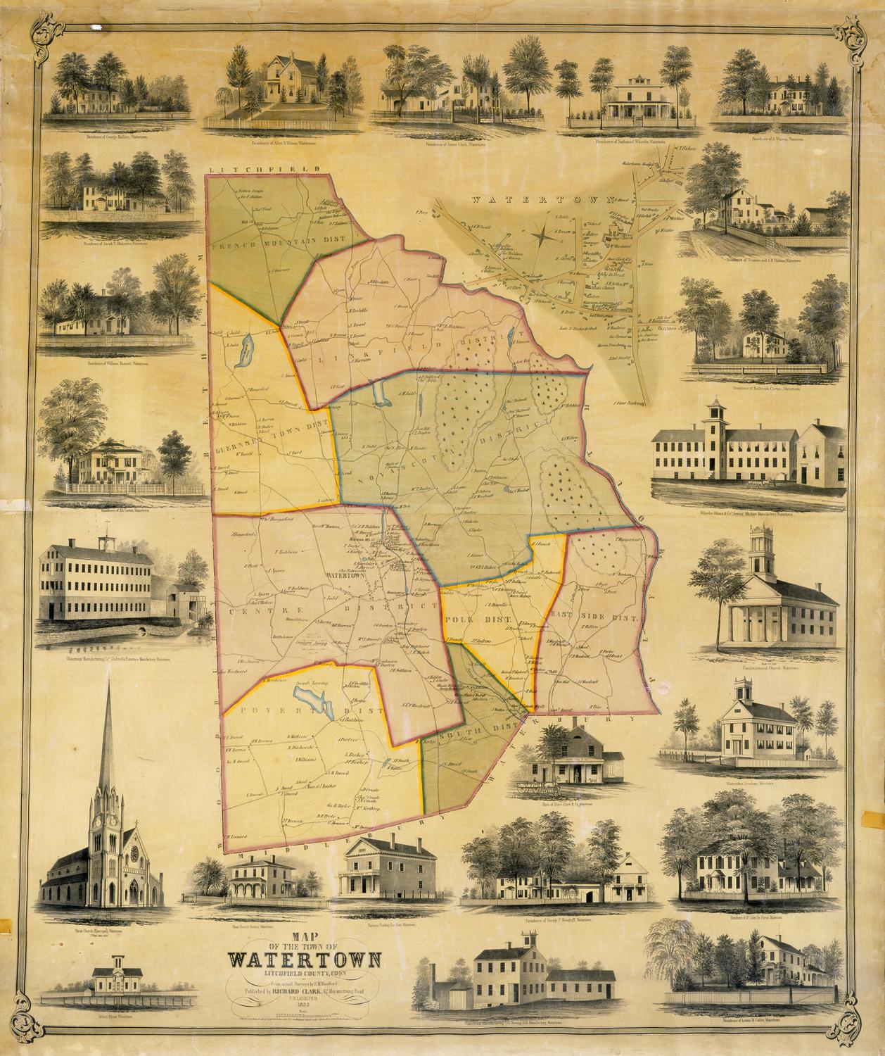
Map of the Town of New Hartford, Litchfield County, Connecticut
SurveyorSurveyed by
Lawrence Fagan
American, born about 1825
PrintmakerLithographed by
Friend & Aub
American, founded 1852
PrinterPrinted by
Wagner & McGuigan
American, 1845 - 1859
PublisherPublished by
Richard Clark
American
Date1852
MediumLithography; black printer's ink and watercolor on wove paper mounted on fabric
DimensionsPrimary Dimensions (image height x width): 34 3/4 x 40in. (88.3 x 101.6cm)
Sheet (height x width): 37 3/4 x 42 3/8in. (95.9 x 107.6cm)
Sheet (height x width): 37 3/4 x 42 3/8in. (95.9 x 107.6cm)
ClassificationsGraphics
Credit LineMuseum purchase
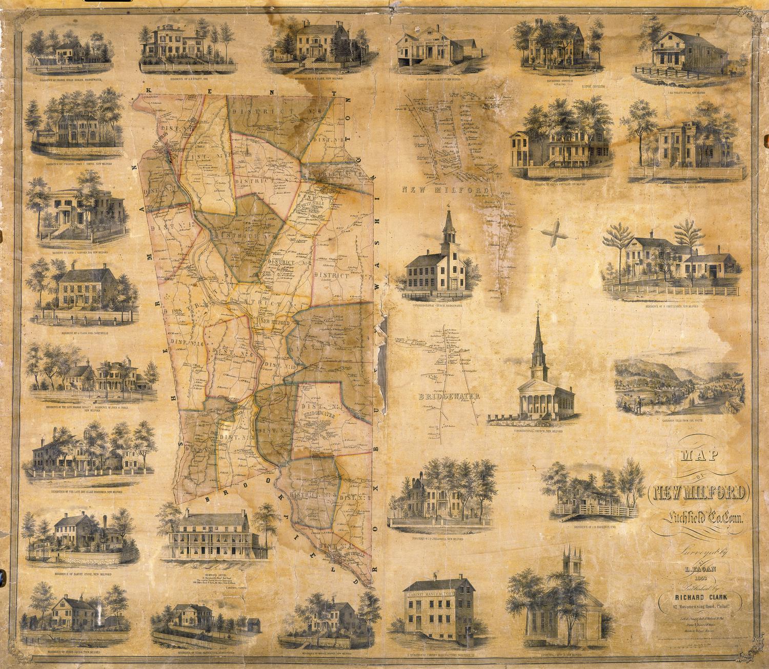
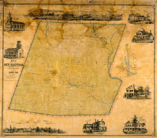
DescriptionMap of New Hartford, Connecticut, with Barkhamsted to the north, Canton to the east, Harwinton and Burlington to the south, and Torrington to the west. The villages of Bakerville, Nepaug, New Hartford Center, Pine Meadow, and Town HIll are shown with their houses, businesses, and property owners. The Farmington River and the Nepaug River are shown in blue. Elevation is indicated by hachure marks. A separate inset map at right provides detail for the center of New Hartford. Vignettes surrounding the map include the North Congregational Church, the South Congregational Church, Smith and Brown's Manufactory, the Green Woods Manufacturing Company, the New Hartford Centre Hotel, and the residences of J. C. Smith, D. B. Smith, and Major S. Brown.
Object number1956.95.2
MarkingsOn verso, upper left, on gummed label, typed in black ink, "MAPS / Case 3 / No. 14"On verso, upper right, on gummed label, typed in black ink, "MAPS / Case 3 / No. 14"InscribedOn recto, left center, printed in black ink, "MAP / of THE TOWN of / NEW HARTFORD / LITCHFIELD CO., CONN. / Surveyed and drawn by / L. FAGAN / Published by / RICHARD CLARK / 42 Moyamensing Road, Philada. / 1852 / Lith. by Friend & Aub, 80 Walnut St. Phila. / Wagner & McGuigan's Steam Lith. Press / Entered according to act of Congress in the year 1852, by Richard Clark / in the Clerk's Office of the District court of the eastern District of Pa."
On verso, upper left, in pencil, "MAPS / Case 3 / No. 14"
On verso, upper right, in pencil, "MAPS / Case 3 / No. 14"
On verso, lower right, in pencil, "1956.95.2"NotesCartographic Note: Four inches equal one mile
Collections
- Maps and Charts: Finding Your Place in Connecticut History
On View
Not on view