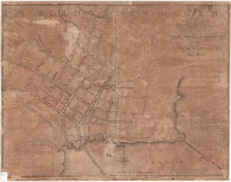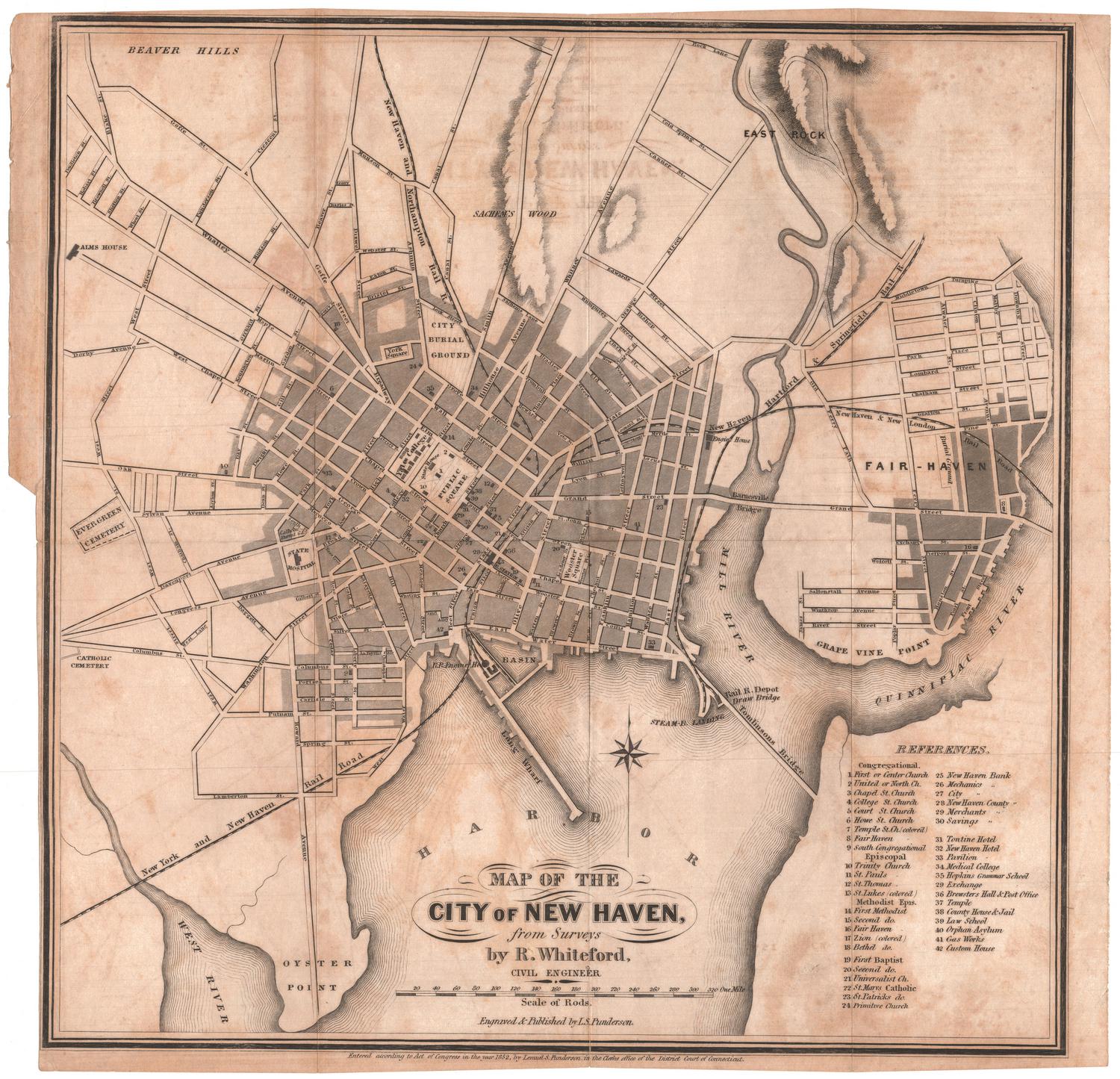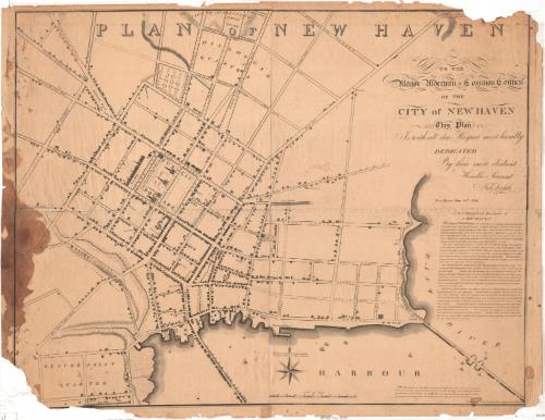
Plan of New Haven
SurveyorSurveyed by
Amos Doolittle
American, 1754 - 1832
PrintmakerEngraved by
Amos Doolittle
American, 1754 - 1832
PublisherPublished by
Amos Doolittle
American, 1754 - 1832
Date1824
MediumEngraving; black printer's ink on wove paper
DimensionsPrimary Dimensions (image height x width): 28 3/8 x 35 1/8in. (72.1 x 89.2cm)
Platemark (width only): 37in. (94cm)
Sheet (height x width): 29 1/2 x 38in. (74.9 x 96.5cm)
Platemark (width only): 37in. (94cm)
Sheet (height x width): 29 1/2 x 38in. (74.9 x 96.5cm)
ClassificationsGraphics
Credit LineMuseum purchase
DescriptionMap of the town of New Haven, Connecticut, focusing on the town green and its surrounding blocks, with Temple Square to the north, the East River to the east, the harbor to the south, and Howe Street to the west. In the public square, the State House, Episcopal church, United Society church and Old Burying Ground are shown. Yale College is pictured above College Street. Dwellings and shops are represented with drawings of buildings and are not labeled. Other notable landmarks include the new burying ground, public well, county jail, bell foundry, rope walks, and Tomlinson's Bridge. Boats are depicted in the harbor and along the Union or Long Wharf. On the right side is a written geographical description of the city.
Object number1965.96.0
MarkingsRecto, top and bottom left corners, printed in black ink on stickers: "MAPS / Drawer / 69"Verso, bottom, handwritten in pencil on sticker: "1059"
InscribedRecto, top, printed in black ink: "PLAN OF NEW HAVEN"
Right side, printed in black ink: "TO THE / Mayor Aldermen & Common Council / OF THE / CITY of NEW HAVEN / This Plan / Is with all due Respect most humbly / DEDICATED / By their most obedient / Humble Servant / Amos Doolittle / New-Haven May 28th 1824"
Bottom right, printed in black ink: "The Buildings in this Plan are marked differently from what is customary. / Instead of giving the ground-plot, it was thought it would be more pleasing to have / the elevation of the Front. In doing this care has been taken, not only to exhibit / the proportions of each building, but likewise the exact number of its doors & windows"
Bottom right, printed in black ink: "Surveyed & Published by A. Doolittle Engraver New-Haven"
Verso, top right, handwritten in pencil: "70355"NotesCartographic Note: Scale: 5/8 inch equals 10 rods
Collections
- Maps and Charts: Finding Your Place in Connecticut History
On View
Not on view