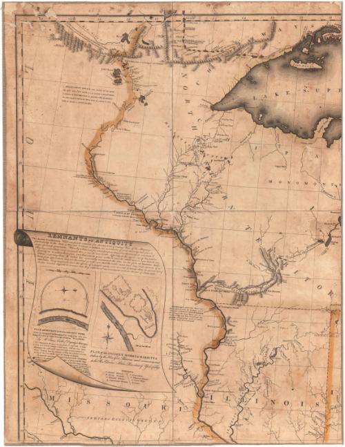
A Map of the United States and British Provinces of Upper and Lower Canada with other parts adjacent
PrintmakerEngraved by
Amos Doolittle
American, 1754 - 1832
PrintmakerEngraved by
Thomas Kensett
American, 1786 - 1829
PrinterPrinted by
Shelton & Kensett
American, founded 1813
Date1816
MediumEngraving; black printer's ink and watercolor on paper, lined with linen
DimensionsPrimary Dimensions (.a image height x width): 23 1/8 x 17 3/4in. (58.7 x 45.1cm)
Sheet (.a height x width): 23 3/4 x 18 3/8in. (60.3 x 46.7cm)
Mount (.a height x width): 24 x 18 5/8in. (61 x 47.3cm)
Primary Dimensions (.b image height x width): 23 1/2 x 18 1/2in. (59.7 x 47cm)
Sheet (.b height x width): 24 x 18 1/2in. (61 x 47cm)
Mount (.b height x width): 24 1/8 x 18 5/8in. (61.3 x 47.3cm)
Primary Dimensions (.c image height x width): 23 1/2 x 17 5/8in. (59.7 x 44.8cm)
Sheet (.c height x width): 24 x 18 1/2in. (61 x 47cm)
Mount (.c height x width): 24 1/4 x 18 5/8in. (61.6 x 47.3cm)
Primary Dimensions (.d image height x width): 23 1/2 x 18in. (59.7 x 45.7cm)
Sheet (.d height x width): 25 1/8 x 18 1/2in. (63.8 x 47cm)
Mount (.d height x width): 25 1/2 x 18 3/4in. (64.8 x 47.6cm)
Primary Dimensions (.e image height x width): 23 1/2 x 18 1/2in. (59.7 x 47cm)
Sheet (.e height x width): 25 3/8 x 18 1/2in. (64.5 x 47cm)
Mount (.e height x width): 25 5/8 x 18 5/8in. (65.1 x 47.3cm)
Primary Dimensions (.f image height x width): 23 1/2 x 17 3/4in. (59.7 x 45.1cm)
Sheet (.f height x width): 25 3/8 x 18 1/4in. (64.5 x 46.4cm)
Mount (.f height x width): 25 3/8 x 18 5/8in. (64.5 x 47.3cm)
ClassificationsGraphics
Credit LineConnecticut Museum of Culture and History collection
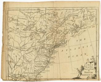
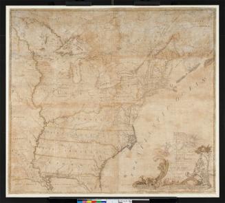
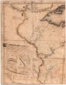
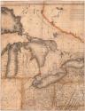
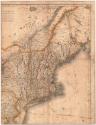
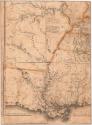
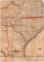
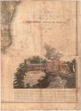
DescriptionMap of the United States and Canada, from Upper and Lower Canada to the north; the Atlantic Ocean to the east; Louisiana, Mississippi and Georgia to the south, and Louisiana to the west. State, territory and country boundary lines are outlined in color. Smaller land divisions include districts, counties and towns, ranges, purchases and divisions. Roads are included. Natural features consist of mountain ranges, drawn in relief; lakes; bays; rivers; waterfalls; and islands. Lands inhabited or hunted on by Native Americans are also labeled. The Missouri, St. Lawrence and Mississippi Rivers are all labeled with a brief, descriptive paragraph. The decorative cartouche features Niagara Falls complete with rainbow and mist, and two Native Americans, one with a weapon, on the rocky ledge overlooking the falls. Below the cartouche is a description of Niagara Falls. To the left of the map is a text block titled, "Remnants of Antiquity," which describes monuments found in Ohio and Indiana Territory.
Object number2012.312.87
InscribedRecto, right side, printed in black ink: "TO / THE PRESIDENT / The / Senators and Representatives of the United States / THIS MAP OF / THE UNITED STATES OF AMERICA / Is most Respectfully Dedicated by / SHELTON & KENSETT / 1816 / A. Doolittle and T. Kensett Sculp"Bottom right, printed in black ink: "A MAP / of the / UNITED STATES / and British Provinces of / UPPER and LOWER CANADA / with other parts adjacent / BY / SHELTON & KENSETT."
Bottom center, printed in black ink: "Scale of Miles / Projected by Thomas Kensett / Entered according to Act of Congress October 1st,, 1816 in the Dist. of Connecticut"
Left side, under "PLAN and DESCRIPTION of an ANCIENT WORK," printed in black ink: "by Mr. Enos Culter, Deputy Surveyor"
Left side, printed in black ink: "PLAN of the ANCIENT WORKS at MARIETTA / taken by the Hon Gen Parsons and communicated / to the Rev Doctor Stiles President of Yale College"NotesCartographic Note: Scale: 1 inch equals about 30 miles
Dimensions Note: The map is composed of six pieces. Dimensions for each piece are listed separately.
Collections
- Maps and Charts: Finding Your Place in Connecticut History
On View
Not on view

Samuel Augustus Mitchell
1835
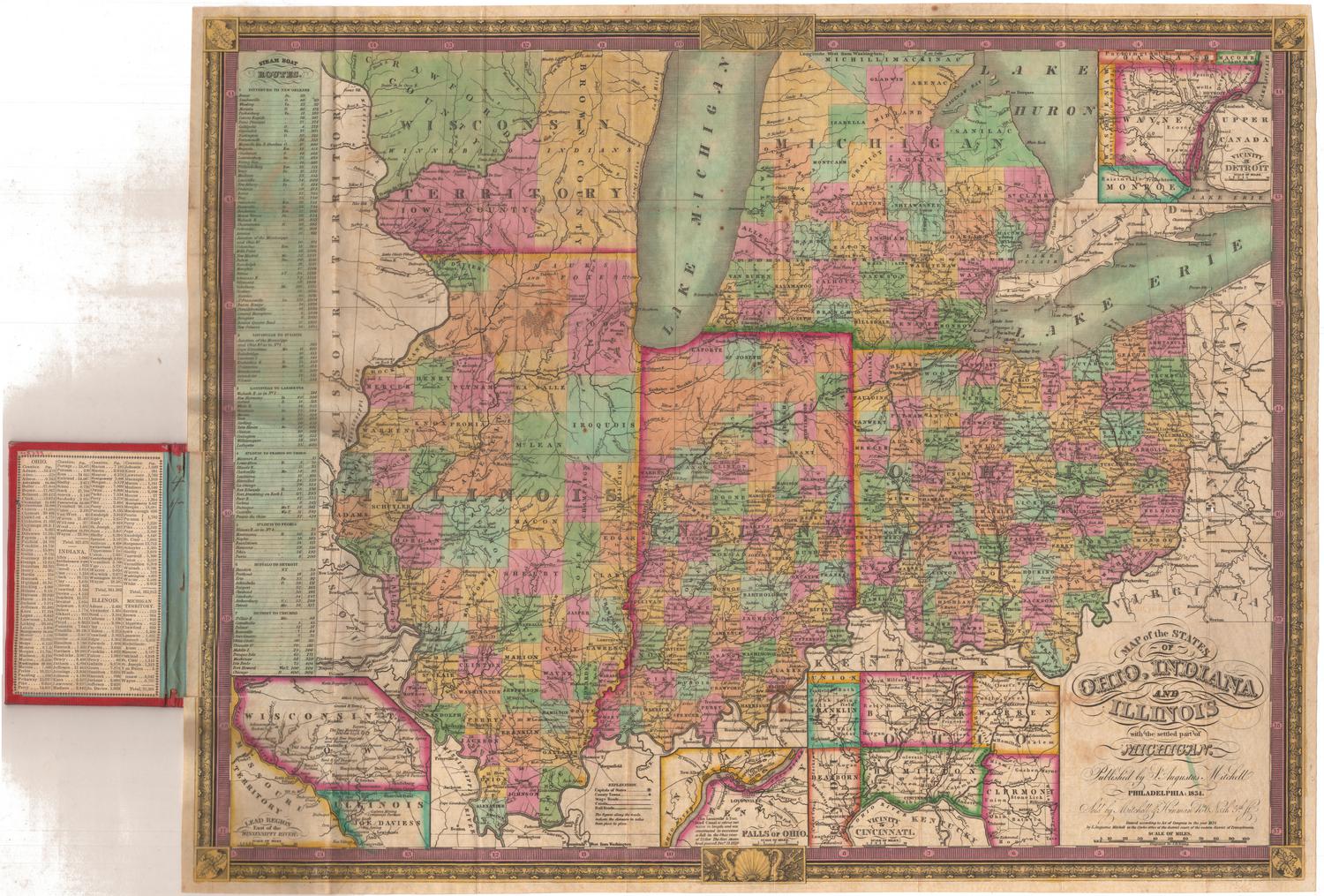
Samuel Augustus Mitchell
1834