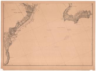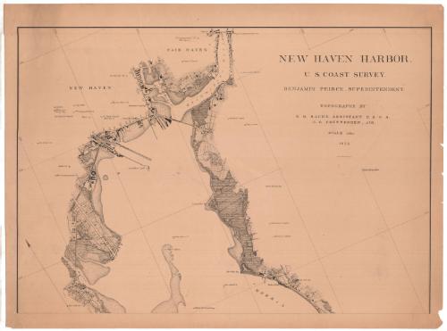
New Haven Harbor
SurveyorSurveyed by
Richard Meade Bache
American, 1830 - 1907
SurveyorSurveyed by
George Benjamin Chittenden
American, 1849 - 1939
PrinterLithographed by
Julius Bien
1826 - 1909
PublisherPublished by
United States Coast Survey
American, founded 1807
Date1872
MediumLithography; black printer's ink on wove paper
DimensionsPrimary Dimensions (image height x width): 21 3/16 x 30 3/8in. (53.8 x 77.2cm)
Sheet (height x width): 24 x 32 1/8in. (61 x 81.6cm)
Sheet (height x width): 24 x 32 1/8in. (61 x 81.6cm)
ClassificationsGraphics
Credit LineConnecticut Museum of Culture and History collection
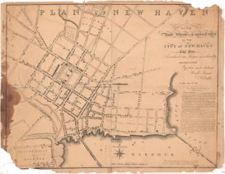
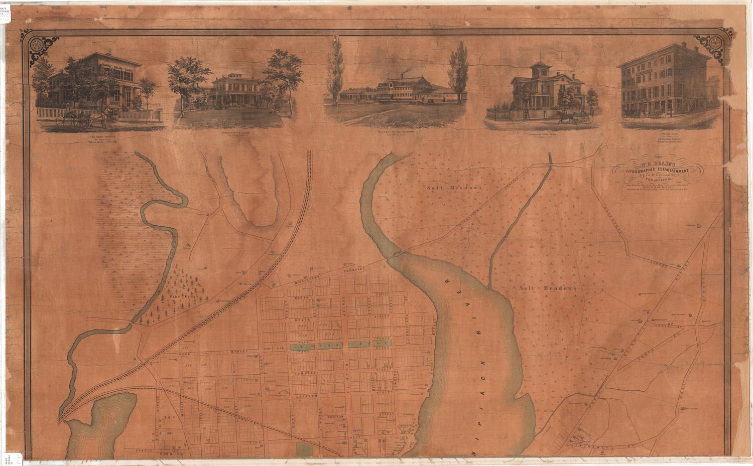
DescriptionMap of the New Haven, Connecticut, harbor and the land around it, from Fair Haven to the north, the East Haven spire to the east, the harbor to the south, and the West River to the west. The Mill and Quinnipiac Rivers are shown near the top of the map. Some of the city streets are laid out but not labeled, and buildings, presumably including dwellings and businesses, are indicated with black rectangles. Notable man-made features and landmarks, such as cupolas, signal towers, churches and City Hall are marked and labeled. A variety of lines indicates different types of and uses for land, none of which are explained. In the water part of the map, signals, buoys, the long wharf light and a watch house are marked and labeled. Water depth is not included.
Object number2012.312.190.1
InscribedRecto, top right, printed in black ink: "NEW HAVEN HARBOR. / U.S. COAST SURVEY. / BENJAMIN PEIRCE, SUPERINTENDENT. / TOPOGRAPHY BY / R.M. BACHE, ASSISTANT U.S.C.S. / G.B. CHITTENDEN, AID. / SCALE 1/10,000 / 1872 / JULIUS BIEN, PHOTO-LITH."NotesCartographic Note: Scale: 1/10,000Collections
- Maps and Charts: Finding Your Place in Connecticut History
On View
Not on view