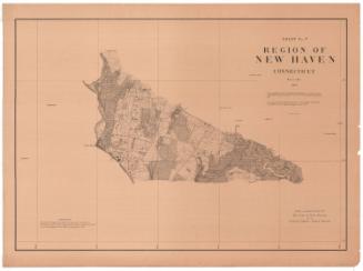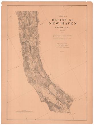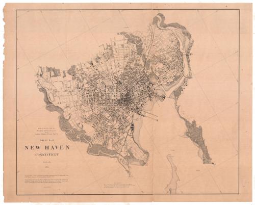
New Haven, Connecticut
MakerMade by
United States Coast Survey
American, founded 1807
SurveyorTriangulation by
Richard Meade Bache
American, 1830 - 1907
SurveyorTriangulation by
Horace Andrews
American, 1852 - 1945
SurveyorTriangulation by
Edward Goodfellow
American, about 1828 - 1899
SurveyorTopography by
Richard Meade Bache
American, 1830 - 1907
SurveyorTopography by
James P. Bogart
1852 - 1903
PrinterLithographed by
Julius Bien
1826 - 1909
Date1877
MediumPhoto lithograph; black printer's ink on wove paper
DimensionsPrimary Dimensions (image height x width): 29 7/8 x 36in. (75.9 x 91.4cm)
Sheet (height x width): 32 1/8 x 40 1/4in. (81.6 x 102.2cm)
Sheet (height x width): 32 1/8 x 40 1/4in. (81.6 x 102.2cm)
ClassificationsGraphics
Credit LineConnecticut Museum of Culture and History collection
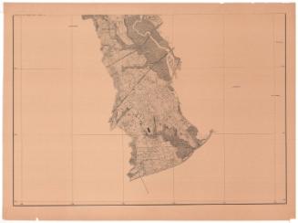
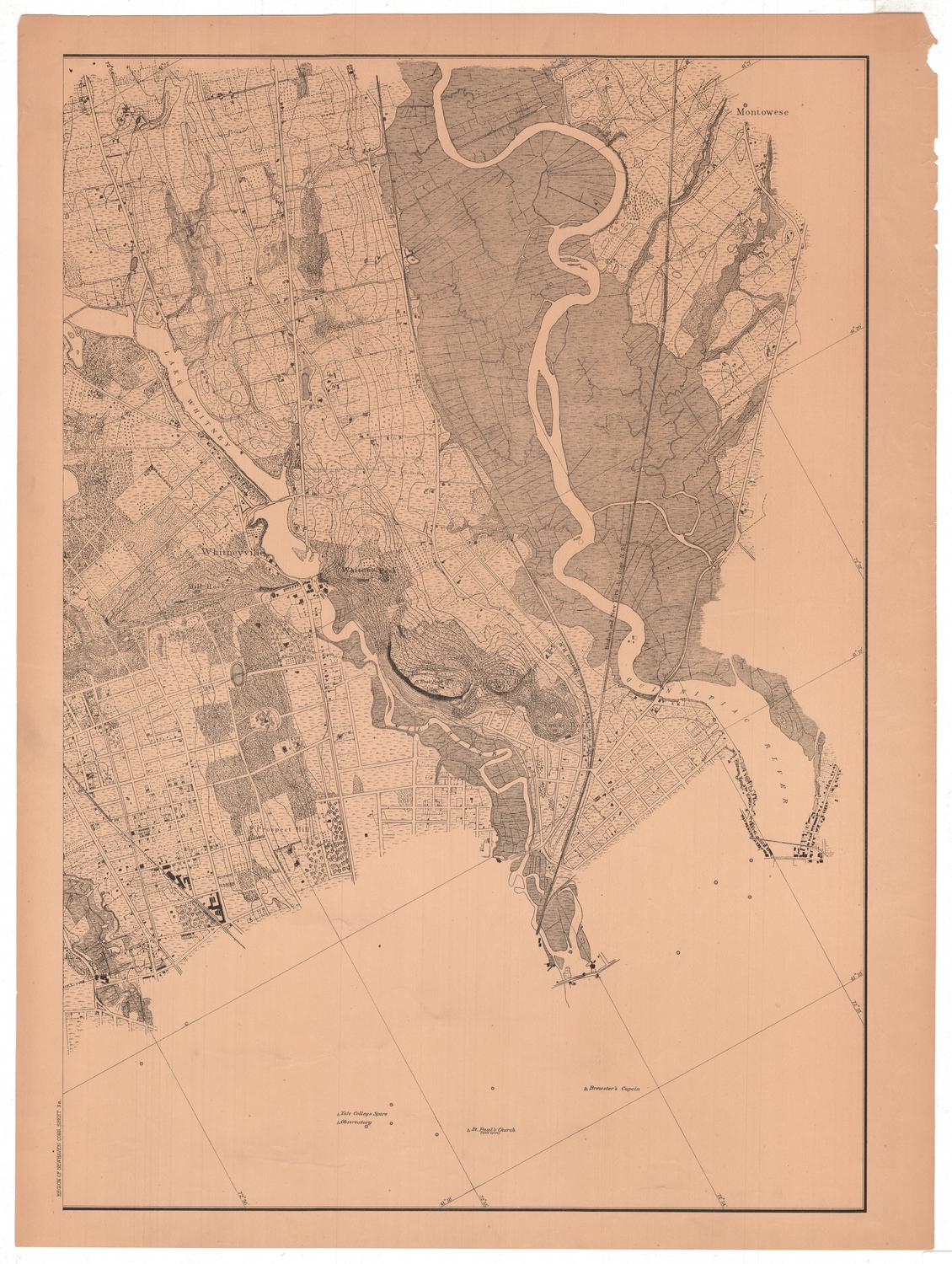
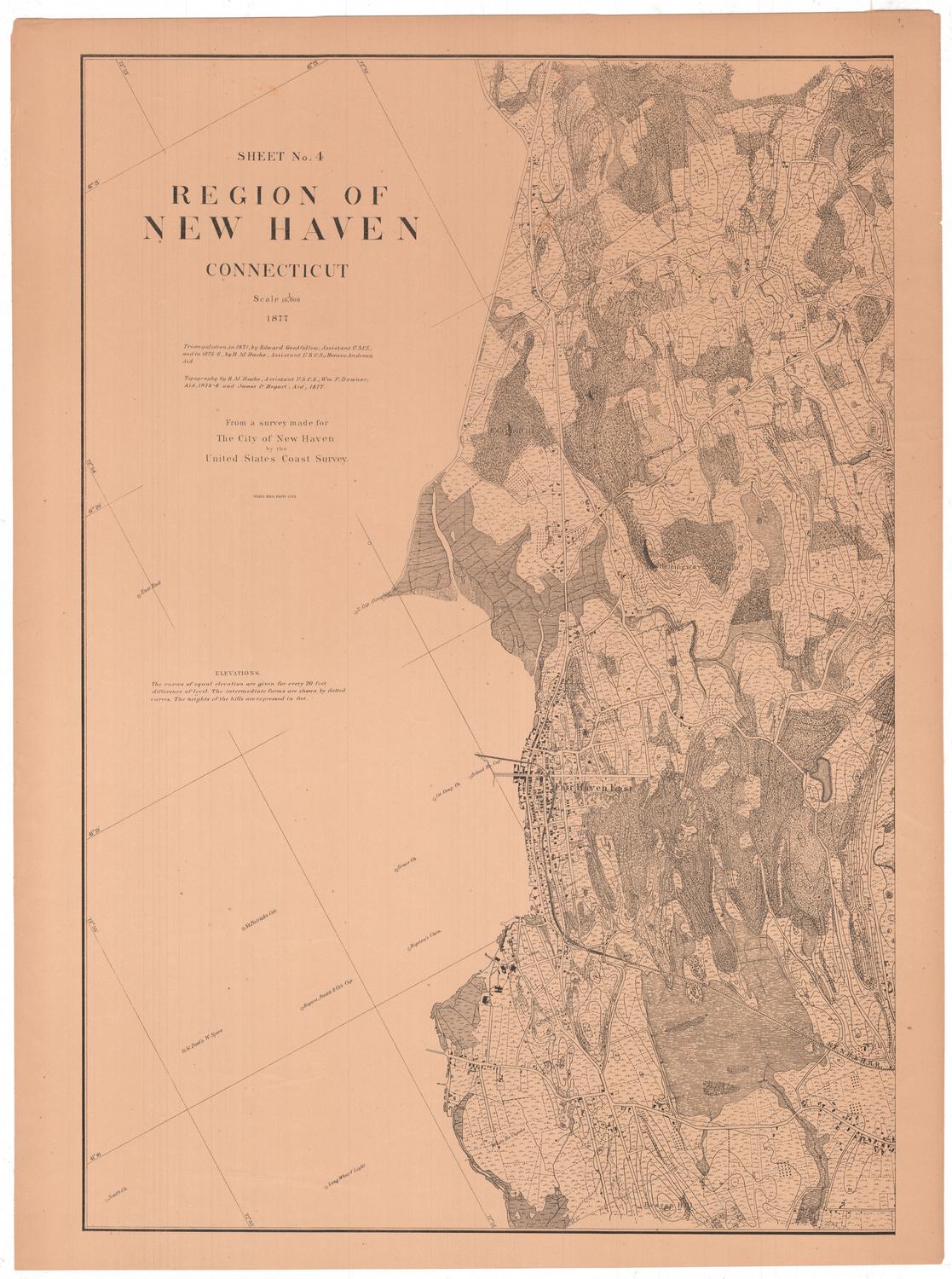
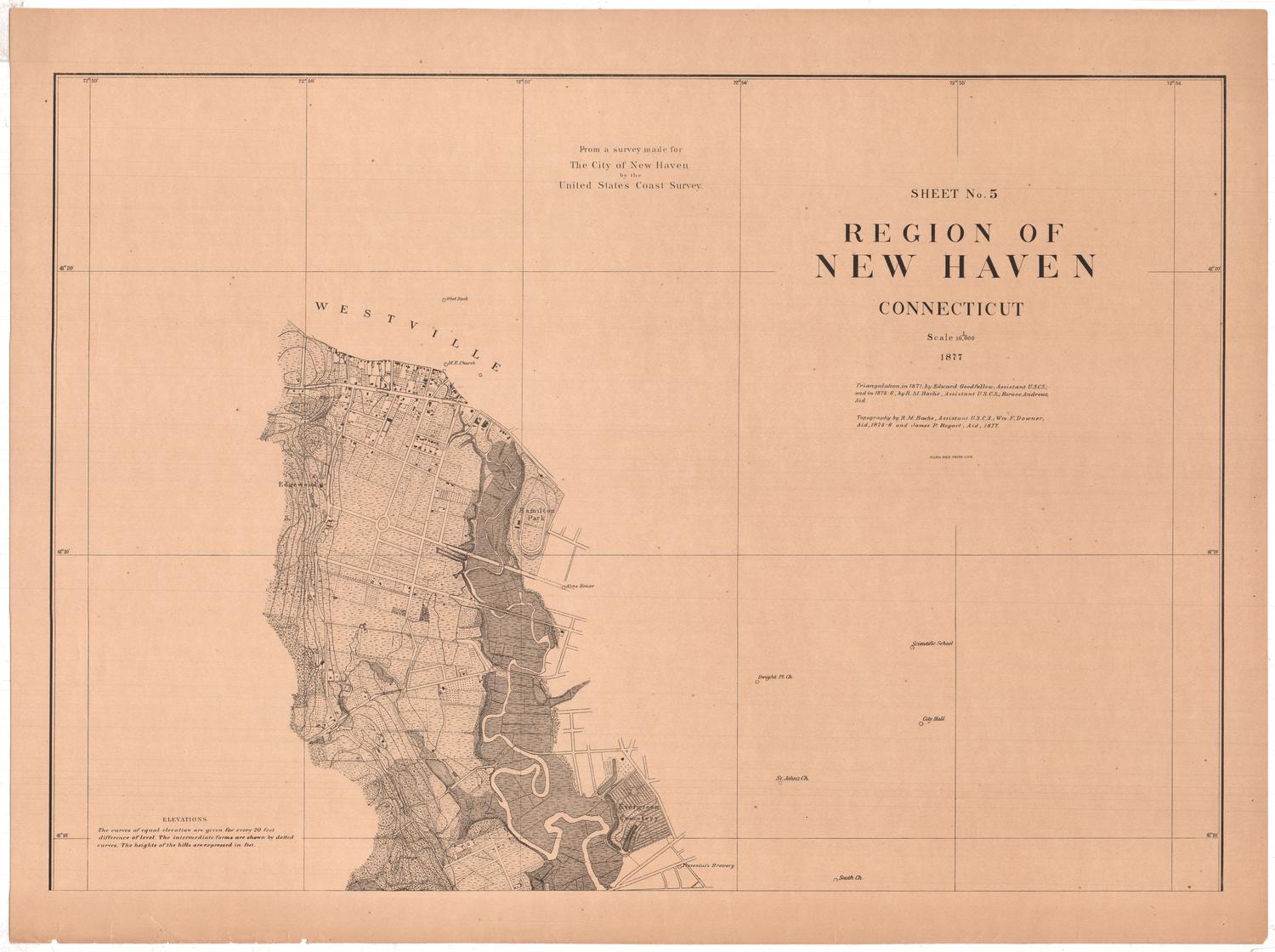
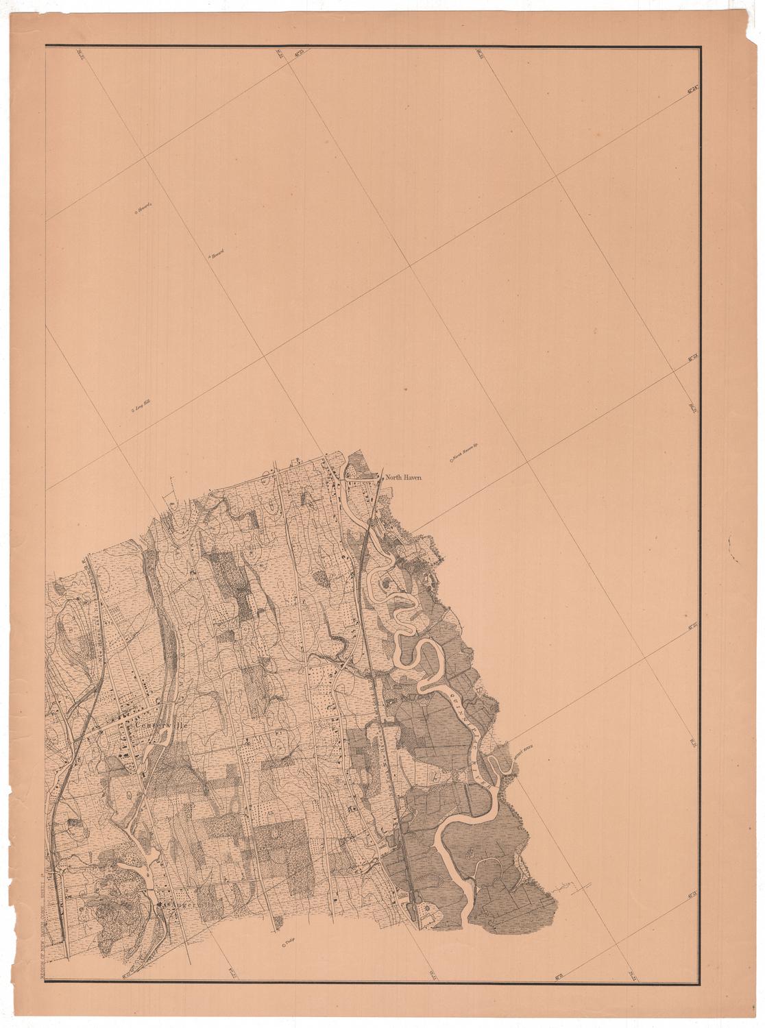
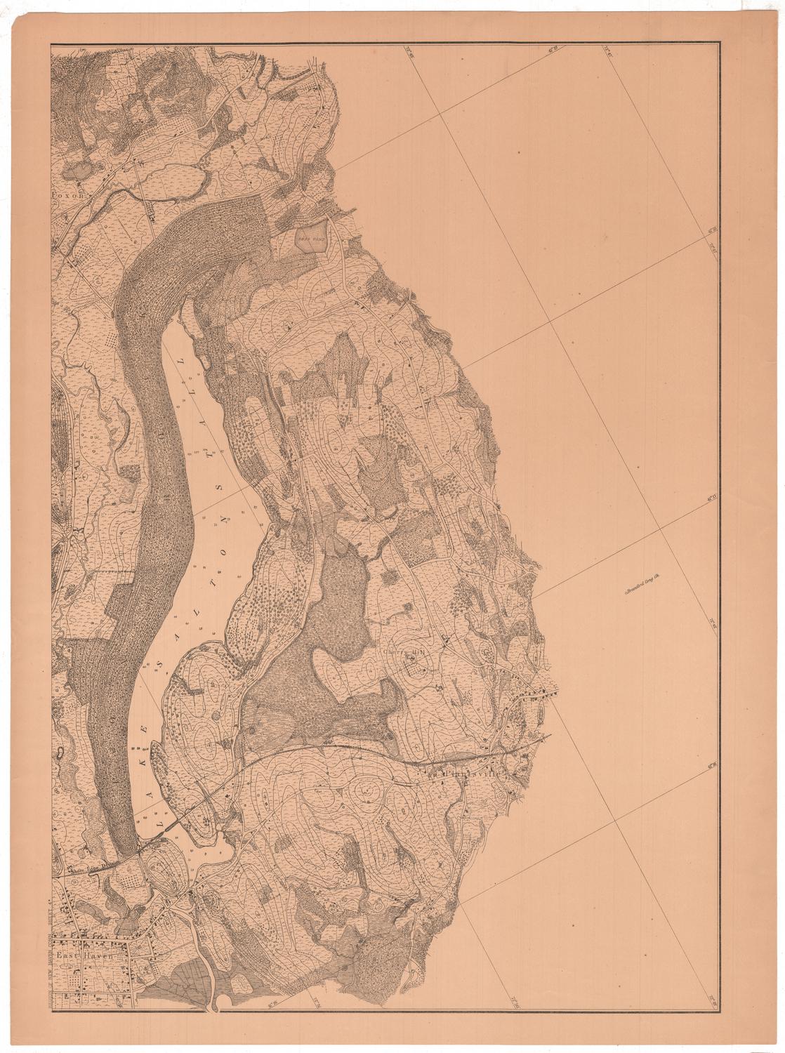
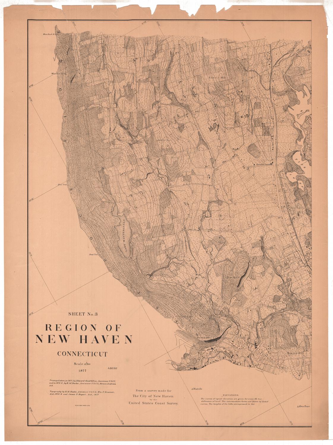
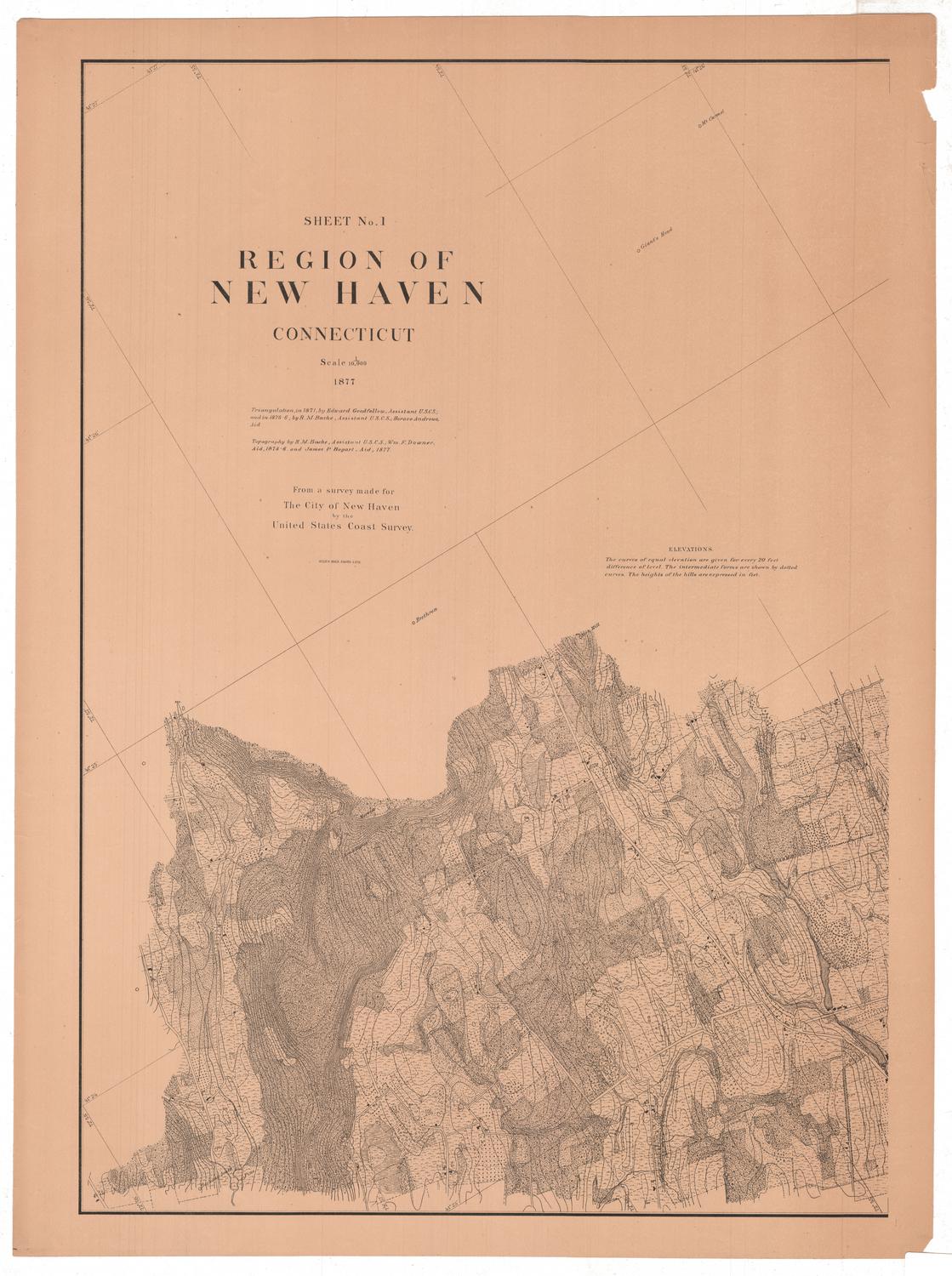
DescriptionSheet 6 of an 11-sheet map of New Haven, Connecticut, showing the town center and the immediate outlying areas. It extends from the Mill River to the north, the Quinnipiac River to the east, the harbor and Long Island Sound to the south, and the West River to the west. What are presumably roads are indicated with solid parallel lines. Contour lines indicate elevation with the height of the hill provided in feet. Buildings appear to be shown with small, shaded rectangular shapes. Additionally, some landmarks beyond the area detailed are provided: for example, the East Rock and buoys in the harbor, in the case of this map.
Object number2012.312.216.10
InscribedRecto, bottom left, printed in black ink: "From a survey made for / The City of New Haven / by the / United States Coast Survey / SHEET No. 6 / NEW HAVEN / CONNECTICUT / Scale 1/10:000 / 1877 / Triangulation, in 1871, by Edward Goodfellow, Assistant U.S.C.S. and in 1873-4 by / R.M. Bache, Assistant U.S.C.S. and Horace Andrews, Aid. / Topography pantagraphed by James P. Bogart, Aid, from the work on 1/1200 executed by / R.M. Bache, Assistant U.S.C.S. for the Harbor Commission of New Haven, and in the / interior of the City, from that on 1/1200 executed by the City Engineer's Office. / JULIUS BIEN, PHOTO-LITH."Bottom center, printed in black ink: "ELEVATIONS / The curves of equal elevation are given for every 20 feet / difference of level. The intermediate forms are shown by dotted / curves. The heights of the hills are expressed in feet."NotesCartographic Note: Scale: 1:10,000
Collections
- Maps and Charts: Finding Your Place in Connecticut History
On View
Not on view