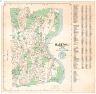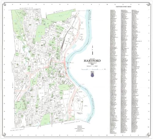
City of Hartford, Connecticut
MakerPrepared by
Metropolitan District Commission
American, founded 1929
Date1997
MediumLithography; black and colored printer's inks on wove paper
DimensionsPrimary Dimensions (image height x width): 23 x 25in. (58.4 x 63.5cm)
Sheet (height x width): 24 3/8 x 25 1/2in. (61.9 x 64.8cm)
Sheet (height x width): 24 3/8 x 25 1/2in. (61.9 x 64.8cm)
ClassificationsGraphics
Credit LineGift of Ursula Korzenik
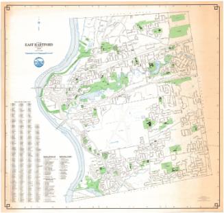
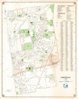
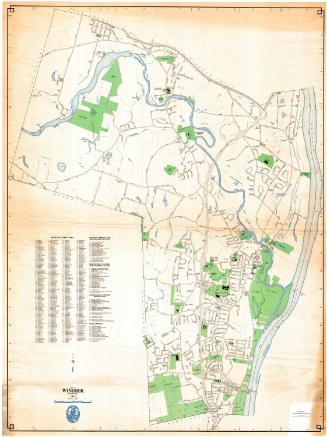
DescriptionMap of Hartford, Connecticut, with Bloomfield and Windsor to the north, the Connecticut River to the east, Newington and Wethersfield to the south, and West Hartford to the west. Local roads are labeled; and parks, hospitals, schools and universities, civic buildings and other public spaces are colored green. Ponds, rivers and other bodies of water are blue. The interstate highways are shown in red. To the right of the map is a street index.
Object number2004.142.4
MarkingsRecto, top and bottom left corners, printed in black ink on stickers: "MAPS / Drawer / 82"Verso, bottom left corner, stamped in black ink: "Connecticut Historical Society / Library"InscribedRecto, center, printed in black ink: "CITY OF / HARTFORD / CONNECTICUT / 1997"
Bottom center, printed in black ink: "PREPARED BY / GIS SERVICES / THE METROPOLITAN DISTRICT / 555 MAIN ST / HARTFORD, CT 06142"
Verso, bottom left corner, handwritten in pencil: "98456"NotesCartographic Note: Scale: 1 inch equals 1600 feet
Collections
- Maps and Charts: Finding Your Place in Connecticut History
On View
Not on view