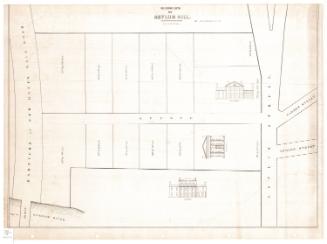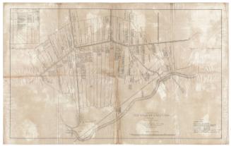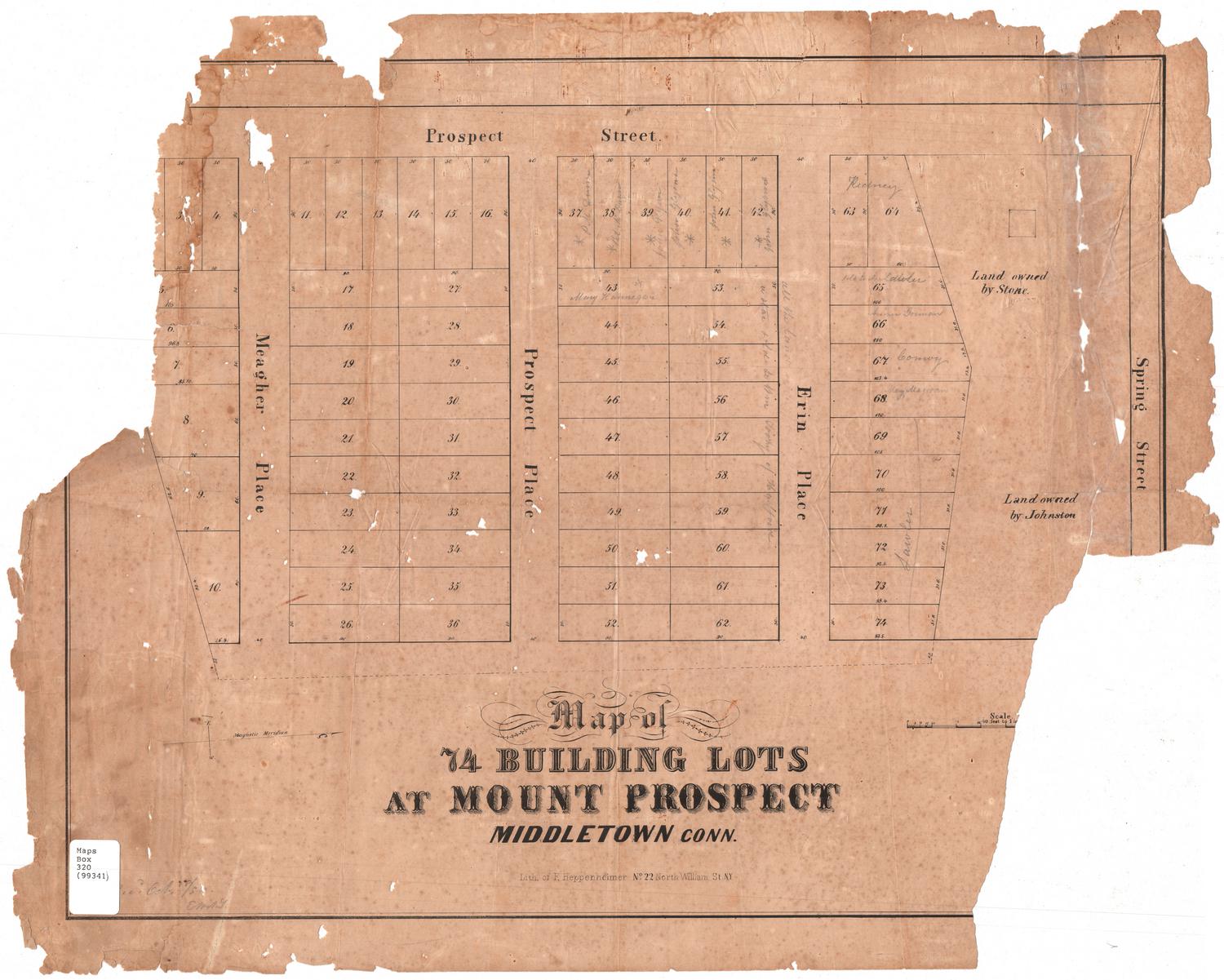
Map of 74 Building Lots at Mount Prospect, Middletown, Connecticut
PrinterPrinted by
F. Heppenheimer
American, active 1854 - 1884
Date1854-1856
MediumLithography; black printer's ink on wove paper
DimensionsPrimary Dimensions (image height x width): 17 1/4 x 22in. (43.8 x 55.9cm)
Sheet (height x width): 19 1/4 x 24in. (48.9 x 61cm)
Sheet (height x width): 19 1/4 x 24in. (48.9 x 61cm)
ClassificationsGraphics
Credit LineConnecticut Museum of Culture and History collection
DescriptionMap of part of Middletown, Connecticut, from Spring Street to the north, land lots to the east, Meagher Place to the south, and Prospect Street to the east. It depicts 74 numbered lots with dimensions provided, presumably in feet. Between Erin Place and Spring Street are two large, unnumbered lots owned by Stone and Johnston.
Object number2006.129.0
MarkingsRecto, bottom left corner, printed in black ink on sticker: "Maps / Box / 320 / (99341)"InscribedRecto, bottom, printed in black ink: "Map of / 74 BUILDING LOTS / AT MOUNT PROSPECT / MIDDLETOWN CONN. / Lith. of F. Heppenheimer No. 22 North William St. N.Y."Handwritten in pencil on lots: [surnames of people who presumably purchased lots, including William Toohy of Hartford]
Verso, top, handwritten in pencil: "Deacidified / 9/27/02"
Top, handwritten in pencil: "MAP BOX / #86"NotesCartographic Note: No scale
Date Note: According to Harry T. Peters, the lithographer F. Heppenheimer gave his address as 22 North William Street from 1854 to 1856. After that, his address appears as 22 and 24 North William Street.
Title Note: The name Mount Prospect does not occur in Connecticut Place Names. The area in question appears to correspond to Prospect Hill, which is located at the top of Spring Street, near Saint John's Cemetery.
Collections
- Maps and Charts: Finding Your Place in Connecticut History
On View
Not on view
D. W. Kellogg & Co.
1830-1840