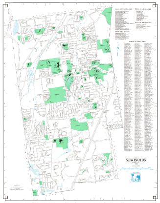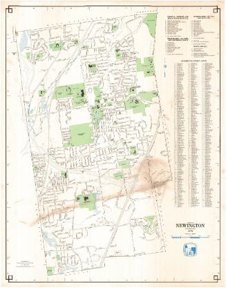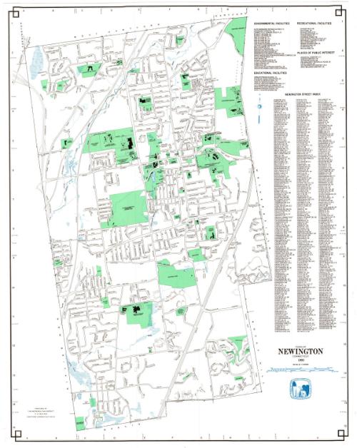
Town of Newington, Connecticut
MakerPrepared by
Metropolitan District Commission
American, founded 1929
Date1993
MediumLithography; black and colored printer's inks on wove paper
DimensionsPrimary Dimensions (image height x width): 29 3/4 x 23 3/4in. (75.6 x 60.3cm)
Sheet (height x width): 30 1/4 x 23 3/4in. (76.8 x 60.3cm)
Sheet (height x width): 30 1/4 x 23 3/4in. (76.8 x 60.3cm)
ClassificationsGraphics
Credit LineConnecticut Museum of Culture and History collection
DescriptionMap of the town of Newington with West Hartford and Hartford to the north, Wethersfield and Rocky Hill to the east, Berlin to teh south, and New Britain and Farmington to the west. An indexed key at the right locates Governmental Facilities, Educational Facilities, Recreational Facilities, Places of Interest, and included a street index. A compass is at upper right.
Object number2012.312.248
InscribedOn recto, lower right, printed in black ink, "TOWN OF / NEWINGTON / CONNECTICUT / 1993"On verso, lower right, in pencil, accession numberNotesCartographic Note: Scale: 1:12,000
Collections
- Maps and Charts: Finding Your Place in Connecticut History
On View
Not on view