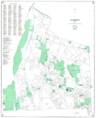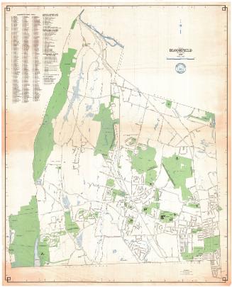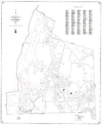
Town of Bloomfield, Connecticut
MakerPrepared by
Metropolitan District Commission
American, founded 1929
Date1993
MediumLithography; black and colored printer's inks on wove paper
DimensionsPrimary Dimensions (imageheight x width): 40 1/4 x 32 3/8in. (102.2 x 82.2cm)
Sheet (height x width): 42 x 32 3/4in. (106.7 x 83.2cm)
Sheet (height x width): 42 x 32 3/4in. (106.7 x 83.2cm)
ClassificationsGraphics
Credit LineConnecticut Museum of Culture and History collection
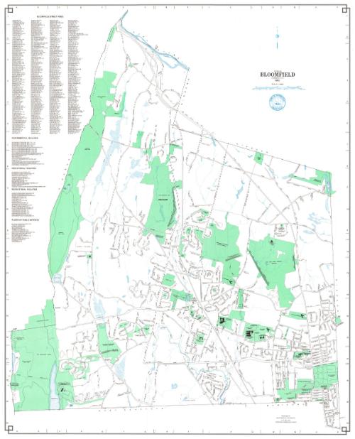
DescriptionMap of the town of Bloomfield with East Granby and Windsor to the north, Windsor to the east, Hartford and West Hartford to the south, and Simsbury and Avon to the west. Street, streams, schools, cemeteries, and an industrial park are shown. Other prominent features include Penwood State Forest, Talcott Mountain, the Talcott Mountain Tunnel, and the Metropolitan District Water Treatment Plant at Reservoir 6. Flood control facilities include the Cold Spring Flood Water Retention Reservoir, the Tunxis Flood Water Retention Reservoir, the Wintonbury Flood Water Retention Reservoir, and the Blue Hills Flood Water Retention Reservoir, and associated retarding dams and protective dikes. An indexed key at the right locates Governmental Facilities, Educational Facilities, Recreational Facilities, Places of Interest, and includes a street index. A compass is at upper right.
Object number2012.312.247
InscribedOn recto, upper right, printed in black ink, "TOWN OF / BLOOMFIELD / CONNECTICUT / 1993"On verso, lower right, in pencil, accession numberNotesCartographic Note: Scale: 1:12,000
Collections
- Maps and Charts: Finding Your Place in Connecticut History
On View
Not on view