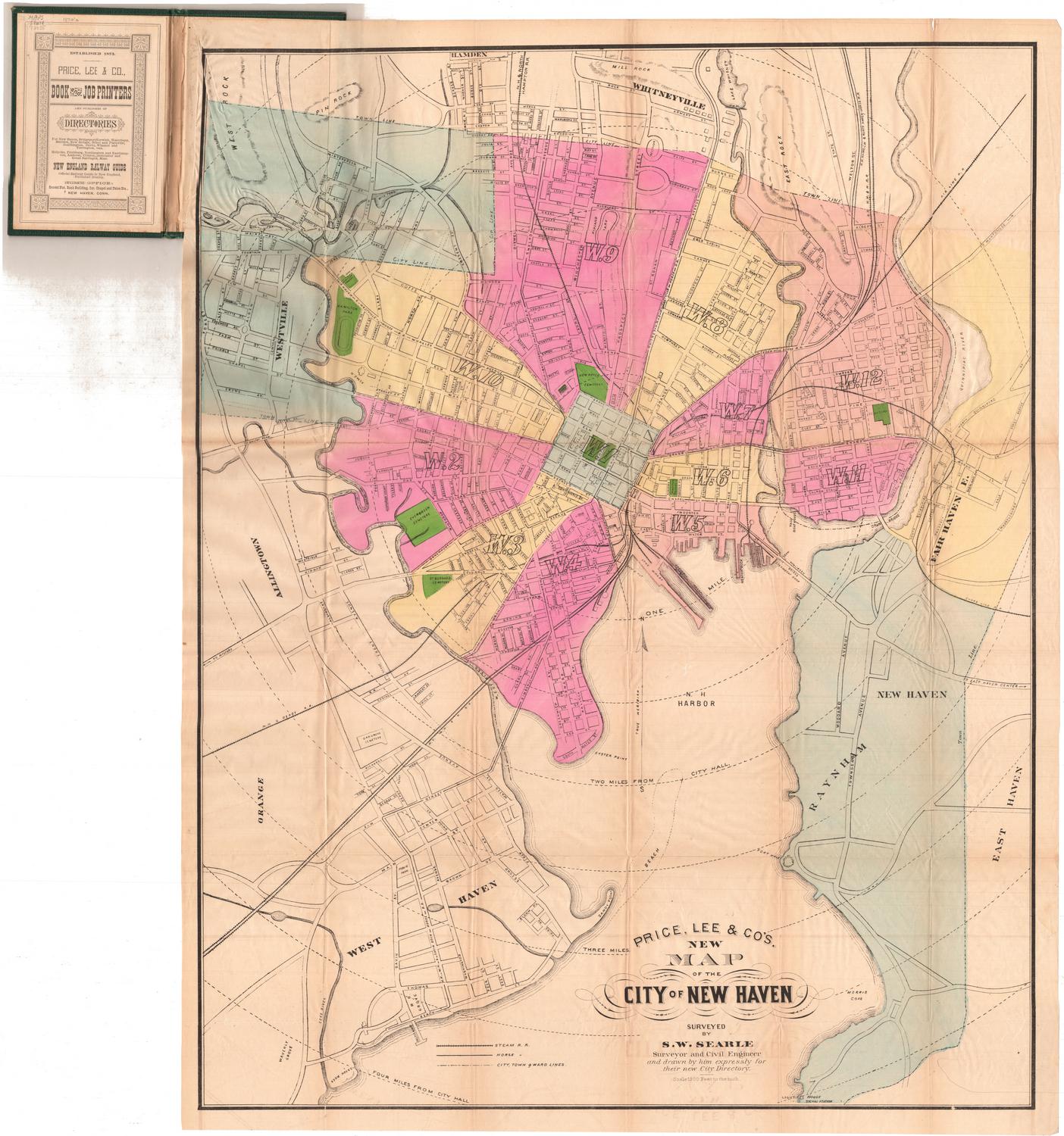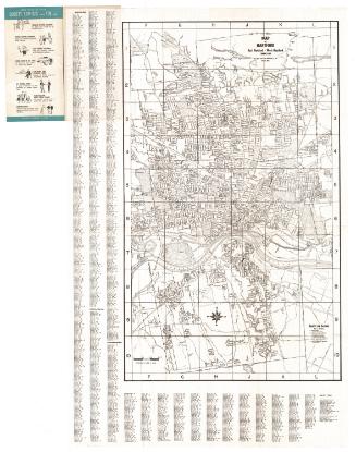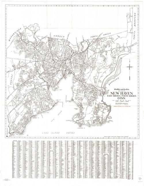
The Price & Lee Company's New Map of New Haven, East Haven and West Haven, Connecticut
PrinterPrinted by
R. A. Welcke Offset Co.
American, active 1967
PublisherPublished by
Price & Lee Co.
American
Dateprobably 1967
MediumOffset lithography; black printer's ink on wove paper
DimensionsPrimary Dimensions (image height x width): 23 5/8 x 23 3/4in. (60 x 60.3cm)
Sheet (height x width): 32 x 25in. (81.3 x 63.5cm)
Sheet (height x width): 32 x 25in. (81.3 x 63.5cm)
ClassificationsGraphics
Credit LineConnecticut Museum of Culture and History collection
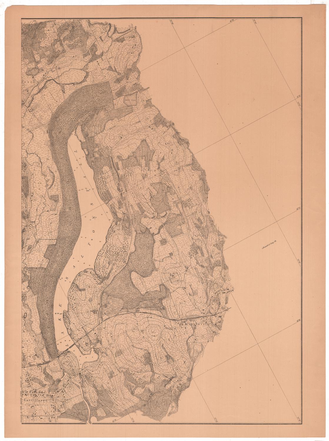
DescriptionMap of the towns of New Haven, East Haven and West Haven, extending from the boundary lines of Woodbridge, Hamden and North Haven to the north; Branford and North Branford to the east; the Long Island Sound to the south; and Orange to the west. City streets are labeled, and natural features such as Lake Saltonstall, Lake Phipps, and the Maltby Lakes; and the West, Quinnipiac and Farm Rivers. Parks and golf courses are labeled. The New York, New Haven and Hartford Railroad runs through town. Street indexes for all three towns are found below the map.
Object number2012.312.219
MarkingsRecto, bottom right, printed in black ink on sticker: "MAPS / DRAWER / 141"InscribedRecto, right side, printed in black ink: "The Price and Lee Co's. / NEW MAP OF / NEW HAVEN / EAST HAVEN & WEST HAVEN, / CONN."Right side, printed in black ink: "COPYRIGHT BY THE PRICE & LEE CO. NEW HAVEN, CONN."
Bottom left image area, printed in black ink: "67 [circled]"
Bottom right image area, printed in black ink: "Showing Passable Streets Only - Proposed Streets Eliminated"
Bottom left, printed in black ink: "PHOTO OFFSET / by / R. A. WELCKE OFFSET CO., Inc. / New York City"NotesCartographic Note: Scale: About 1/4 inches equals 500 feet
Collections
- Maps and Charts: Finding Your Place in Connecticut History
On View
Not on view