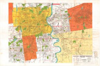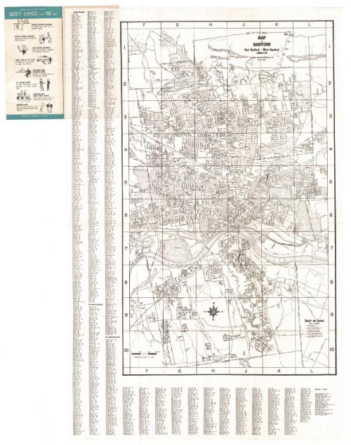
Map of Hartford, East Hartford, and West Hartford
PublisherPublished by
Interstate Publishing Co., Inc.
American, active 1950s-1960s
Date1950-1960
MediumLithography; black printer's ink on wove paper
DimensionsPrimary Dimensions (image height x width): 27 7/8 x 17in. (70.8 x 43.2cm)
Sheet (height x width): 34 1/8 x 21 7/8in. (86.7 x 55.6cm)
Sheet (height x width): 34 1/8 x 21 7/8in. (86.7 x 55.6cm)
ClassificationsGraphics
Credit LineConnecticut Museum of Culture and History collection
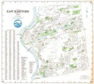
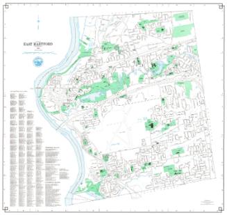
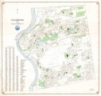
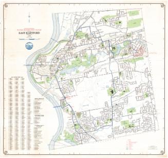
DescriptionStreet map of the towns of Hartford, East Hartford and West Hartford, Connecticut. Oriented so that north points to the right side of the sheet and the Connecticut River appears horizontally across the lower portion of the map. Streets, parks, golf courses, colleges, hospitals and cemeteries are all labeled. Natural features include rivers, coves and ponds. The five locations of the Society for Savings, the distributor of the map, are denoted with solid black squares and numbers. Street indexes for the three towns and points of interest are located around the left and bottom borders.
Object number2012.312.158
InscribedRecto, top, printed in black ink: "MAP / of / HARTFORD / East Hartford - West Hartford / CONNECTICUT / Copyright - Interstate Publishing Co., Inc. / Everett, Mass."Bottom right, printed in black ink: "SOCIETY FOR SAVINGS / Key to Locations / [list of locations with addresses]"
Recto of outside, top, in white surrounded by blue ink: "Map / OF HARTFORD, / EAST HARTFORD, / and WEST HARTFORD"
Bottom, in white surrounded by blue ink and black ink: "Compliments of [in white] / Society / for Savings / "The Pratt Street Bank""
Verso of outside cover: [black and white sketches of the five branches of the Society for Savings, with the address below] / [branch hours]
Left inside cover, top, in white surrounded by blue ink: "HOW MANY OF THESE / SOCIETY SERVICES CAN YOU USE? / [list of services and small illustrations]"NotesCartographic Note: Scale: About 2 inches equals 3000 feet
Collections
- Maps and Charts: Finding Your Place in Connecticut History
On View
Not on view
R. A. Welcke Offset Co.
probably 1967