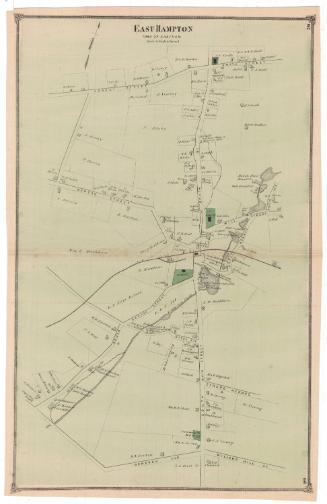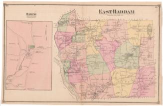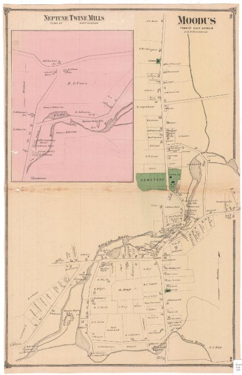
Moodus, Town of East Haddam
PublisherPublished by
F. W. Beers & Co.
American
Date1874
MediumLithography; black printer's ink and watercolor on wove paper
DimensionsPrimary Dimensions (image height x width): 22 3/8 x 14 5/8in. (56.8 x 37.1cm)
Sheet (height x width): 22 7/8 x 14 3/4in. (58.1 x 37.5cm)
Sheet (height x width): 22 7/8 x 14 3/4in. (58.1 x 37.5cm)
ClassificationsGraphics
Credit LineMuseum purchase
DescriptionMap of Moodus in the town of East Haddam, Connecticut, depicting the Moodus River and the various mills and companies along it, including the Moodus Manufacturing Company and twine, shingle, grist and saw mills. Roads are shown but not labeled, and lots of land are depicted with the owner or occupant's name and shaded rectangles representing buildings. A school, a cemetery, a Baptist church, Catholic church and a Methodist Episcopal church are shown in green. At the top left is an inset map of Neptune Twine Mills in East Haddam, along the Moodus River. The mill buildings are depicting, as are the buildings of a coffin trimming factory and a cotton factory.
Object number1980.100.3
MarkingsRecto, bottom right corner, printed in black ink on sticker: "Maps / Box / 322"Verso, top right corner, stamped in blue ink: "THE CONNECTICUT / 80916 / HISTORICAL SOCIETY"InscribedRecto, top left, printed in black ink: "NEPTUNE TWINE MILLS / TOWN OF EAST HADDAM"
Top right, printed in black ink: "MOODUS / TOWN OF EAST HADDAM"
Top right corner, printed in black ink: "92"
Bottom right corner, printed in black ink: "93"NotesCartographic Note: Scale: 1 inch equals 20 rods
Collections
- Maps and Charts: Finding Your Place in Connecticut History
On View
Not on view