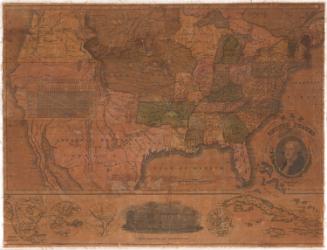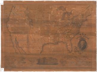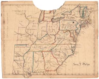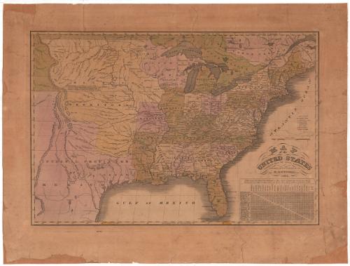
Map of the United States compiled from the latest Authorities
PublisherPublished by
H. F. Sumner & Co.
American, active 1832 - 1848
Date1835
MediumEngraving; black printer's ink and watercolor on paper, lined with paper
DimensionsPrimary Dimensions (image height x width): 14 1/16 x 20 11/16in. (35.7 x 52.5cm)
Platemark (height x width): 14 7/8 x 21 3/8in. (37.8 x 54.3cm)
Sheet (height x width): 18 3/4 x 24 3/4in. (47.6 x 62.9cm)
Mount (height x width): 18 3/4 x 24 3/4in. (47.6 x 62.9cm)
Platemark (height x width): 14 7/8 x 21 3/8in. (37.8 x 54.3cm)
Sheet (height x width): 18 3/4 x 24 3/4in. (47.6 x 62.9cm)
Mount (height x width): 18 3/4 x 24 3/4in. (47.6 x 62.9cm)
ClassificationsGraphics
Credit LineConnecticut Museum of Culture and History collection
DescriptionMap of the United States, with states outlined in dotted lines and colored green, pink or yellow. The "District of Huron attached to Michigan," Missouri Territory, Texas and the "internal provinces of Mexico" are west of Missouri, Arkansas Territory and Louisiana. In the top left corner, there is an unnamed piece of land that is probably the Oregon territory. The Explanation, found to the right of the image, explains the symbols used to denote capital towns, "important towns," large towns, smaller towns, mission stations, court houses, forts and canals. In the lower right corner, there is a table that shows the distances from Washington, D.C., to the capital or largest town in each state, as well as the distances between the capital or largest towns in each state.
Object number2012.312.86
MarkingsRecto, top left, printed in black ink on sticker: "MAPS / Box / 181"InscribedRecto, right, printed in black ink: "MAP / of the / UNITED STATES / compiled from the latest Authorities. / PUBLISHED BY H.F. SUMNER & CO. / HARTFORD, / 1835."Verso, top left, handwritten in pencil: "Maps / Flat / 41"NotesCartographic Note: Scale: 1 inch equals approximately 115 miles
Collections
- Maps and Charts: Finding Your Place in Connecticut History
On View
Not on view