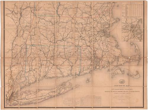
Post Route Map of the States of New Hampshire, Vermont, Massachusetts, Rhode Island, Connecticut and parts of New York and Maine
MakerDesigned by
William L. Nicholson
Scottish-American, born 1824
DraftsmanDrawn by
Paul Goepel
PrintmakerEngraved by
David McClelland
American, 1821 - 1896
PublisherPublished by
United States Post Office Department
American, 1792 - 1971
Date1882
MediumEngraving; black printer's ink and watercolor on wove paper, lined with linen, in leatherette covers
DimensionsPrimary Dimensions (image height x width): 30 x 38 7/8in. (76.2 x 98.7cm)
Sheet (height x width): 30 1/2 x 40 3/4in. (77.5 x 103.5cm)
Mount (height x width): 30 1/2 x 40 3/4in. (77.5 x 103.5cm)
Sheet (height x width): 30 1/2 x 40 3/4in. (77.5 x 103.5cm)
Mount (height x width): 30 1/2 x 40 3/4in. (77.5 x 103.5cm)
ClassificationsGraphics
Credit LineGift of Arthur J. Warmsley
DescriptionPocket map of Massachusetts, Connecticut and Rhode Island (missing the Vermont and New Hampshire portion), and the eastern part of New York state. The map primarily depicts the postal routes in the region using color coding to indicate the frequency of delivery and post offices marked with open circles. Railroads are also prominent and include the New York, New Haven and Hartford; Boston and New York Air Line; Danbury and Norwalk; Shepaug; Housatonic; New Haven and Northampton; Connecticut Valley; and New York and New England. Physical features depicted include rivers and lakes. On the right side is an inset map of Boston. In the top right is a distance table and at the bottom is a table of general statistics about the six New England states and New York, including area, population, post offices, railroads and canals.
Object number1990.184.0
MarkingsVerso, center, stamped in blue ink: "CtHi"InscribedFront cover, printed in black ink on label adhered to cover: "POST ROUTE MAP / OF THE / NEW ENGLAND STATES / (EXCEPTING MAINE)"Recto, bottom right, printed in black ink: "POST ROUTE MAP / OF THE STATES OF / NEW HAMPSHIRE, VERMONT / MASSACHUSETTS, RHODE ISLAND, CONNECTICUT / AND PARTS OF NEW YORK AND MAINE. / Designed and Constructed under the Orders / of / POSTMASTER GENERAL WM. DENNISON / AND / SECOND ASS'T POSTMASTER GEN'L GEO. WM. MCLELLAN / BY / W.L. NICHOLSON Topographer of P.O. Dep't. / The first edition was issued in / 1886."
Bottom right corner, printed in black ink: "Eng. by D. McClelland, Washn. D.C."
Bottom left corner, printed in black ink: "Drawn by P. Goepel"
Verso, center, handwritten in pencil: "Maps / 89848"
Center, handwritten in pencil: "89848"
NotesCartographic Note: Scale: 1 inch equals 6 miles
Collections
- Maps and Charts: Finding Your Place in Connecticut History
On View
Not on view
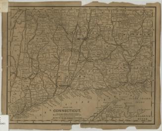


Kellogg & Bulkeley
1910-1915