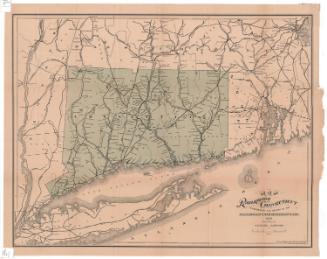
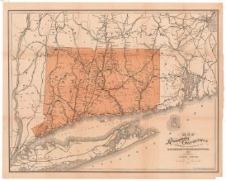
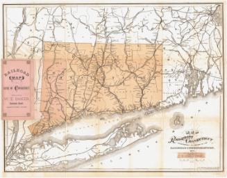
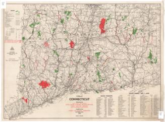
Connecticut Railroads
After a work byAfter a work by
Rand, McNally & Co.
American, founded 1868
Datebefore 1986
MediumPhoto-engraving and letterpress; black and red printer's inks on wove paper
DimensionsPrimary Dimensions (image height x width): 11 1/2 x 15 1/2in. (29.2 x 39.4cm)
Sheet (height x width): 18 1/4 x 19 1/2in. (46.4 x 49.5cm)
Sheet (height x width): 18 1/4 x 19 1/2in. (46.4 x 49.5cm)
ClassificationsGraphics
Credit LineConnecticut Museum of Culture and History collection
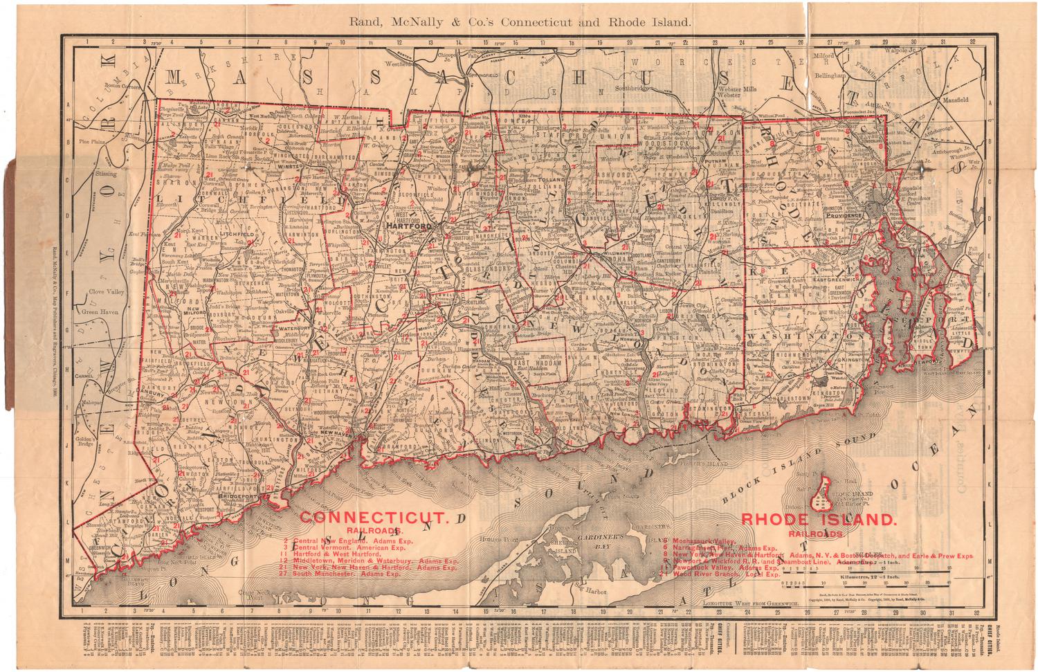
DescriptionMap of Connecticut with Massachusetts to the north, Rhode Island to the east, Long Island Sound and part of Long Island to the south, and New York to the west. Railroad are shown as bold red lines superimposed over a nineteenth century map. Names of the railroads are inscribed in red.
Object number2012.312.277
InscribedOn recto, upper center, printed in black ink, "CONNECTICUT RAILROADS"; lower margin, printed in black ink, "Berkshire. Boston, Hartford & Erie. Connecticut Central. Connecticut Valley. Connecticut Western. Danbury & Norwalk. Housatonic. Hartford, Providence & Fishkill. Naugatuck. New Canaan. New Haven & Derby. New Haven, Middletown & Willimantic. New Haven & Northampton. New London Northern. New York, Housatonic & Northern. New York & New England. New York, New Haven & Hartford. New York, Providence & Boston. Norwich & Worcester. Pawtuxet Valley. Shepaug. Shore Line. South Manchester. Stockbridge & Pittsfield. Stonington & Providence. Watertown & Waterbury.NotesCartographic Note: 1 3/16 inches equals approximately 10 miles. It seems likely that the map is not reproduced at its orignal scale.Date Note: This map resembles maps in Gregg M. Turner and Melancthon W. Jacobus, Connecticut Railroads.... An Illustrated History (Connecticut Historical Society, 1986) and may have been produced in conjunction with that publication.
Collections
- Maps and Charts: Finding Your Place in Connecticut History
On View
Not on view