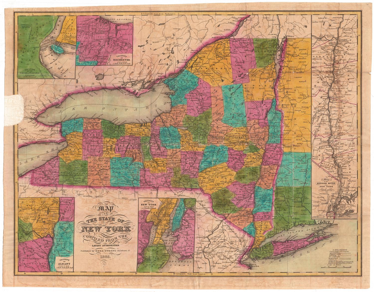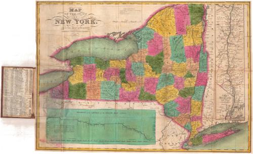
Map of the State of New York
PublisherPublished by
Case & Waters
1834 - 1837
Date1834
MediumEngraving; black printer's ink and watercolor on wove paper, between cardboard covers
DimensionsPrimary Dimensions (image height x width): 15 5/8 x 21 7/8in. (39.7 x 55.6cm)
Sheet (height x width): 15 3/4 x 22 1/8in. (40 x 56.2cm)
Sheet (height x width): 15 3/4 x 22 1/8in. (40 x 56.2cm)
ClassificationsGraphics
Credit LineGift of the heirs of James G. Batterson
DescriptionMap of New York State, with Vermont, Massachusetts, and Connecticut to the east, and Pennsylvania and New Jersey to the south. The state is outlined in pink and divided into counties, colored blue, green, yellow, peach, or pink. Physical features include elevation, conveyed through hachure marks; lakes, including Lake Ontario, Lake Erie, and the Finger Lakes; and rivers. Canals, proposed canals, railroads, and proposed railroads are depicted using different lines. At the bottom of the sheet is a profile of the levels of the Grand Erie Canal. On the right side is an inset map of the Hudsrom River from Albany to New York City. On the inner cover is a list of the counties and their populations in 1820 and 1830.
Object number1902.8.1
MarkingsFront of housing, top left, printed in black ink on sticker: "Maps / 16916"Center, printed in black ink on sticker: "Case & Waters. / Map of the state of New York : from / the best authorities."InscribedRecto, top left, printed in black ink: "MAP / OF THE STATE / OF / NEW YORK. / FROM THE BEST AUTHORITIES. / Published by CASE & WATERS, Hartford, Ct. / 1834"
Verso, left side, handwritten in red ink: "16916"
Front cover, gold tooled: "NEW-YORK"
NotesCartographic Note: Scale: About 1/2 inch equals 10 miles
Collections
- Maps and Charts: Finding Your Place in Connecticut History
On View
Not on view


H. F. Sumner & Co.
1833