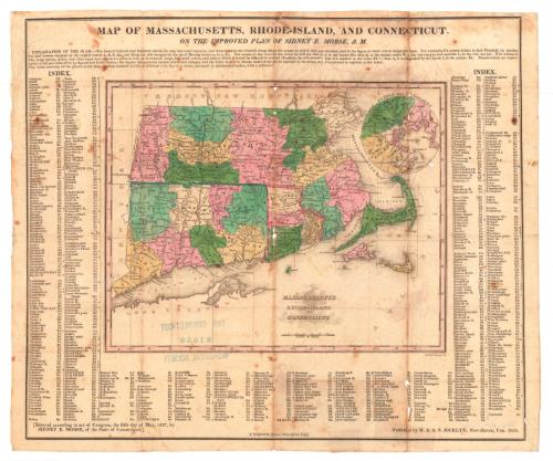
Map of Massachusetts, Rhode-Island, and Connecticut, on the Improved Plan of Sidney E. Morse
MakerCopyrighted by
Sidney E. Morse
American, 1794 - 1871
PrinterPrinted by
Sidney Babcock
American, 1797 - 1888
PublisherPublished by
N. & S. S. Jocelyn
American, founded 1818
Date1828
MediumEngraving; printer's ink and watercolor on wove paper in cardboard folder
DimensionsPrimary Dimensions (image height x width): 12 x 14 1/8in. (30.5 x 35.9cm)
Sheet (height x width): 12 1/2 x 15in. (31.8 x 38.1cm)
Folder (height x width): 3 7/8 x 2 1/2in. (9.8 x 6.4cm)
Sheet (height x width): 12 1/2 x 15in. (31.8 x 38.1cm)
Folder (height x width): 3 7/8 x 2 1/2in. (9.8 x 6.4cm)
ClassificationsGraphics
Credit LineMuseum purchase
DescriptionMap of Massachusetts, Rhode Island, and Connecticut, with New York to the west, Vermont and Massachusetts to the north, the Atlantic Ocean to the east, and Long Island Sound and Long Island to the south. A circular inset map shows Boston and Vicinity. Counties are different colors. Major rivers and mountain ranges are shown. A scale of miles is at lower center. The top, bottom, and sides of the map have letters corresponding to the lines of longitude and latitude and the map is surrounded by lists of towns, counties, and geographical features to which these letters provide a key.
Object number1981.145.1
MarkingsOn verso, lower right, stamped in blue ink, "THE CONNECTICUT / 81550 / HISTORICAL SOCIETY"; center, stamped in blue ink, "CtHi"InscribedOn recto, upper center, printed in black ink, "MAP OF MASSACHUSETTS, RHODE-ISLAND, AND CONNECTICUT, / ON THE IMPROVED PLAN OF SIDNEY E. MORSE"On verso, upper right, in pencil, "Maps / Box / 126"
Lower right, in pencil, "1981.145.1"NotesCartographic Note: 1 1/2 inches equals thirty-five miles
Collections
- Maps and Charts: Finding Your Place in Connecticut History
On View
Not on view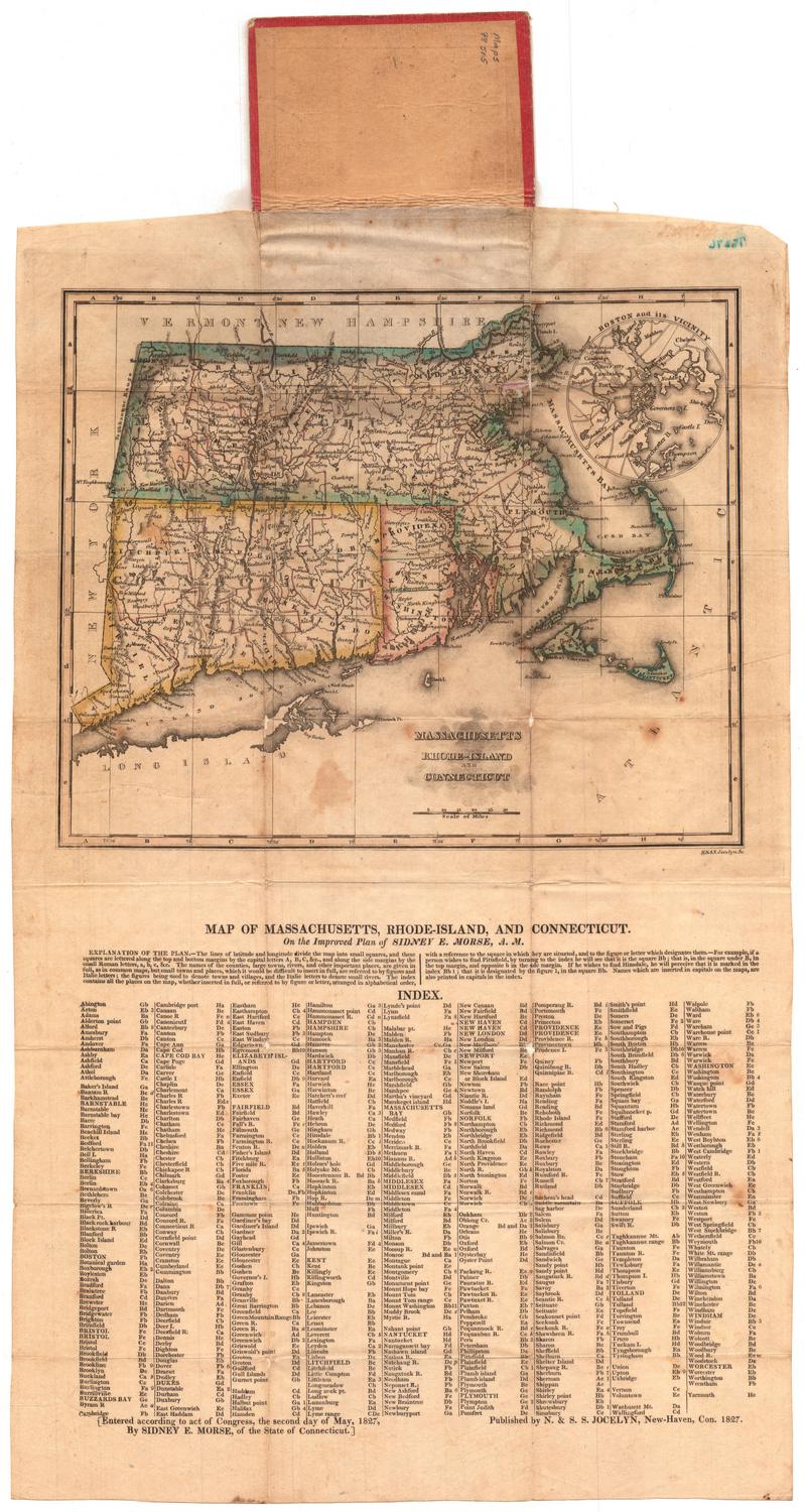


H. F. Sumner & Co.
1833


H. F. Sumner & Co.
1833