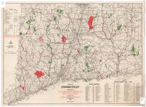
A Map of Connecticut
DraftsmanDrawn by
National Survey Co.
American, founded 1912
PublisherPublished by
Connecticut Commission on Forests and Wildlife
American, 1925 - 1971
Date1936
MediumLithography; black, green and red printer's inks on wove paper
DimensionsPrimary Dimensions (image height x width): 19 x 26 1/8in. (48.3 x 66.4cm)
Sheet (height x width): 20 x 27in. (50.8 x 68.6cm)
Sheet (height x width): 20 x 27in. (50.8 x 68.6cm)
ClassificationsGraphics
Credit LineGift of Mrs. E. S. Holland
DescriptionMap of Connecticut, with the border of Massachusetts to the north, Rhode Island to the east, and New York to the west. The coastline of Connecticut is shown but the Long Island Sound is not identified. The map shows counties, towns and cities, although its focus is state-owned land and streams. State forests and parks are colored green and state leased or owned shooting grounds, sanctuaries and streams are colored red. Highways, railroads, street-railroads, steamships and canals are all shown. There are lists of the state forests and parks below the map.
Object number1977.120.3
MarkingsRecto, top left and bottom right corners, printed in black ink on sticker: "MAPS / Box / 296"InscribedRecto, left side, printed in black ink: "[The National Survey symbol] / COPYRIGHT / NATIONAL SURVEY CO., / CHESTER, VT."Bottom, printed in black and red ink: "A Map of / CONNECTICUT / Showing the / STATE PARKS AND FORESTS / STATE LEASED STREAMS, WILDLIFE REFUGES, / PUBLIC SHOOTING GROUNDS / AND THE IMPROVED HIGHWAY ROUTES / Issued by the / FOREST AND WILDLIFE COMMISSION / HARTFORD, CONN. / 1936 / SCALE 1:250,000"
Verso, top left corner, handwritten in pencil: "77944"NotesCartographic Note: Scale: 1 inch equals 4 miles; 1:250,000
Collections
- Maps and Charts: Finding Your Place in Connecticut History
On View
Not on view
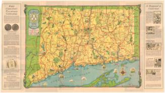
Connecticut State Highway Department
1934