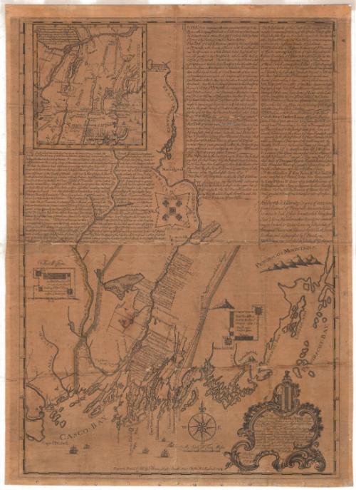
This Plan of Kennebeck and Sagadahock Rivers and Country adjacent...
PrintmakerEngraved by
Thomas Johnston
American, 1708 - 1767
PrinterPrinted by
Thomas Johnston
American, 1708 - 1767
Date1754
MediumEngraving; black ink on laid paper, lined with linen
DimensionsPrimary Dimensions (image height x width): 31 3/8 x 22in. (79.7 x 55.9cm)
Sheet (height x width): 32 3/4 x 23 3/4in. (83.2 x 60.3cm)
Mount (height x width): 32 3/4 x 23 3/4in. (83.2 x 60.3cm)
Sheet (height x width): 32 3/4 x 23 3/4in. (83.2 x 60.3cm)
Mount (height x width): 32 3/4 x 23 3/4in. (83.2 x 60.3cm)
ClassificationsGraphics
Credit LineConnecticut Museum of Culture and History collection
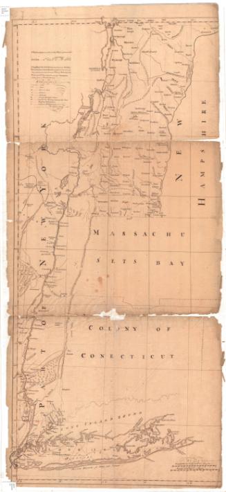
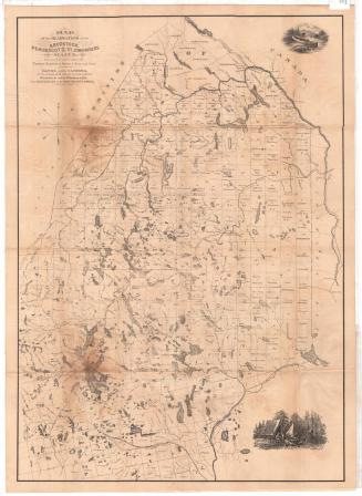
DescriptionMap of what is now coastal Maine, oriented east-west so that Cape Elizabeth is to the west and Penobscot Bay to the east. Islands, points, necks, waterfalls and rivers are depicted, particularly the Sagadahock and Kennebeck Rivers. Forts Western, Frankfort and Halifax, along the Kennebec River, are are shown, along with information about when the fort was built and by whom. The Penobscot Mountains are shown in profile. At the top of the sheet there is a map showing parts of New England, New York State and Canada, from the St. Lawrence River to the north, the "north east part of Massachusetts" to the east, parts of Connecticut, Rhode Island and New York to the south, and Lake Ontario to the west. The rest of the sheet is blocks of text that describe the lands shown and provide some historical context. The cartouche is decorative and features the Latin phrase, "Pro rege et republica" inscribed below a flag or shield with six stripes and five small symbols. Above this is a figure who appears to be kneeling.
Object number1991.190.0
InscribedRecto, bottom right, printed in black ink: "To his / Excellency William Shirley Esq. / Capt. General & Governour in Chief in & over / his Majesty's Provice of ye Massachusetts Bay / in New England. / This Plan of Kennebeck & Saga- / dahock Rivers & Country adjacent, (whereon / are delineated ye Boundaries of several An- / -cient Grants) being taken from actual Surveys / made by Joseph Health Espr. Mr. Phineas Jones / John North Esqr. & Mr. Emphraim Jones, is / most humbly inscribed by / Yor. Excellency's most Obedt. & humble Servt, / Thos. Johnston. / Boston / Novemr. 20, / 1754."Bottom, printed in black ink: "Engrav'd Printed & Sold by Thomas Johnston Brattle Street Boston New England 1754"NotesCartographic Note: Scale: About 2 3/8 inches equals 10 miles
Collections
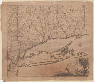
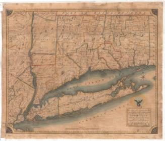
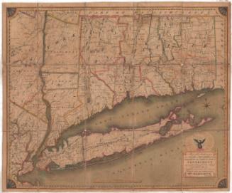
- Maps and Charts: Finding Your Place in Connecticut History
On View
Not on view
Thomas Sedgwick Steele
1881

H. F. Sumner & Co.
1833