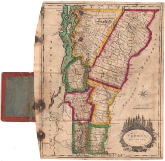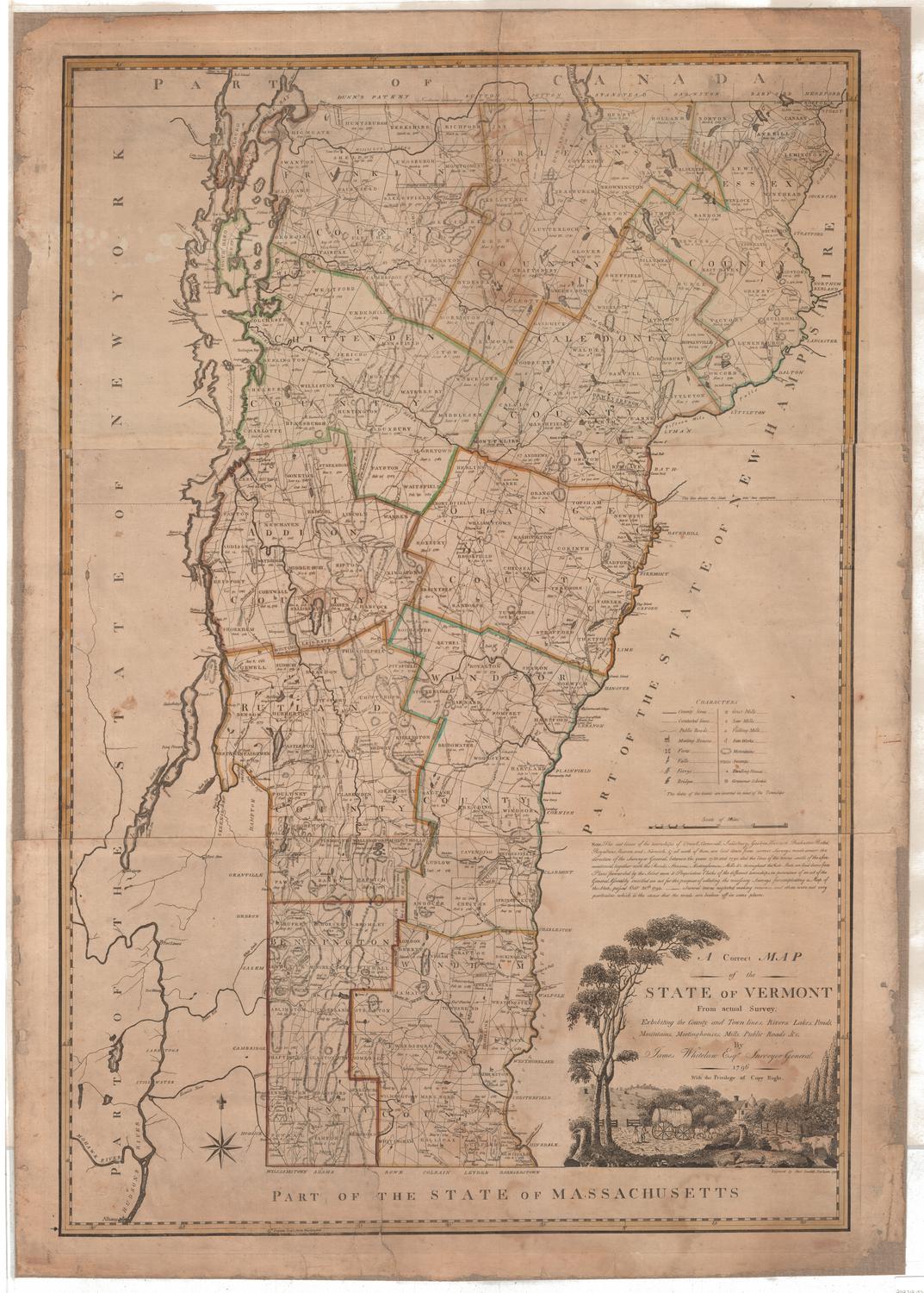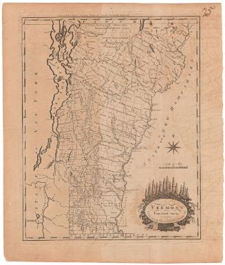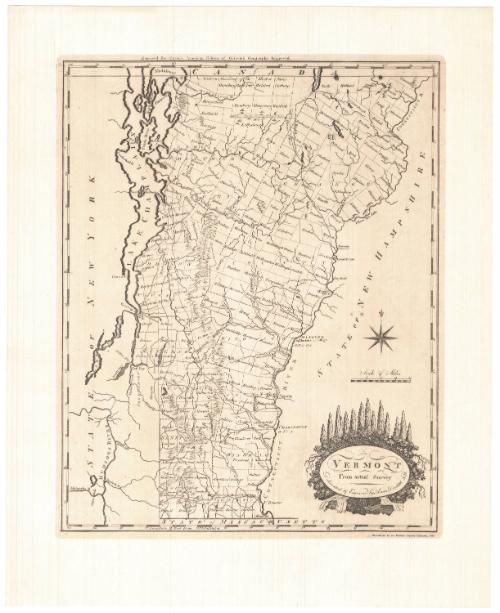
Vermont From actual Survey
PrinterPrinted by
Meriden Gravure Company
American, 1888 - 1977
After a work byAfter a work by
Amos Doolittle
American, 1754 - 1832
Date1957
MediumPhotomechanical prints; black printer's ink on paper
DimensionsPrimary Dimensions (image height x width): 14 7/8 x 11 7/8in. (37.8 x 30.2cm)
Sheet (height x width): 19 x 15 3/8in. (48.3 x 39.1cm)
Sheet (height x width): 19 x 15 3/8in. (48.3 x 39.1cm)
ClassificationsGraphics
Credit LineConnecticut Museum of Culture and History collection
DescriptionReproduction of a map of Vermont, from the border of Canada to the north, the border of New Hampshire to the east, the border of Massachusetts to the south, and the Border of New York to the west. Vermont is divided into counties and towns, both of which are labeled. Man-made features include villages, marked with circles, roads and Dartmouth College, the only building depicted. Natural features include rivers, lakes and mountains, with elevation conveyed through clusters of shaded triangles. The decorative cartouche shows a natural scene, with tall fir trees, smaller bushy plants with their roots hanging down around the title, and a waterfall cascading over rocks.
Object number2012.312.214
MarkingsVerso, center, stamped in blue ink: "CtHi"InscribedRecto, top right, printed in black ink: "Engraved for Carey's American Edition of Guthrie's Geography Improved"Bottom right, printed in black ink: "VERMONT / From actual Survey / Delineated & Engraved by Amos Doolittle N.H."
Bottom right, printed in black ink: "Reproduced by the Meriden Gravure Company, 1957"NotesCartographic Note: Scale: 1 7/8 inches equals 20 miles
Collections
- Maps and Charts: Finding Your Place in Connecticut History
On View
Not on view