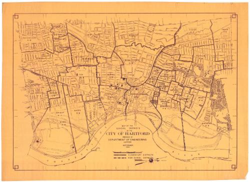
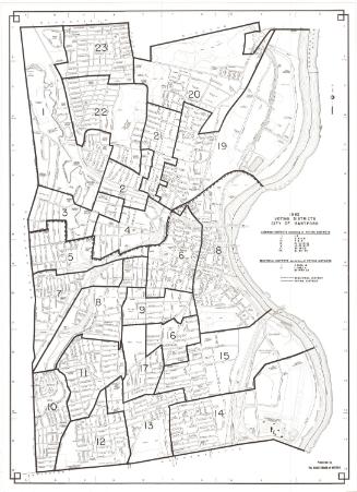
Map of the School Districts of the City of Hartford
DraftsmanDrawn by the
Engineering Department (Hartford, Conn.)
American, founded 1907
Date1965
MediumPhotostat; gelatin silver print on paper
DimensionsPrimary Dimensions (image height x width): 22 3/4 x 32in. (57.8 x 81.3cm)
Sheet (height x width): 25 5/8 x 35 1/4in. (65.1 x 89.5cm)
Sheet (height x width): 25 5/8 x 35 1/4in. (65.1 x 89.5cm)
ClassificationsGraphics
Credit LineConnecticut Museum of Culture and History collection
DescriptionMap of the school districts in Hartford, Connecticut, oriented so that north points to the right side of the sheet and the Connecticut River appears on the bottom. Solid and broken lines indicate elementary school districts and high school districts, respectively.
Object number2012.312.168
InscribedRecto, bottom center, printed in black ink: "MAP OF THE / SCHOOL DISTRICTS / OF THE / CITY OF HARTFORD / PREPARED BY / DEPARTMENT OF ENGINEERING / HARTFORD / SEPTEMBER / 1965"NotesCartographic Note: Scale: 1 inch equals 1000 feetCollections
- Maps and Charts: Finding Your Place in Connecticut History
On View
Not on view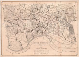

Kellogg & Bulkeley
1915-1920

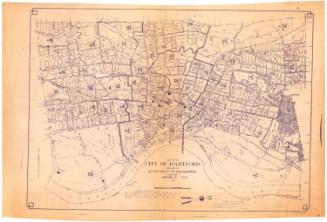
Kellogg & Bulkeley
1910-1915