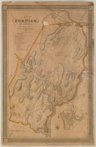
A Distance Map of the Town of Franklin
DraftsmanDrawn by
Andrew B. Smith
American, 1818 - 1885
Date1858
MediumDrawing; pencil and red and black ink on wove paper, on rollers
DimensionsPrimary Dimensions (image height x width): 50 3/4 x 45 3/4in. (128.9 x 116.2cm)
Sheet (height x width): 51 1/2 x 45 3/4in. (130.8 x 116.2cm)
Mount (height x width): 53 1/2 x 45 3/4in. (135.9 x 116.2cm)
Sheet (height x width): 51 1/2 x 45 3/4in. (130.8 x 116.2cm)
Mount (height x width): 53 1/2 x 45 3/4in. (135.9 x 116.2cm)
ClassificationsGraphics
Credit LineMuseum purchase
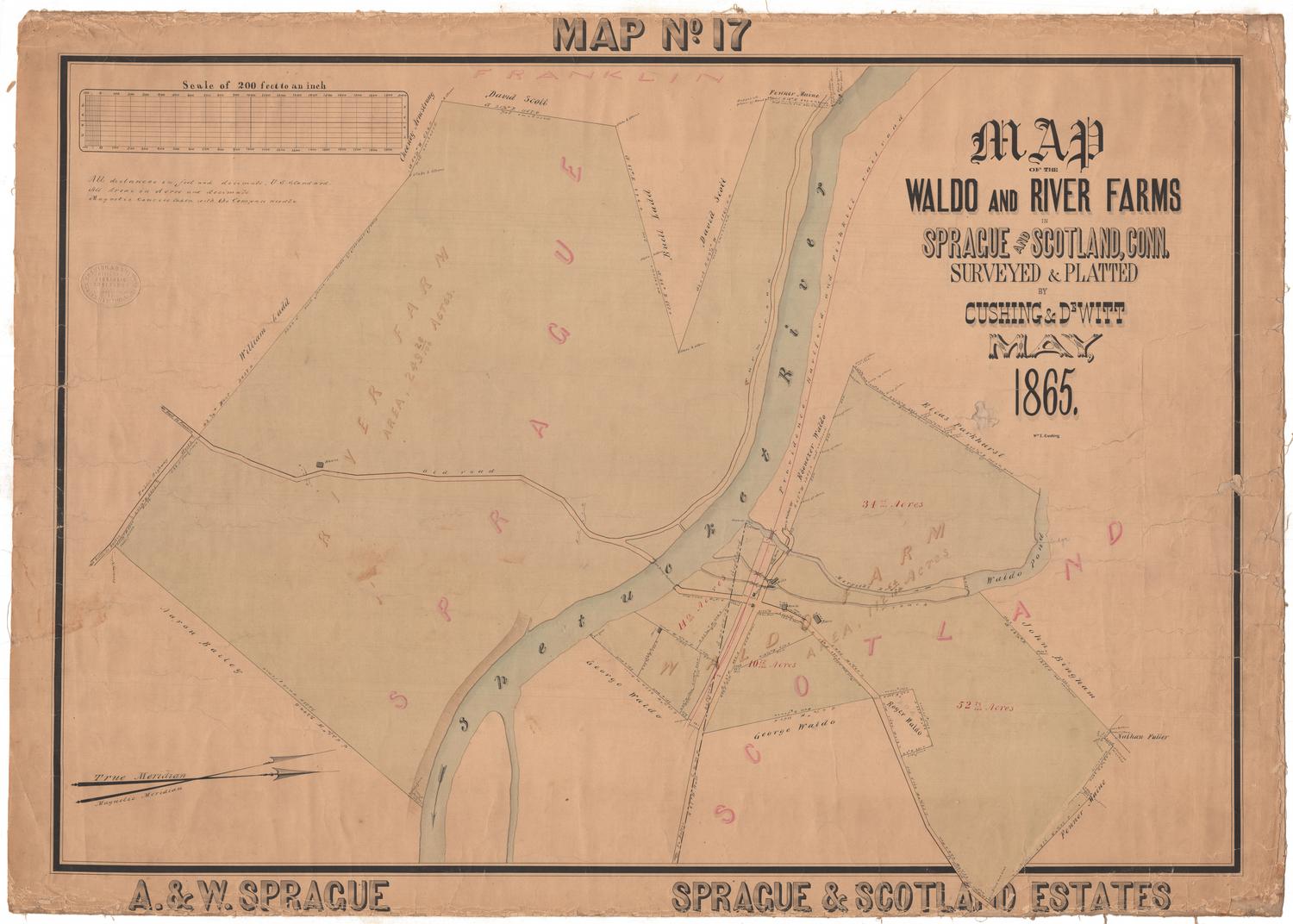
DescriptionManuscript map of Franklin, Connecticut, with the Shetucket River to the east. The local roads are shown, with black squares along them marking the locations of houses and businesses. The owner's names are provided, along with measurements that indicate the distance between that building and its neighbor. The Shetucket River and various ponds and brooks are shown.
Object number1947.21.1
MarkingsVerso, top left, typed in black and red ink on sticker: "Map [red] / Rack [red] / #65 [red] / Franklin, 1858. / manuscript."Top left, printed in black ink on sticker: "MAPS / Case 5 / No. 1"
Top right, printed in black ink on sticker: "MAPS / Case 5 / No. 1"InscribedRecto, top right, handwritten in pencil: "A Distance map of the Town of Franklin, / showing the distance from house to hou / se in rods, & the distance from the / Court-House at Norwich Land- / ing in miles, quarter & rods. / By A. B. Smith / Jan 1st 1858. / Scale 48 / rods to / an inch."
Verso, top left, handwritten in brown ink: "56286"
Top left, handwritten in pencil: "MAPS / Case 5 / No. 1"
Top right, handwritten in pencil: "MAPS / Case 5 / No. 1"NotesCartographic Note: Scale: 1 inch equals 48 rods
Collections
- Maps and Charts: Finding Your Place in Connecticut History
On View
Not on view