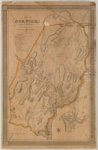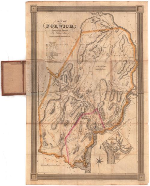
A Map of Norwich, from actual survey
SurveyorSurveyed by
William Lester Jr.
PrintmakerEngraved by
S. Stiles & Co.
American, 1833 - 1835
PrinterPrinted by
S. Stiles & Co.
American, 1833 - 1835
PublisherPublished by
Thomas Robinson
American, born about 1797
Date1833
MediumEngraving; black printer's ink and watercolor on wove paper, in cardboard covers
DimensionsPrimary Dimensions (image height x width): 28 1/8 x 18 1/2in. (71.4 x 47cm)
Sheet (height x width): 29 3/8 x 19 7/8in. (74.6 x 50.5cm)
Sheet (height x width): 29 3/8 x 19 7/8in. (74.6 x 50.5cm)
ClassificationsGraphics
Credit LineConnecticut Museum of Culture and History collection
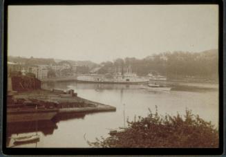
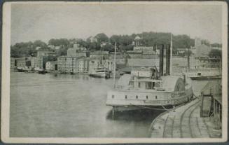
DescriptionMap of Norwich, Connecticut, with the Shetucket River to the east. The boundary of the city is outlined in yellow, with the city center enclosed within a pink boundary line. Physical features include elevation, conveyed with hachure marks; the Yantic River, the Thames River and the Shetucket River; brooks; and swamps. The Norwich and Hartford Turnpike, Norwich and Woodstock Turnpike, Norwich and New London Turnpike, Norwich and Salem Turnpike, and the Norwich City and New London Turnpikes run through the city. The common roads are labeled. The Boston, Norwich and New London Railroad runs along the Thames and Shetucket Rivers. Buildings are depicted as shaded rectangles, with some of them colored green, red, blue, or orange and labeled with letters or numbers. These correspond with buildings on the references list. An inset map in the lower right corner depicts part of Norwich and contains letters and numbers that correspond with the references list in the inset.
Object number1967.110.0
MarkingsVerso, center, stamped in blue ink: "CtHi"InscribedFront cover, gold-tooled: "MAP OF NORWICH"Inside cover, top left, handwritten in pencil: "71913"
Top, handwritten in pencil: "J.H. Freeman / Levenhook [?]"
Center, handwritten in pencil: "Maps / 71913"
Recto of map, top left, printed in black ink: "A MAP OF / NORWICH, / from actual survey / By William Lester Jr. / PUBLISHED BY THOMAS ROBINSON. / 1833. / ENGRAVED & PRINTED BY S. STILES & CO. NEW YORK."
Verso, center, handwritten in pencil: "71913"
NotesCartographic Note: Scale: 1 inch equals 100 rods
Collections
- Maps and Charts: Finding Your Place in Connecticut History
On View
Not on view