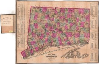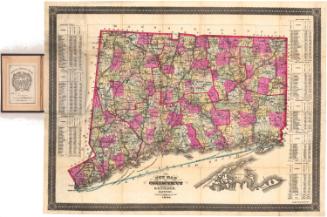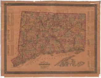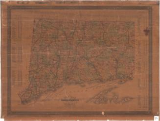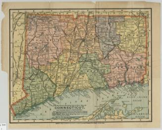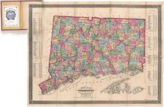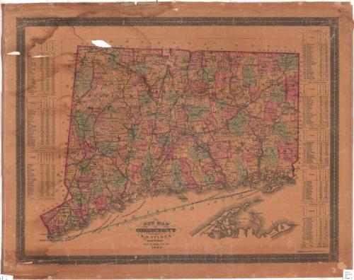
New Map of Connecticut
PublisherPublished by
Samuel D. Tilden
American, 1828 - 1893
PrinterPrinted by
Bingham & Dodd
1860 - 1878
Date1882
MediumLithography; printer's ink and watercolor on wove paper backed with fabric
DimensionsPrimary Dimensions (image height x width): 21 x 26 1/4in. (53.3 x 66.7cm)
Sheet (height x width): 23 3/4 x 28 3/4in. (60.3 x 73cm)
Sheet (height x width): 23 3/4 x 28 3/4in. (60.3 x 73cm)
ClassificationsGraphics
Credit LineGift of Mr. & Mrs. Peter Fresina
DescriptionMap of Connecticut with New York to the west, Massachusetts to the north, Rhode Island to the east, and Long Island Sound to the south. Counties as well as states bordering Connecticut are indicated. Within Connecticut, counties, towns, and smaller communities are shown; rivers and railroads are clearly indicated; some roads are shown. In Long Island Sound, the "BOUNDARY LINE ESTABLISHED 1880" is prominently featured. Lists of towns with their populations in 1860, 1870, and 1880 are at left and right of the map.
Object number1993.173.0
InscribedOn recto, lower center, printed in black ink, "NEW MAP / OF / CONNECTICUT / Published by / S. D. TILDEN, / HARTFORD. / Scale: 4 1/2 Miles to an inch / 1882"NotesCartographic Note: 4 1/2 miles equal one inchCollections
- Maps and Charts: Finding Your Place in Connecticut History
On View
Not on view