Massachusetts
DraftsmanDrawn by
Unknown
Dateafter 1812
MediumDrawing; black ink and watercolor on paper, mounted on cardboard
DimensionsPrimary Dimensions (image height x width): 6 1/8 x 7 7/8in. (15.6 x 20cm)
Sheet (height x width): 6 5/8 x 8 3/8in. (16.8 x 21.3cm)
Mount (height x width): 6 5/8 x 8 3/8in. (16.8 x 21.3cm)
Sheet (height x width): 6 5/8 x 8 3/8in. (16.8 x 21.3cm)
Mount (height x width): 6 5/8 x 8 3/8in. (16.8 x 21.3cm)
ClassificationsGraphics
Credit LineConnecticut Museum of Culture and History collection
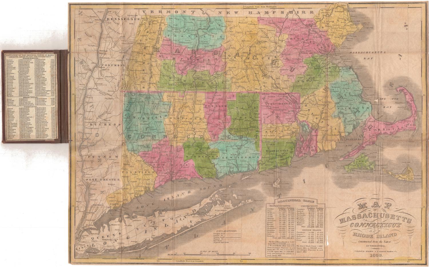
DescriptionMap of Massachusetts, with Vermont and New Hampshire to the north, the Massachusetts Bay to the east, Connecticut and Rhode Island to the south, and New York to the west. The state is divided into 11 counties (Berkshire, Franklin, Hampshire, Hampden, Worcester, Essex, Middlesex, Norfolk, Plymouth, Bristol and Barnstable), with the names of towns appearing in their rough geographic locations. The only physical feature shown is elevation, conveyed with shading.
Object number2007.82.0
MarkingsVerso, center, stamped in blue ink: "CtHi"InscribedRecto, bottom, handwritten in black ink: "MASSACHUSETTS"Verso, center, handwritten in pencil: "99696"NotesCartographic Note: No scale
Collections
- Maps and Charts: Finding Your Place in Connecticut History
On View
Not on view


H. F. Sumner & Co.
1833