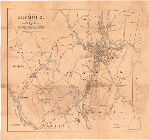
Map of Seymour, New Haven County, Connecticut
MakerMade by
Matthews-Northrup Company
American
Date1902
MediumLithography; black printer's ink on wove paper
DimensionsPrimary Dimensions (image height x width): 20 7/8 x 22 3/4in. (53 x 57.8cm)
Sheet (height x width): 23 1/2 x 25in. (59.7 x 63.5cm)
Sheet (height x width): 23 1/2 x 25in. (59.7 x 63.5cm)
ClassificationsGraphics
Credit LineMuseum purchase
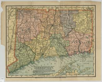
DescriptionMap of the town of Seymour, Connecticut, with Beacon Falls to the north, Woodbridge and Bethany to the east, Ansonia and Derby to the south, the Housatonic River and Oxford to the west. The streets are all labeled. Black squares represent the locations of dwellings, businesses and other buildings. Businesses, schools and churches are labeled. The Naugatuck River runs through the town, with Rimmon Pond at its north end. Bladens Brook, Ice House Lake, and reservoirs owned by the Ansonia Water Company are also shown. Elevation is conveyed with contour lines.
Object number1959.114.2
MarkingsRecto, top and bottom left corners, printed in black ink on stickers: "MAPS / Drawer / 51"InscribedRecto, top left, printed in black ink: "MAP OF / SEYMOUR, / NEW HAVEN COUNTY, / CONNECTICUT. / 1902."Bottom right corner, printed in black ink: "The Matthews-Northrup Works, Buffalo, N.Y."
Verso, top left, printed in black ink: "66336"
Top, printed in black ink: "MAP BOX #94"NotesCartographic Note: Scale: 4 inches equal 1 mile
Collections
- Maps and Charts: Finding Your Place in Connecticut History
On View
Not on view
Matthews-Northrup Company
1913