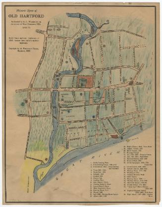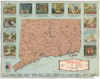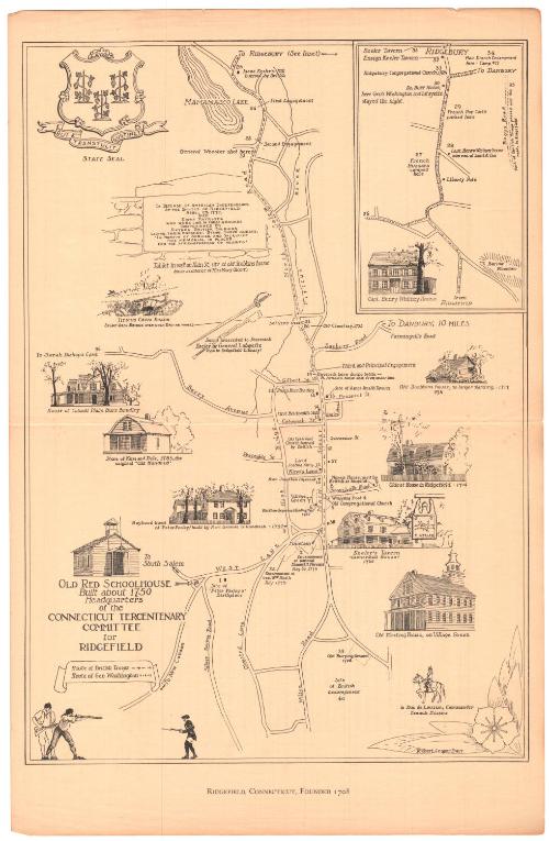
Ridgefield, Connecticut, Founded 1708
DraftsmanDrawn by
Robert Cooper Barr
1889-1913
Date1935
MediumLithography; black printer's ink on wove paper
DimensionsPrimary Dimensions (image height x width): 16 3/8 x 11 1/2in. (41.6 x 29.2cm)
Sheet (height x width): 18 3/4 x 12 1/4in. (47.6 x 31.1cm)
Sheet (height x width): 18 3/4 x 12 1/4in. (47.6 x 31.1cm)
ClassificationsGraphics
Credit LineMuseum purchase
DescriptionMap of the town of Ridgefield, Connecticut, from Mamamasco Lake to the north, Main Street to the east, the road to New Canaan to the south, and West Lane and Barry Avenue to the west. The map traces the history of the town, with numbers and a date and/or numbers, a date, and a black square marking the site of a historic event or location. These numbers correspond with the key, printed on the back and on a separate sheet of paper. The routes of the British troops and General Washington during the American Revolution are shown with arrows and circles. Vignettes of historic houses and buildings appear around the sides of the map: Colonel Philip Burr Bradley's house; King and Dole's store; Peter Parley's house, built by Reverend Samuel G. Goodrich; the old red schoolhouse; the old meeting house; Keeler's Tavern; the oldest house in Ridgefield; and Old Stebbins house. At the top left are drawings of the Titicus cross roads, the sword presented to Jeremiah Keller by General Lafayette, the tablet commemorating the men who died in the Battle of Ridgefield in 1777, and the state seal. In the top right corner is an inset map of the road to Ridgebury, with Captain Henry Whitney's house in the bottom left corner and Barlow Mountain in the bottom right (the elevation is conveyed with hachure marks).
Object number1975.103.1
MarkingsVerso, left side, stamped in blue ink: "CtHi"Verso of map key, top center, stamped in blue ink: "CtHi"InscribedRecto, bottom left, printed in black ink: "OLD RED SCHOOLHOUSE / Built about 1750 / Headquarters / of the / CONNECTICUT TERCENTENARY / COMMITTEE / for / RIDGEFIELD"
Bottom, printed in black ink: "RIDGEFIELD, CONNECTICUT, FOUNDED 1708"
Verso, top left corner, handwritten in pencil: "25"
Center, handwritten in pencil: "76009"
Bottom left corner, handwritten in pencil: "MAP BOX / 108"
Bottom right corner, handwritten in pencil: "76009"
Verso of map key, top center, handwritten in pencil: "76009"
Top center, handwritten in pencil: "Map / Box / 108"
Top center, handwritten in pencil: "76009"
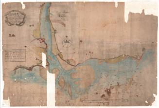
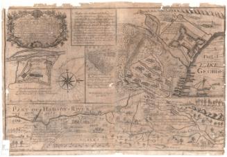
Top left, handwritten in pencil: "Map Box / 108"NotesCartographic Note: No scale
Collections
- Maps and Charts: Finding Your Place in Connecticut History
On View
Not on view