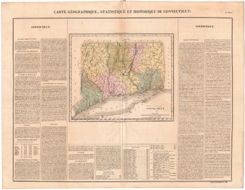
Carte Geographique, Statistique et Historique du Connecticut
PrinterPrinted by
J. Carez
French
PublisherProbably published by
Jean Alexandre Buchon
French, 1791 - 1846
Dateprobably 1825
MediumEngraving; black printer's ink and watercolor on wove paper
DimensionsPrimary Dimensions (image height x width): 9 5/8 x 11 3/8in. (24.4 x 28.9cm)
Sheet (height x width): 20 3/8 x 26 1/4in. (51.8 x 66.7cm)
Sheet (height x width): 20 3/8 x 26 1/4in. (51.8 x 66.7cm)
ClassificationsGraphics
Credit LineMuseum purchase
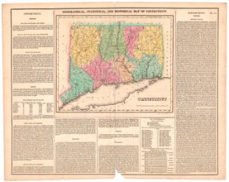
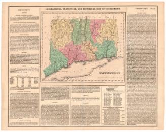
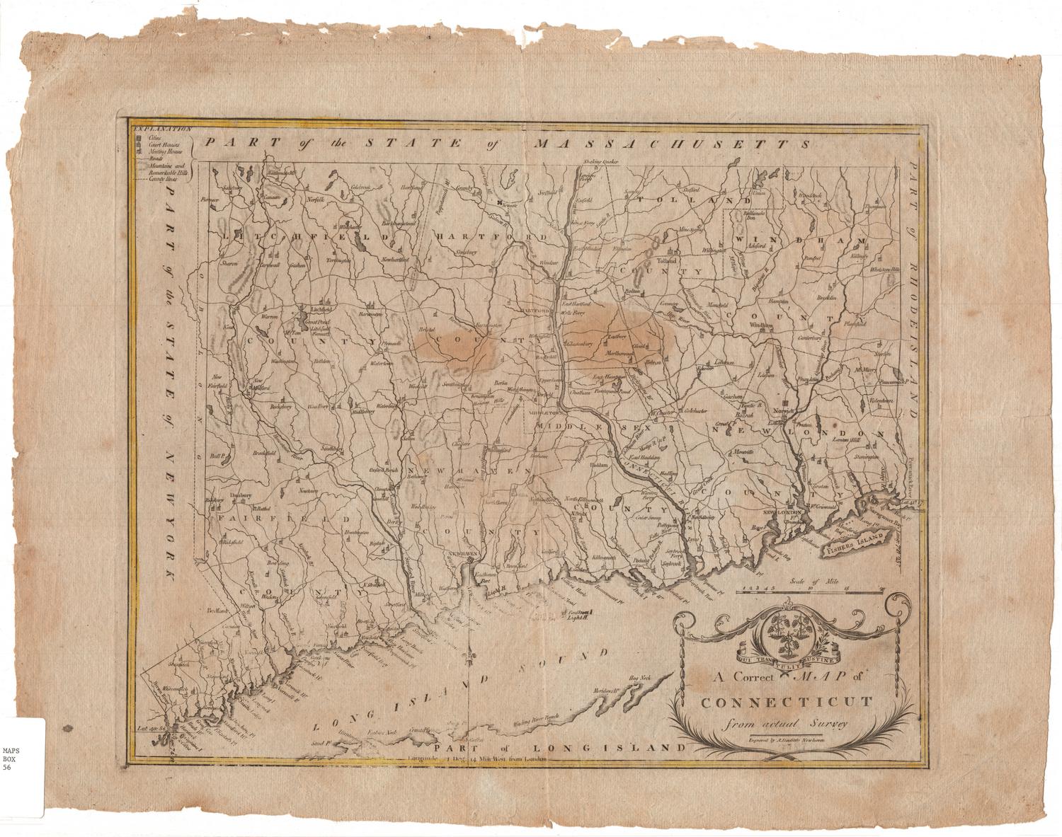
DescriptionMap of Connecticut, with Massachusetts to the north, Rhode Island to the east, Long Island and the Long Island Sound to the south, and New York to the west. The state is divided into counties that are labeled and delineated with broken solid lines, while towns are also labeled and delineated with dotted lines. Elevation is conveyed with hachure marks, and other natural features include rivers, ponds, islands, harbors, and points. The map is surrounded by text blocks in French that describe Connecticut's physical features, population distribution, climate, higher education, government, and history.
Object number1977.119.0
InscribedRecto, bottom right of map, printed in black ink: "CONNECTICUT."Bottom right, printed in black ink: "FONDERIE ET IMPRIMERIE DE J. CAREZ."NotesCartographic Note: Scale: 1/2 inch equals 5 miles
Collections
- Maps and Charts: Finding Your Place in Connecticut History
On View
Not on view