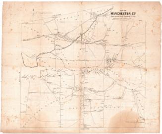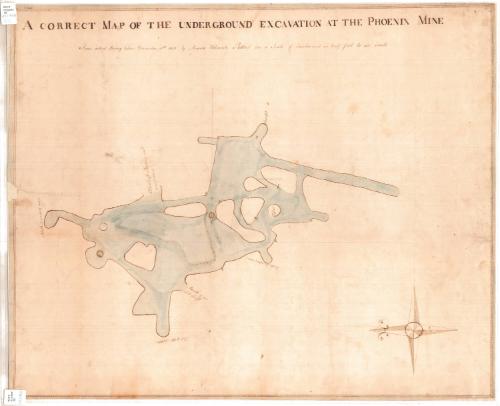
A Correct Map of the Underground Excavation at the Phoenix Mine
SurveyorSurveyed by
Amasa Holcomb
American, 1787 - 1873
Date1831
MediumDrawing; black ink and water color on paper, lined with paper
DimensionsPrimary Dimensions (image height x width): 22 5/8 x 27 3/4in. (57.5 x 70.5cm)
Sheet (height x width): 23 x 28 1/4in. (58.4 x 71.8cm)
Mount (height x width): 23 x 28 1/4in. (58.4 x 71.8cm)
Sheet (height x width): 23 x 28 1/4in. (58.4 x 71.8cm)
Mount (height x width): 23 x 28 1/4in. (58.4 x 71.8cm)
ClassificationsGraphics
Credit LineGift of C. Russell Noyes
DescriptionMap of the Phoenix Copper Mine in Granby, Connecticut, showing the mine from above. The letters B-F, H, L and M appear on the map, though there is no indication of what they represent. Several parts of the mine are labeled, including the north and south sounding rooms, the mouth of the old shaft, an unexplored part of the old shaft, a pillar, and the foot of a ladder on the west side of the mine.
Object number1952.97.1
MarkingsRecto, top and bottom left corners, printed in black ink on stickers: "MAPS / Drawer / 36"Verso, bottom, handwritten in pencil on sticker: "1056"InscribedRecto, top left corner, handwritten in black ink: "60466"
Top, handwritten in black ink: "A CORRECT MAP OF THE UNDERGROUND EXCAVATION AT THE PHOENIX MINE / From actual Survey taken December 15th 1831 by Amasa Holcomb. Plotted on a scale of Twelve and an half feet to an inch"NotesCartographic note: Scale: 1 inch equals 12 1/2 feet
Collections
- Maps and Charts: Finding Your Place in Connecticut History
On View
Not on view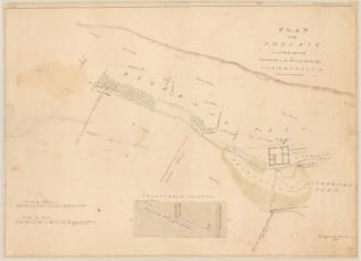
ca. 1950