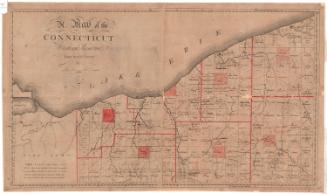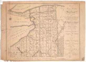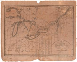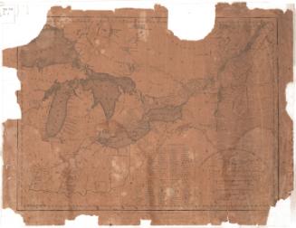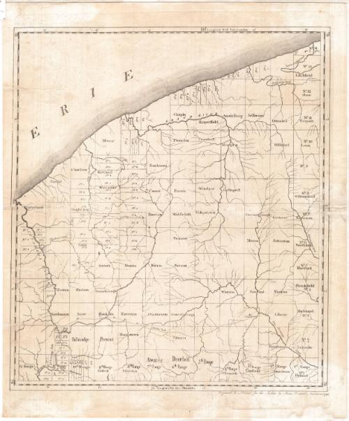
A Map of the Connecticut Western Reserve
SurveyorSurveyed by
Seth Pease
American, 1774 - 1819
PrintmakerEngraved by
Amos Doolittle
American, 1754 - 1832
PublisherPublished by
Amos Doolittle
American, 1754 - 1832
Date1798
MediumEngraving; black printer's ink on laid paper lined with Japanese paper
DimensionsPrimary Dimensions (image height x width): 19 x 16 7/8in. (48.3 x 42.9cm)
Platemark (height x width): 20 3/4 x 17 1/8in. (52.7 x 43.5cm)
Sheet (height x width): 21 3/4 x 18 1/4in. (55.2 x 46.4cm)
Platemark (height x width): 20 3/4 x 17 1/8in. (52.7 x 43.5cm)
Sheet (height x width): 21 3/4 x 18 1/4in. (55.2 x 46.4cm)
ClassificationsGraphics
Credit LineConnecticut Museum of Culture and History collection
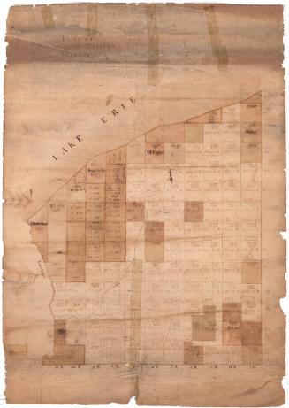
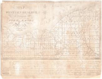
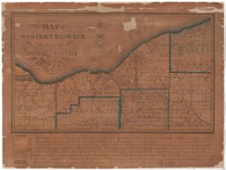
DescriptionMap of the Connecticut Western Reserve in what is now Ohio, from Lake Erie to the north, Venango Creek and Big Beaver River to the west, Tuscarawas Branch of the Muskingum River to the south, and the Cuyahoga River to the west. The land is divided into fourteen rows and twelve columns, all referred to as "ranges." Some of the resulting squares have names and some do not; additionally, some are divided further into numbered sections, divided with dotted lines.
Object number2012.312.95
MarkingsRecto, top left, printed in black ink on sticker: "MAPS / Box / 205"InscribedRecto, bottom right, printed in black ink: "Engraved &c Printed for the Author by Amos Doolittle Newhaven 1798"Verso, bottom right corner, handwritten in pencil: "Map / Box / #55"NotesCartographic Note: No scale
Collections
- Maps and Charts: Finding Your Place in Connecticut History
On View
Not on view